Brazoria County

Brazoria County, Texas

Brazoria County, Texas
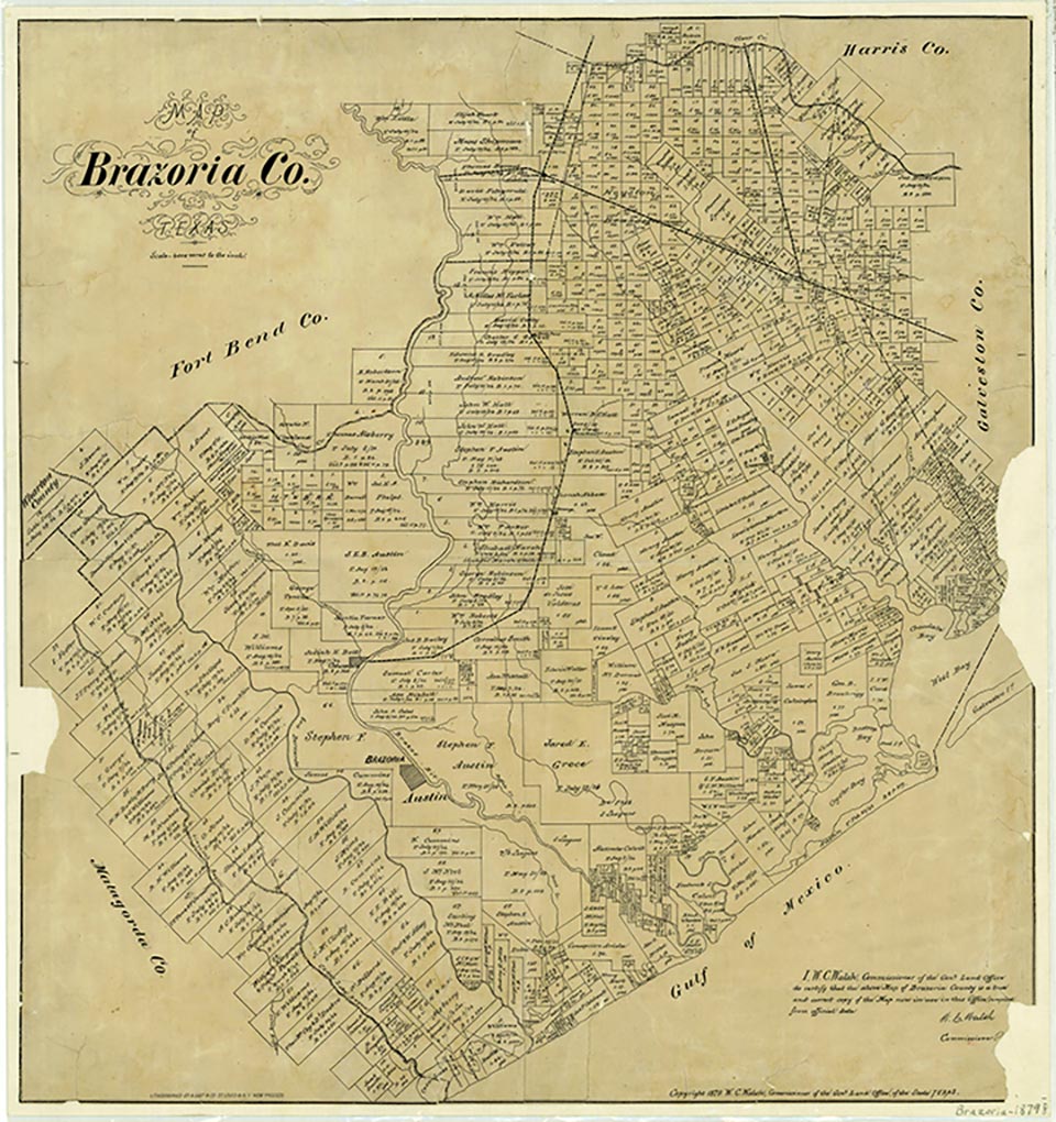
Brazoria County, on the prairie of the Gulf Coast at the mouth of the Brazos River in Southeast Texas, is bordered by Matagorda, Fort Bend, Harris, and Galveston counties. It covers an area of 1,407 square miles. Its highest altitude, Damon Mound, is 146 feet above sea level. The center of the county lies at approximately 29°10' north latitude and 95°26' west longitude, near the county seat, Angleton. Other principal towns include Alvin, Amsterdam, Brazoria, Damon, Pearland, Rosharon, West Columbia, Holiday Lake, Old Ocean, Bailey's Prairie, Iowa Colony, Bonney, Hillcrest Village, Brookside Village, Danbury, Liverpool, Manvel, and Sweeny; the towns that constitute Brazosport include Clute, Freeport, Quintana, Oyster Creek, Jones Creek, Lake Jackson, Richwood, and Surfside Beach. Key county roads include State highways 6, 35, 36, and 288, and railroad service is provided by the Union Pacific and Burlington Northern Santa Fe railroads. The annual rainfall is fifty-two inches, and the mean annual temperature is 69° F. Hurricanes and floods are common in the region, among the most notable being the hurricanes of 1854, 1900, 1909, 1915, 1932, 1941, Hurricane Carla in 1961, and the floods of 1899, 1913, 1915, 1929, and 1940. Soils in the county are chiefly alluvial loams and clays, and are highly productive when well drained. The growing season averages 309 days a year. In 1982, between 61 and 70 percent of the land was considered prime farmland. The principal streams flowing through Brazoria County into the Gulf of Mexico include the Brazos and San Bernard rivers, Oyster Creek, Bastrop Bayou, and Chocolate Bayou. The Gulf Intracoastal Waterway crosses Brazoria County near the coast. The Brazos River divides the county into two sections; the western one-third is covered by hardwoods, and the rest is generally prairieland. Abundant groves of pin oak, cedar, live oak, mulberry, hackberry, ash, elm, cottonwood, and pecan trees grow in the river and creek bottoms, while cordgrasses, bunchgrasses, and sedges predominate in the coastal marshes. When settlers first arrived, wildlife was abundant, including deer, bear, turkey, and fish. Two major national wildlife refuges, the Brazoria and San Bernard, are close to the Gulf Coast in Brazoria County. In 1947 the county ranked fourth in state timber production. More recently, the petrochemical industry and mineral resources including oil, gas, sulfur, salt, lime, sand, and gravel, concentrated in the Damon Mound-West Columbia-Freeport area, have dominated the county economy. Magnesium is also extracted locally from seawater.
Before Anglo-American colonization, the region was occupied by Karankawa Indians. Archeological excavations have revealed some of the shell middens and campsite refuse of this nomadic people, who exploited maritime and mainland resources on a seasonal basis as early as a.d. 450. Skirmishes with colonists, including the battle of Jones Creek in 1824, resulted in expulsion of most of the Indian population to the area south of the Rio Grande by 1850.
Diana J. Kleiner | © TSHA
Adapted from the official Handbook of Texas, a state encyclopedia developed by Texas State Historical Association (TSHA). It is an authoritative source of trusted historical records.
- ✅ Adoption Status:
- This place is available for adoption! Available for adoption!
- Adopted by:
- Your name goes here
- Dedication Message:
- Your message goes here
Currently Exists
Yes
Place type
Brazoria County is classified as a County
Altitude Range
0 ft – 146 ft
Size
Land area does not include water surface area, whereas total area does
- Land Area: 1,357.7 mi²
- Total Area: 1,608.6 mi²
Temperature
January mean minimum:
45.6°F
July mean maximum:
90.3°F
Rainfall, 2019
56.5 inches
Population Count, 2019
374,264
Civilian Labor Count, 2019
176,327
Unemployment, 2019
9.5%
Property Values, 2019
$46,196,173,154 USD
Per-Capita Income, 2019
$47,239 USD
Retail Sales, 2019
$4,379,490,138 USD
Wages, 2019
$1,714,078,754 USD
County Map of Texas
Brazoria County
- Brazoria County
Places of Brazoria County
| Place | Type | Population (Year/Source) | Currently Exists |
|---|---|---|---|
| Town | – | – | |
| Town | – | – | |
| Town | 27,576 (2021) | Yes | |
| Town | 193 (2014) | Yes | |
| Town | 150 (2014) | Yes | |
| Town | 19,401 (2021) | Yes | |
| Town | – | – | |
| Town | 781 (2021) | Yes | |
| Town | – | – | |
| Town | – | – | |
| Town | – | – | |
| Town | – | – | |
| Town | – | – | |
| Town | – | – | |
| Town | – | – | |
| Town | – | – | |
| Town | 183 (2021) | Yes | |
| Town | 2,845 (2021) | Yes | |
| Lake | – | Yes | |
| Town | 60,138 (2019) | Yes | |
| Town | 1,552 (2021) | Yes | |
| Town | – | – | |
| Town | – | – | |
| Town | – | – | |
| Town | – | – | |
| Town | – | – | |
| Town | – | – | |
| Town | – | – | |
| Town | – | – | |
| Town | – | – | |
| Town | 60 (2014) | Yes | |
| Town | – | – | |
| Town | 90 (2014) | Yes | |
| Town | – | – | |
| Town | 10,593 (2021) | Yes | |
| Town | – | – | |
| Town | – | – | |
| Town | – | – | |
| Town | 154 (2021) | Yes | |
| Town | 1,655 (2021) | Yes | |
| Town | 90 (2014) | Yes | |
| Town | 300 (2014) | Yes | |
| Town | – | – | |
| Town | – | – | |
| Lake | – | Yes | |
| Town | 178 (2021) | Yes | |
| Town | – | – | |
| Town | – | – | |
| Town | – | – | |
| Town | – | – | |
| Town | – | – | |
| Town | – | – | |
| Town | 60 (2014) | Yes | |
| Town | 10,594 (2021) | Yes | |
| Town | – | – | |
| Town | – | – | |
| Town | – | – | |
| Town | – | – | |
| Town | – | – | |
| Town | – | – | |
| Town | – | – | |
| Town | – | – | |
| Town | 693 (2021) | Yes | |
| Town | – | – | |
| Town | 100 (2014) | Yes | |
| Town | 1,022 (2021) | Yes | |
| Town | – | – | |
| Town | – | – | |
| Town | 10,883 (2021) | Yes | |
| Town | – | – | |
| Town | 1,959 (2021) | Yes | |
| Town | – | – | |
| Town | – | – | |
| Town | – | – | |
| Town | 27,879 (2021) | Yes | |
| Town | – | – | |
| Town | – | – | |
| Town | – | – | |
| Town | – | – | |
| Town | – | – | |
| Town | 494 (2021) | Yes | |
| Town | – | – | |
| Town | – | – | |
| Town | – | – | |
| Town | 12,355 (2021) | Yes | |
| Town | – | – | |
| Town | – | – | |
| Town | – | – | |
| Town | – | – | |
| Town | 20 (2014) | Yes | |
| Town | – | – | |
| Town | – | – | |
| Town | 160 (2014) | Yes | |
| Town | – | – | |
| Lake | – | Yes | |
| Town | – | – | |
| Town | 150 (2014) | Yes | |
| Town | – | – | |
| Town | 31 (2014) | Yes | |
| Town | – | – | |
| Town | – | – | |
| Town | 1,186 (2021) | Yes | |
| Town | – | – | |
| Town | 125,990 (2021) | Yes | |
| Town | – | – | |
| Town | – | – | |
| Town | – | – | |
| Town | – | – | |
| Town | – | – | |
| Town | 25 (2021) | Yes | |
| Town | – | – | |
| Town | – | – | |
| Town | – | – | |
| Town | – | – | |
| Town | – | – | |
| Town | 4,761 (2021) | Yes | |
| Town | 90 (2014) | Yes | |
| Town | – | – | |
| Town | 1,721 (2021) | Yes | |
| Town | – | – | |
| Town | – | – | |
| Town | – | – | |
| Lake | – | Yes | |
| Town | – | – | |
| Town | – | – | |
| Town | 212 (2021) | Yes | |
| Town | – | – | |
| Town | – | – | |
| Town | – | – | |
| Town | – | – | |
| Town | – | – | |
| Town | – | – | |
| Town | 656 (2021) | Yes | |
| Town | 3,591 (2021) | Yes | |
| Town | 152 (2014) | Yes | |
| Town | – | – | |
| Town | – | – | |
| Town | – | – | |
| Town | – | – | |
| Town | – | – | |
| Town | – | – | |
| Town | 3,611 (2021) | Yes | |
| Town | – | – | |
| Town | 2,134 (2021) | Yes | |
| Lake | – | Yes | |
| Town | – | – |
Photos Nearby:

Brazoria, Texas
The Gulf Intracoastal Waterway at the mouth of the San Bernard River, Brazoria County, Texas. Photo by Robert Plocheck. Texas Almanac.

Angleton, Texas
Brazoria County Courthouse in Angleton, Texas. Photograph by Adavyd.
Proud to call Texas home?
Put your name on the town, county, or lake of your choice.
Search Places »