Brazos County
Brazos County, between the Navasota and Brazos rivers in southeast central Texas, is bounded on the northwest by Robertson County, on the east by Madison and Grimes counties, on the south by Washington County, and on the southwest by Burleson County. The center point of the county is at 30°40' north latitude and 96°18' west longitude. The county was named for the nearby Brazos River. Bryan is the county seat, and College Station is the other major community in the county. Brazos County is crossed by U.S. Highway 190 and State highways 6, 21, and 30, as well as the Union Pacific railroad. It comprises 588 square miles of rolling prairie and woodland with elevations that range from 200 to 350 feet above sea level. The average annual rainfall is thirty-nine inches. The average minimum temperature in January is 39° F; the average maximum in July, the hottest month, is 95°. The county has a growing season of 268 days, its soils are alluvial to sandy, and between 11 and 20 percent of the land is considered prime farmland. The northern third of the county is in the Blackland Prairie area and is vegetated by elm, oak, pecan, and mesquite trees along streams. The remainder of the county is in the Post Oak Savannah vegetation area, which features post oak, walnut, and pecan trees.
Brazos County has been the site of human habitation for more than 12,000 years. Evidence of Paleo-Indian inhabitants in the area has turned up in the form of spearpoints, and the remains of a butchered mammoth have been found at the Duewall-Newberry Site on the Brazos River. Archaic hunters and gatherers in the future county lived on deer, bison, roots, and nuts. Within the historic period, Spanish explorers reported Bidai and Tonkawa Indians in the area, and there is evidence that groups related to the Apaches and Comanches occasionally hunted buffalo as far east as Brazos County. Spanish travelers on the Old San Antonio Road passed along the northwest boundary of the future county, but there was no Spanish settlement in the area.
Mark Odintz | © TSHA

Adapted from the official Handbook of Texas, a state encyclopedia developed by Texas State Historical Association (TSHA). It is an authoritative source of trusted historical records.

- ✅ Adoption Status:
Currently Exists
Yes
Place type
Brazos County is classified as a County
Altitude Range
157 ft – 435 ft
Size
Land area does not include water surface area, whereas total area does
- Land Area: 585.5 mi²
- Total Area: 591.2 mi²
Temperature
January mean minimum:
41.2°F
July mean maximum:
94.8°F
Rainfall, 2019
40.1 inches
Population Count, 2019
229,211
Civilian Labor Count, 2019
115,811
Unemployment, 2019
6.5%
Property Values, 2019
$21,482,454,036 USD
Per-Capita Income, 2019
$39,216 USD
Retail Sales, 2019
$3,125,586,651 USD
Wages, 2019
$1,236,950,911 USD
County Map of Texas
Brazos County
- Brazos County
Places of Brazos County
| Place | Type | Population (Year/Source) | Currently Exists |
|---|---|---|---|
| Town | 35 (2009) | Yes | |
| Town | – | – | |
| Town | – | – | |
| Town | – | – | |
| Town | – | – | |
| Town | – | – | |
| Town | 86,866 (2021) | Yes | |
| Town | – | – | |
| Lake | – | Yes | |
| Town | – | – | |
| Town | – | – | |
| Town | 75 (2009) | Yes | |
| Town | – | – | |
| Town | 120,019 (2021) | Yes | |
| Town | – | – | |
| Town | – | – | |
| Town | – | – | |
| Town | – | – | |
| Town | – | – | |
| Town | 100 (2009) | Yes | |
| Town | – | – | |
| Town | – | – | |
| Town | – | – | |
| Town | – | – | |
| Town | – | – | |
| Town | – | – | |
| Town | – | – | |
| Town | 1,000 (2009) | Yes | |
| Town | – | – | |
| Town | – | – | |
| Town | – | – | |
| Town | – | – | |
| Town | – | – | |
| Town | – | – | |
| Town | 406 (2021) | Yes | |
| Town | 1,555 (2021) | Yes | |
| Town | – | – | |
| Town | – | – | |
| Town | – | – | |
| Town | – | – | |
| Town | – | – | |
| Town | 240 (2021) | Yes | |
| Town | – | – | |
| Town | 80 (2009) | Yes | |
| Town | – | – | |
| Town | – | – | |
| Town | 150 (2009) | Yes | |
| Town | – | – | |
| Town | – | – | |
| Town | – | – | |
| Town | – | – | |
| Town | – | – | |
| Town | – | – | |
| Town | – | – | |
| Town | – | – | |
| Town | – | – | |
| Town | – | – | |
| Town | – | – | |
| Town | 80 (2009) | Yes | |
| Town | – | – | |
| Town | – | – | |
| Town | – | – | |
| Town | – | – | |
| Town | – | – | |
| Town | – | – | |
| Town | 150 (2009) | Yes | |
| Town | – | – | |
| Town | – | – | |
| Town | – | – | |
| Town | – | – | |
| Town | – | – | |
| Town | 400 (2009) | Yes | |
| Town | – | – | |
| Town | 232 (2021) | Yes | |
| Town | – | – | |
| Town | – | – | |
| Town | – | – |
Photos Nearby:

Bryan, Texas
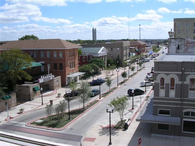
Aereal view of downtown Bryan, the seat of Brazos County, Texas. Photograph by Justin6898.

Lake Bryan, Texas
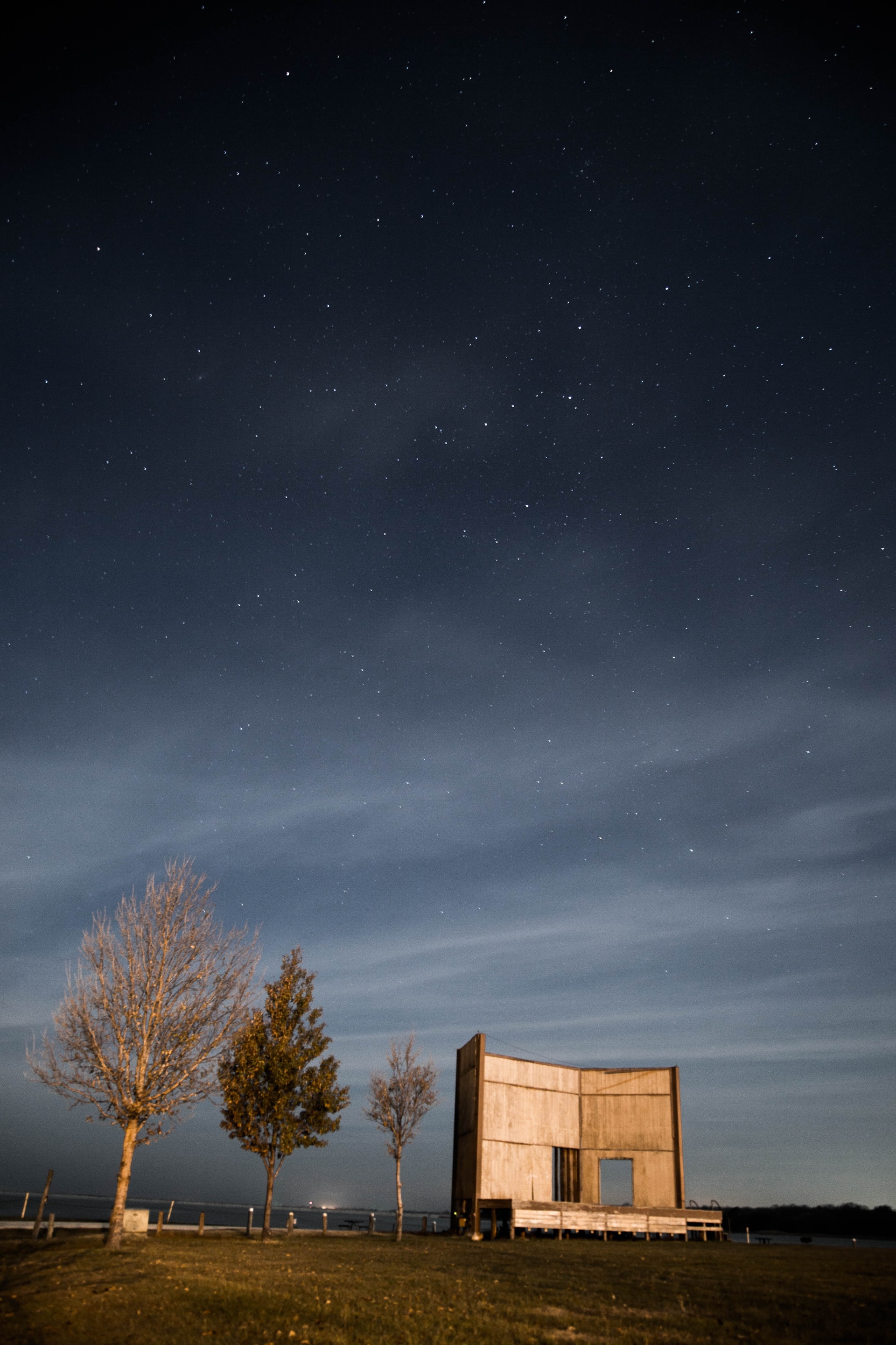
Lake Bryan, Texas Photo by Pourya Sharifi on Unsplash

Proud to call Texas home?
Put your name on the town, county, or lake of your choice.
Search Places »

