Kaufman County

Kaufman County, Texas

Kaufman County, Texas
Kaufman County is located in northeastern Texas. Terrell, the county's largest town, is thirty miles east of Dallas. The county's center lies at approximately 32°35' north latitude and 96°18' west longitude. The county comprises 788 square miles of the Blackland Prairie region of Northeast Texas. The terrain is predominantly level to gently undulating, with an elevation ranging from 300 to 550 feet above sea level. The county is on the divide between two large rivers, the Trinity and the Sabine. It is located in the Trinity River watershed and is drained, in its western half, by the East Fork of the Trinity River and its tributaries, and, in its eastern half, by Cedar Creek and its tributaries, which flow into Cedar Creek Reservoir in the southern part of the county. Prairie grasses and mesquite, oak, pecan, and elm trees grow along the streams of the county. The soils are slightly acidic, with dark to light loamy surfaces and clayey subsoils. Mineral resources include limestone, sand and gravel, oil, and gas. The climate is subtropical-humid. Temperatures range in July from an average low of 72° F to an average high of 97° and in January from 33° to 54°. Rainfall averages thirty-nine inches, and the growing season averages 245 days each year.
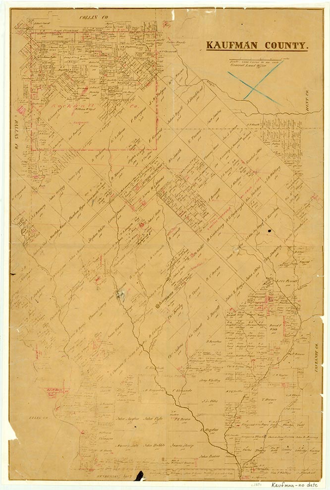
Various Indians, Caddoes and Cherokees prominent among them, inhabited the territory that is today Kaufman County long before American settlers arrived. By the time of the coming of these first settlers, in 1840, the Cherokees had been driven by the Caddoes into East Texas. The Americans placated the Caddoes with jewelry and trinkets and consequently experienced few Indian problems. The first Kaufman County settlement was started in 1840 by William P. King and a group of forty pioneers from Holly Springs, Mississippi, who had purchased certificates for headrights from the Republic of Texas. The group built a fort and named it King's Fort in honor of their leader. Because of readily available land grants and because the land had been praised in eastern towns, the area around King's Fort, or Kingsboro, or Fort de Kingsboro, attracted settlers rapidly. On July 27, 1846, after the annexation of Texas by the United States, King patented the survey that included King's Fort with the new state government. The territory was at that time part of the recently organized Henderson County. Kaufman County was drawn from Henderson County, established in February 1848, and named for David Spangler Kaufman, a diplomat and member of the Congress of the Republic of Texas, the legislature of the state of Texas, and the Congress of the United States. King's Fort was renamed Kaufman and became the county seat in March 1851, after four elections. The county's northern boundary was reduced by the establishment of Rockwall County in 1873, and its limits have since remained unchanged. Kaufman County was settled predominantly by natives of the southern United States, particularly Tennessee, Arkansas, and Missouri. Though slaves were brought to the county, slavery was never widespread here, perhaps because cotton culture remained minimal until after the Civil War. The 1860 census counted 533 slaves (15 percent of the population).
Brian Hart | © TSHA
Adapted from the official Handbook of Texas, a state encyclopedia developed by Texas State Historical Association (TSHA). It is an authoritative source of trusted historical records.
- ✅ Adoption Status:
- This place is available for adoption! Available for adoption!
- Adopted by:
- Your name goes here
- Dedication Message:
- Your message goes here
Currently Exists
Yes
Place type
Kaufman County is classified as a County
Altitude Range
300 ft – 611 ft
Size
Land area does not include water surface area, whereas total area does
- Land Area: 780.7 mi²
- Total Area: 807.7 mi²
Temperature
January mean minimum:
33.1°F
July mean maximum:
94.3°F
Rainfall, 2019
39.9 inches
Population Count, 2019
136,154
Civilian Labor Count, 2019
64,193
Unemployment, 2019
7.9%
Property Values, 2019
$11,275,477,495 USD
Per-Capita Income, 2019
$42,837 USD
Retail Sales, 2019
$1,539,131,418 USD
Wages, 2019
$404,659,136 USD
County Map of Texas
Kaufman County
- Kaufman County
Places of Kaufman County
| Place | Type | Population (Year/Source) | Currently Exists |
|---|---|---|---|
| Town | 20 (2009) | Yes | |
| Town | 75 (2009) | Yes | |
| Town | – | – | |
| Town | – | – | |
| Town | – | – | |
| Town | 300 (2009) | Yes | |
| Town | – | – | |
| Town | – | – | |
| Town | – | – | |
| Town | – | – | |
| Town | – | – | |
| Town | – | – | |
| Lake | – | Yes | |
| Town | – | – | |
| Town | – | – | |
| Town | 50 (2009) | Yes | |
| Town | – | – | |
| Town | – | – | |
| Town | 500 (2009) | Yes | |
| Town | – | – | |
| Town | 2,358 (2021) | Yes | |
| Town | 194 (2021) | Yes | |
| Town | 4,278 (2021) | Yes | |
| Town | – | – | |
| Town | – | – | |
| Town | – | – | |
| Town | – | – | |
| Town | – | – | |
| Town | 1,065 (2021) | Yes | |
| Town | – | – | |
| Town | – | – | |
| Town | – | – | |
| Town | 27,256 (2021) | Yes | |
| Town | 90 (2009) | Yes | |
| Town | – | – | |
| Town | 100 (2009) | Yes | |
| Town | – | – | |
| Town | – | – | |
| Town | 347 (2021) | Yes | |
| Town | – | – | |
| Town | – | – | |
| Town | – | – | |
| Town | 7,114 (2021) | Yes | |
| Town | 75 (2009) | Yes | |
| Town | – | – | |
| Town | – | – | |
| Town | – | – | |
| Town | – | – | |
| Town | 50 (2009) | Yes | |
| Town | – | – | |
| Town | – | – | |
| Town | 7,379 (2021) | Yes | |
| Town | 1,178 (2021) | Yes | |
| Town | – | – | |
| Town | – | – | |
| Town | – | – | |
| Lake | – | Yes | |
| Town | – | – | |
| Town | 259 (2009) | Yes | |
| Town | – | – | |
| Town | 50 (2009) | Yes | |
| Town | – | – | |
| Town | – | – | |
| Town | – | – | |
| Town | – | – | |
| Town | 4,562 (2021) | Yes | |
| Town | – | – | |
| Town | 20 (2009) | Yes | |
| Town | 147,691 (2021) | Yes | |
| Town | 670 (2021) | Yes | |
| Town | 887 (2021) | Yes | |
| Town | 65 (2009) | Yes | |
| Town | – | – | |
| Town | – | – | |
| Town | 75 (2009) | Yes | |
| Town | – | – | |
| Town | – | – | |
| Town | 90 (2009) | Yes | |
| Town | 762 (2021) | Yes | |
| Town | 75 (2009) | Yes | |
| Town | – | – | |
| Town | 1,280 (2020) | Yes | |
| Town | – | – | |
| Town | – | – | |
| Town | 322 (2021) | Yes | |
| Town | – | – | |
| Town | – | – | |
| Town | – | – | |
| Town | – | – | |
| Town | 732 (2021) | Yes | |
| Town | – | – | |
| Town | – | – | |
| Town | – | – | |
| Town | 50 (2009) | Yes | |
| Town | 50 (2009) | Yes | |
| Town | 2,710 (2021) | Yes | |
| Town | 18,567 (2021) | Yes | |
| Lake | – | Yes | |
| Town | – | – | |
| Town | 65 (2009) | Yes | |
| Town | – | – | |
| Town | 8,201 (2021) | Yes | |
| Town | – | – | |
| Town | – | – | |
| Town | – | – | |
| Town | – | – | |
| Town | – | – | |
| Town | – | – | |
| Town | – | – | |
| Town | 100 (2009) | Yes | |
| Town | – | – | |
| Town | – | – | |
| Town | – | – | |
| Town | – | – |
Photos Nearby:

Ables Springs, Texas
Ables Springs, Texas Historical Marker Photography on Flicker by Rheba

Dr. Doom enjoying a quiet evening on a pier at Lake Ray Hubbard
Photo by Nelo Hotsuma, Flickr, CC2
Proud to call Texas home?
Put your name on the town, county, or lake of your choice.
Search Places »