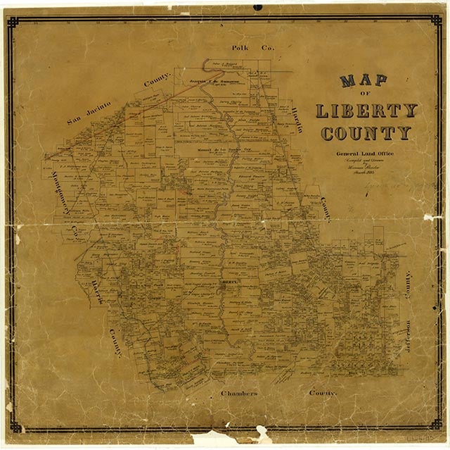
Liberty County

Liberty County, Texas

Liberty County, Texas
Liberty County, bisected by the Trinity River, is on U.S. Highway 90 halfway between Beaumont and Houston. This part of Southeast Texas is in the Coastal Prairie. The center point of the county, which comprises 1,174 square miles, is at 30°11' north latitude and 94°50' west longitude, near the Trinity River and the Hardin oilfield. The altitude varies from twenty to 200 feet. The climate is subtropical and humid, the annual rainfall averages 51.15 inches, and the temperature ranges from a minimum of 40° F in January to a maximum of 94° in July. The northern fourth of the county is part of the Big Thicket, a once-impenetrable wilderness wooded with pine, oak, ash, hickory, cypress, and walnut. Today, this area is covered with loblolly, shortleaf, longleaf, and slash pines, hardwoods including oak, hickory, and maple, shrubs, Indian grass, and native legumes. The county's southern section consists of Gulf prairies and marshes vegetated with tall prairie grasses, oak, mesquite, and prickly pear. The soil types include sandy, sandy loam, black sandy, and black waxy. Between 41 and 50 percent of the land is considered prime farmland. Drainage and irrigation systems provide for diversified crops-rice, cotton, grains, potatoes, corn, vegetables, and fruits. Hogs, beef cattle, sheep, goats, and poultry are raised, and honey is produced commercially. Natural resources include deposits of lignite, iron ore, sulfur, brick clay, salt, lime, and glass sand, as well as oil and gas. The county is served by the Union Pacific and the Burlington Northern Santa Fe railroads.
The future Liberty County was first inhabited by prehistoric Indians, whose artifacts can be found at various sites including those of Orcoquisac Indian villages. The Jamison and Daniel sites, located opposite each other on the margins of the Trinity about three miles north of Liberty, have revealed mass burials, arrow points, pottery, and other artifacts dating to 1000 B.C. or earlier, as has a site near Dayton. During most of the eighteenth century, the area was contested by French interests seeking to expand from Louisiana, and Spanish interests from the west and south. Though the Spanish crown granted Pánfilo de Narváez the privilege to colonize the lands between the Rio Grande and the cape of Florida in 1526, Karankawa Indians, including Coapites and related groups, were the sole occupants of the future Liberty County until the 1740s. Rumors of French exploration on the Texas coast by Joseph Blancpain and others prompted the Spanish to send Joaquín de Orobio y Basterra on an exploratory expedition in 1748, and fears of French intrusion continued. The Spanish established Nuestra Señora de la Luz Mission and San Agustín de Ahumada Presidio in 1756; the mission was for the Akokisa and Bidai Indians. Spanish maps in 1757 showed the Atascosito settlement and a Spanish military road known as the Atascosito Road, which crossed the Trinity near the present site of Liberty. Ten years later the Marqués de Rubí included the area in his tour of inspection, but parts of the mission were destroyed by a storm in 1766 and the presidio was abandoned in 1772. According to some sources, a trading-post settlement named Arkokisa or Arkosisa (variants of Akokisa) existed from roughly 1770 to 1790 near what later became the townsite of Liberty.
Diana J. Kleiner | © TSHA
Adapted from the official Handbook of Texas, a state encyclopedia developed by Texas State Historical Association (TSHA). It is an authoritative source of trusted historical records.
- ✅ Adoption Status:
Currently Exists
Yes
Place type
Liberty County is classified as a County
Altitude Range
3 ft – 243 ft
Size
Land area does not include water surface area, whereas total area does
- Land Area: 1,158.4 mi²
- Total Area: 1,176.3 mi²
Temperature
January mean minimum:
41.2°F
July mean maximum:
92.1°F
Rainfall, 2019
61.3 inches
Population Count, 2019
88,219
Civilian Labor Count, 2019
33,018
Unemployment, 2019
11.7%
Property Values, 2019
$7,554,904,022 USD
Per-Capita Income, 2019
$37,237 USD
Retail Sales, 2019
$877,009,503 USD
Wages, 2019
$244,414,533 USD
County Map of Texas
Liberty County
- Liberty County
Places of Liberty County
| Place | Type | Population (Year/Source) | Currently Exists |
|---|---|---|---|
| Town | – | – | |
| Town | – | – | |
| Town | – | – | |
| Town | 1,009 (2021) | Yes | |
| Town | – | – | |
| Town | – | – | |
| Town | – | – | |
| Town | – | – | |
| Town | – | – | |
| Town | – | – | |
| Town | – | – | |
| Town | 615 (2021) | Yes | |
| Town | – | – | |
| Town | – | – | |
| Town | – | – | |
| Town | – | – | |
| Town | – | – | |
| Town | – | – | |
| Town | 75 (2009) | Yes | |
| Town | 7,999 (2021) | Yes | |
| Town | – | – | |
| Town | – | – | |
| Town | – | – | |
| Town | – | – | |
| Town | 992 (2021) | Yes | |
| Town | – | – | |
| Town | 9,134 (2021) | Yes | |
| Town | 50 (2021) | Yes | |
| Town | 389 (2021) | Yes | |
| Town | – | – | |
| Town | – | – | |
| Town | 75 (2009) | Yes | |
| Town | – | – | |
| Town | – | – | |
| Town | – | – | |
| Town | – | – | |
| Town | – | – | |
| Town | 200 (2009) | Yes | |
| Town | – | – | |
| Town | – | – | |
| Town | – | – | |
| Town | – | – | |
| Town | – | – | |
| Town | – | – | |
| Town | – | – | |
| Town | – | – | |
| Town | – | – | |
| Town | – | – | |
| Town | – | – | |
| Town | – | – | |
| Town | – | – | |
| Town | – | – | |
| Town | – | – | |
| Town | – | – | |
| Town | – | – | |
| Town | – | – | |
| Town | – | – | |
| Town | – | – | |
| Town | 811 (2021) | Yes | |
| Town | 225 (2009) | Yes | |
| Town | – | – | |
| Town | 475 (2021) | Yes | |
| Town | – | – | |
| Town | – | – | |
| Town | – | – | |
| Town | – | – | |
| Town | – | – | |
| Town | 668 (2021) | Yes | |
| Town | – | – | |
| Town | – | – | |
| Town | – | – | |
| Town | – | – | |
| Town | – | – | |
| Town | – | – | |
| Town | – | – | |
| Town | – | – | |
| Town | 8,539 (2021) | Yes | |
| Town | – | – | |
| Town | – | – | |
| Town | – | – | |
| Town | – | – | |
| Town | – | – | |
| Town | – | – | |
| Town | – | – | |
| Town | – | – | |
| Town | – | – | |
| Town | – | – | |
| Town | – | – | |
| Town | – | – | |
| Town | – | – | |
| Town | – | – | |
| Town | – | – | |
| Town | – | – | |
| Town | 65 (2009) | Yes | |
| Town | 180 (2009) | Yes | |
| Town | – | – | |
| Town | – | – | |
| Town | – | – | |
| Town | 246 (2021) | Yes | |
| Town | – | – | |
| Town | – | – | |
| Town | – | – | |
| Town | – | – | |
| Town | – | – | |
| Town | – | – | |
| Town | – | – | |
| Town | – | – | |
| Town | – | – | |
| Town | 1,344 (2021) | Yes | |
| Town | – | – | |
| Town | 60 (2009) | Yes | |
| Town | 231 (2009) | Yes | |
| Town | – | – | |
| Town | – | – | |
| Town | – | – | |
| Town | 135 (2009) | Yes | |
| Town | 150 (2009) | Yes | |
| Town | – | – | |
| Town | – | – | |
| Town | – | – | |
| Town | – | – | |
| Town | – | – | |
| Town | – | – | |
| Town | – | – | |
| Town | – | – | |
| Town | – | – | |
| Town | – | – | |
| Town | – | – | |
| Town | – | – | |
| Town | – | – | |
| Town | 300 (2009) | Yes | |
| Town | – | – | |
| Town | – | – | |
| Town | – | – | |
| Town | – | – | |
| Town | – | – | |
| Town | – | – | |
| Town | – | – | |
| Town | – | – | |
| Town | – | – | |
| Town | – | – | |
| Town | – | – | |
| Town | – | – | |
| Town | – | – |
Proud to call Texas home?
Put your name on the town, county, or lake of your choice.
Search Places »