Motley County

Motley County, Texas

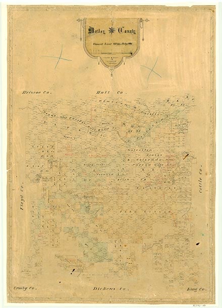
Motley County, in the Rolling Plains region of Northwest Texas, is bounded on the east by Cottle County, on the south by Dickens County, on the west by Floyd County, and on the north by Briscoe and Hall counties. Its center is at 34°03' north latitude and 100°45' west longitude, about eighty miles northeast of Lubbock. The county is named for Junius William Mottley, who died in the battle of San Jacinto (a spelling error was made when the county was named.) This sparsely settled county comprises 959 square miles of rough and broken terrain drained by the North Pease, Middle Pease, and South Pease rivers and their tributaries. Elevations range between 1,928 and 3,034 feet above sea level. The county lies just below the Caprock. Its soils are sand and black and red clay, mixed or not mixed with sand. The average rainfall is 20.35 inches. The average minimum temperature is 26° F in January, and the average maximum is 96° in July. The growing season lasts 218 days. The county produces about $14 million average annual income from agriculture, half of which derives from beef cattle and horses and half primarily from cotton, peanuts, wheat, guar, and other grains. In the mid-1980s about 95 percent of the land in the county was in ranches and farms; 13 percent of the county was cultivated, and 9 percent was irrigated. In 1990 the county produced almost 304,500 barrels of crude oil. U.S. Highway 62/70 runs east to west; State Highway 70 is the major route north to south.
Comanches of the Wanderers, Liver-Eaters, and Downstream bands hunted buffalo and other game in the area before White settlement, but were displaced by the army's Indian campaigns of the 1870s. In 1876 the Texas legislature formed Motley County from lands formerly assigned to the Bexar District and attached the area to Crosby County for judicial purposes. Sometime in the 1870s a buffalo hunter named Ballard established a supply station at the springs that now bear his name. In the mid-1870s Frank Collinson was commissioned by Samuel R. Coggin to bring 8,000 of John S. Chisum's cattle to establish the first ranch in the area. Collinson had known the country as a buffalo hunter in 1874, but had left because of problems with the Indians in the area. In 1878, Henry H. Campbell began buying cattle from Collinson and others for his Matador Land and Cattle Company. Campbell was the first owner of the famed Matador Ranch, which came to control much of the land in the area. In 1879 Arthur B. Cooper moved into the county and established a store at TeePee City, which, according to one source, was a "thriving" settlement at the time. In 1880 the census counted twenty-four residents in the county.
John Leffler | © TSHA
Adapted from the official Handbook of Texas, a state encyclopedia developed by Texas State Historical Association (TSHA). It is an authoritative source of trusted historical records.
- ✅ Adoption Status:
- This place is available for adoption! Available for adoption!
- Adopted by:
- Your name goes here
- Dedication Message:
- Your message goes here
Currently Exists
Yes
Place type
Motley County is classified as a County
Altitude Range
1800 ft – 3083 ft
Size
Land area does not include water surface area, whereas total area does
- Land Area: 989.6 mi²
- Total Area: 989.8 mi²
Temperature
January mean minimum:
29.6°F
July mean maximum:
94.2°F
Rainfall, 2019
23.4 inches
Population Count, 2019
1,200
Civilian Labor Count, 2019
435
Unemployment, 2019
5.1%
Property Values, 2019
$350,819,689 USD
Per-Capita Income, 2019
$28,938 USD
Retail Sales, 2019
$6,281,690 USD
Wages, 2019
$2,532,478 USD
County Map of Texas
Motley County
- Motley County
Places of Motley County
| Place | Type | Population (Year/Source) | Currently Exists |
|---|---|---|---|
| Town | – | – | |
| Town | – | – | |
| Town | – | – | |
| Town | – | – | |
| Town | – | – | |
| Town | 181 (2009) | Yes | |
| Town | – | – | |
| Town | – | – | |
| Town | – | – | |
| Town | – | – | |
| Town | – | – | |
| Town | – | – | |
| Town | – | – | |
| Town | – | – | |
| Town | 571 (2021) | Yes | |
| Town | 15 (2009) | Yes | |
| Town | – | – | |
| Town | – | – | |
| Town | 214 (2021) | Yes | |
| Town | – | – | |
| Town | – | – | |
| Town | – | – | |
| Town | 6 (2009) | Yes | |
| Town | 4 (2009) | Yes |
Photos Nearby:

Matador, Motley County, Texas
The downtown view of the town of Matador, the seat of Motley County, Texas. Photograph by Renelibrary.
.jpg)

Roaring Springs, Texas
The downtown view of Roaring Springs, Texas. Photograph by Renelibrary.
.jpg)
Proud to call Texas home?
Put your name on the town, county, or lake of your choice.
Search Places »