Uvalde County

Uvalde County, Texas

Uvalde County, Texas

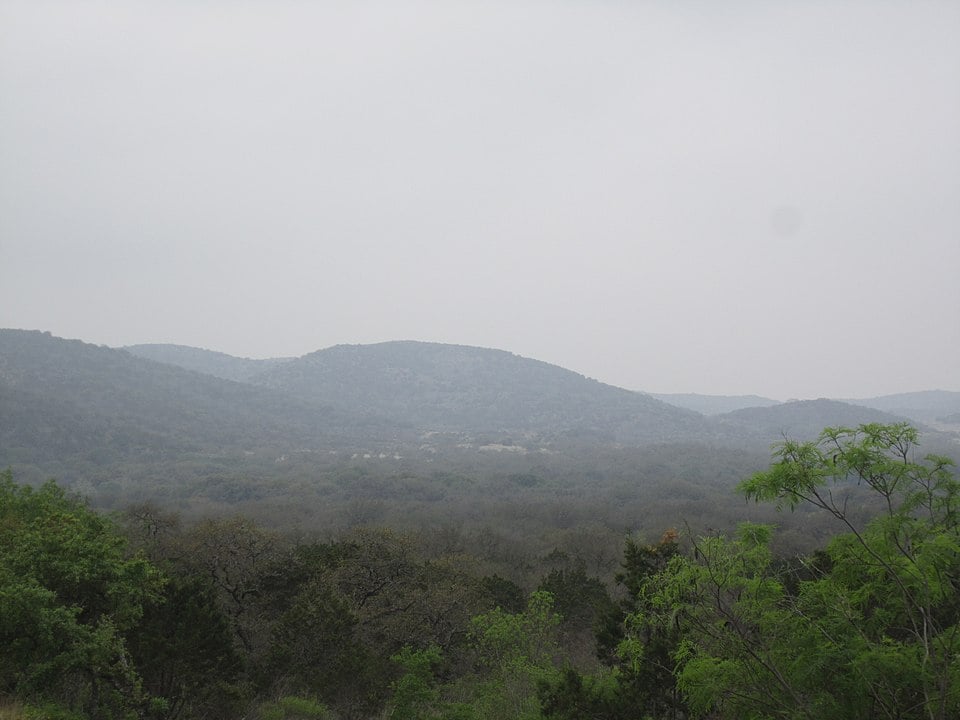
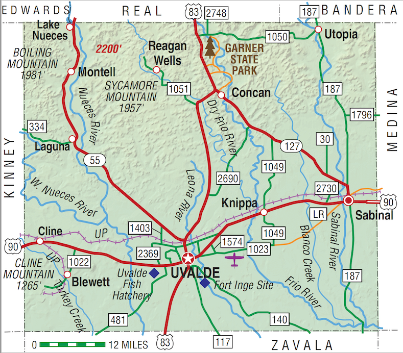
Uvalde County, named for Spaniard Juan de Ugalde, is in Southwest Texas midway between San Antonio and the International Amistad Reservoir on the United States-Mexico border. The county's center is eight miles north of Uvalde at 29°22' north latitude and 99°45' west longitude. Uvalde County covers 1,588 square miles. The Nueces, Leona, Sabinal, Dry Frio, and Frio rivers flow through Uvalde County. At the intersection of U.S. highways 83 and 90 is Uvalde, the county seat. Other major towns are Knippa, Sabinal, and Utopia; minor towns are Cline, Montell, Concan, and Reagan Wells. The main line of the Southern Pacific Railroad parallels U.S. 90 and connects Uvalde with Knippa and Sabinal to the east and Cline to the west. The climate has been described as continental, semi-arid, and subtropical-subhumid. The average rainfall is 23.22 inches annually. Temperatures range from an average low of 37° F and average high of 63° F in January to an average low of 71° and high of 98° in July. The Edwards Plateau covers the northern third of the county. Elevations range from 2,000 feet above sea level to 700 feet above sea level. Low rolling hills and deep canyons cut across the county's midsection from southwest to northeast. The northern and western portions have the short grass and scattered timber common to the eastern Edwards Plateau and Hill Country. Trees include live oak, shinnery oak, red oak, and juniper; buffalo and mesquite grasses dominates the western margin. The southern and eastern region is in the South Texas brushy plains and features thorny vegetation with scattered post oak and live oak.
Artifacts discovered in various parts of the county indicate that people hunted and gathered in the future Uvalde County as long ago as 7000 B.C. The Edwards Plateau and the surrounding hills were the favorite hunting grounds of the Comanche, Tonkawa, and Lipan Apache Indians. Either Álvar Núñez Cabeza de Vaca in 1535 or Andrés do Campo in the middle 1540s may have been the first European to set foot in Uvalde County. Evidence of a permanent Indian village on the Leona River at a place south of the Fort Inge site is indicated in the written accounts of Fernando del Bosque's exploration in 1675. After the establishment of San Antonio in 1718, the Uvalde County region was consistently traversed by Spanish soldiers, commercial packtrains, buffalo hunters, cattlemen, and mineral prospectors. In 1762 Nuestra Señora de la Candelaria Mission was established near the site of present Montell and near the site of a prehistoric Indian village at Candelaria Springs. The mission was abandoned in 1767 due to Comanche attacks. On January 9, 1790, Juan de Ugalde, governor of Coahuila and commandant of the Provincias Internas, led 600 men to a decisive victory over the Apaches near the site of modern Utopia at a place known then as Arroyo de la Soledad. In honor of his victory, the canyon area was thereafter called Cañon de Ugalde.
Ruben E. Ochoa | © TSHA

Adapted from the official Handbook of Texas, a state encyclopedia developed by Texas State Historical Association (TSHA). It is an authoritative source of trusted historical records.

- ✅ Adoption Status:
- This place is available for adoption! Available for adoption!
- Adopted by:
- Your name goes here
- Dedication Message:
- Your message goes here
Currently Exists
Yes
Place type
Uvalde County is classified as a County
Altitude Range
650 ft – 2200 ft
Size
Land area does not include water surface area, whereas total area does
- Land Area: 1,552.0 mi²
- Total Area: 1,558.6 mi²
Temperature
January mean minimum:
38.6°F
July mean maximum:
96.1°F
Rainfall, 2019
24.6 inches
Population Count, 2019
26,741
Civilian Labor Count, 2019
10,836
Unemployment, 2019
7.4%
Property Values, 2019
$4,082,360,085 USD
Per-Capita Income, 2019
$39,458 USD
Retail Sales, 2019
$369,437,909 USD
Wages, 2019
$91,815,312 USD
County Map of Texas
Uvalde County
- Uvalde County
Places of Uvalde County
| Place | Type | Population (Year/Source) | Currently Exists |
|---|---|---|---|
| Town | – | – | |
| Town | – | – | |
| Town | 7 (2014) | Yes | |
| Town | – | – | |
| Town | – | – | |
| Town | – | – | |
| Town | – | – | |
| Town | 15 (2014) | Yes | |
| Town | 500 (2014) | Yes | |
| Town | – | – | |
| Town | – | – | |
| Town | – | – | |
| Town | – | – | |
| Town | – | – | |
| Town | 50 (2014) | Yes | |
| Town | – | – | |
| Town | – | – | |
| Town | – | – | |
| Town | – | – | |
| Town | – | – | |
| Town | – | – | |
| Town | – | – | |
| Town | – | – | |
| Town | – | – | |
| Town | – | – | |
| Town | 808 (2021) | Yes | |
| Town | 8 (2014) | Yes | |
| Town | 60 (2014) | Yes | |
| Town | – | – | |
| Town | – | – | |
| Town | 20 (2014) | Yes | |
| Town | – | – | |
| Town | – | – | |
| Town | – | – | |
| Town | – | – | |
| Town | – | – | |
| Town | – | – | |
| Town | 30 (2014) | Yes | |
| Town | – | – | |
| Town | 1,401 (2021) | Yes | |
| Town | – | – | |
| Town | – | – | |
| Town | – | – | |
| Town | – | – | |
| Town | – | – | |
| Town | – | – | |
| Town | 210 (2021) | Yes | |
| Town | 15,312 (2021) | Yes | |
| Town | 2,388 (2021) | Yes | |
| Town | – | – | |
| Town | – | – | |
| Town | – | – | |
| Town | – | – | |
| Town | – | – | |
| Town | – | – | |
| Town | – | – | |
| Town | – | – |

Proud to call Texas home?
Put your name on the town, county, or lake of your choice.
Search Places »
