Burnet County

Burnet County, Texas

Burnet County, Texas
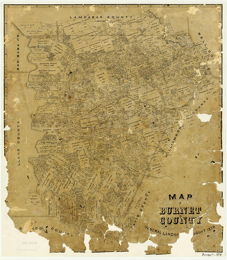
Burnet County in central Texas, is bordered by Lampasas, Bell, Williamson, Travis, Blanco, Llano, and San Saba counties. Burnet, the county seat, is at the intersection of U.S. Highway 281 and State Highway 29 and on the Austin Area Terminal Railroad, about fifty miles northwest of Austin and 150 miles southwest of Fort Worth. The county's center is about three miles northeast of Burnet at 30º47' north latitude and 98º11' west longitude. The county, situated on the northeastern edge of the Hill Country, comprises roughly 1,000 square miles of gentle to broken hills with elevations ranging from 700 to 1,700 feet above sea level. The terrain in the northwestern, western, and southern parts of the county is characterized by rolling hills with local deep and dense dissections; fertile plateaus and valleys are found in the eastern section, and rolling prairies dominate the north and northeast. The land is drained by the Colorado River, which forms most of the western county line before meandering across the southern part of the county; by the San Gabriel River, which rises in three forks in the northern and central parts of the county; and by the Lampasas River, which cuts across the northeastern corner. Wildlife in Burnet County includes deer, coyotes, bobcats, beaver, opossums, ring-tailed cats, foxes, raccoons, turkeys, badgers, weasels, skunks, and squirrels, as well as assorted birds, fish, and reptiles. Among the county's mineral resources are granite, limestone, industrial sand, and graphite. The average minimum temperature is 37° F in January, and the average maximum is 96° in July. The growing season averages 234 days annually, and the rainfall averages about thirty inches.
Central Texas, including Burnet County, has supported human habitation for several thousand years. Although the archeology of Burnet County has not been fully studied, several prehistoric campsites have been found along the rivers and their tributaries. The hunting and gathering peoples who had established themselves in the area by about 4500 b.c. were probably ancestors of the Tonkawa Indians. No evidence of Spanish exploration or settlement has been found in Burnet County, although missions were established in the 1740s and 1750s in neighboring San Saba County. In the early nineteenth century, surveyors found the local Tonkawa and Lipan Apache groups to be friendly, but the Comanches made frequent raids into the area.
Vivian Elizabeth Smyrl | © TSHA
Adapted from the official Handbook of Texas, a state encyclopedia developed by Texas State Historical Association (TSHA). It is an authoritative source of trusted historical records.
- ✅ Adoption Status:
Currently Exists
Yes
Place type
Burnet County is classified as a County
Altitude Range
682 ft – 1608 ft
Size
Land area does not include water surface area, whereas total area does
- Land Area: 994.3 mi²
- Total Area: 1,021.3 mi²
Temperature
January mean minimum:
34.7°F
July mean maximum:
93.0°F
Rainfall, 2019
32.9 inches
Population Count, 2019
48,155
Civilian Labor Count, 2019
22,395
Unemployment, 2019
5.4%
Property Values, 2019
$9,367,491,636 USD
Per-Capita Income, 2019
$46,516 USD
Retail Sales, 2019
$887,699,027 USD
Wages, 2019
$176,145,711 USD
County Map of Texas
Burnet County
- Burnet County
Places of Burnet County
| Place | Type | Population (Year/Source) | Currently Exists |
|---|---|---|---|
| Town | – | – | |
| Town | – | – | |
| Town | 1,764 (2021) | Yes | |
| Town | – | – | |
| Town | – | – | |
| Town | 18 (2021) | Yes | |
| Town | – | – | |
| Town | 6,676 (2021) | Yes | |
| Town | 496 (2009) | Yes | |
| Town | – | – | |
| Town | – | – | |
| Town | 78 (2009) | Yes | |
| Town | – | – | |
| Town | – | – | |
| Town | 1,512 (2021) | Yes | |
| Town | – | – | |
| Town | – | – | |
| Town | – | – | |
| Town | – | – | |
| Town | 264 (2021) | Yes | |
| Town | – | – | |
| Town | – | – | |
| Town | – | – | |
| Town | 340 (2009) | Yes | |
| Town | – | – | |
| Town | – | – | |
| Town | – | – | |
| Town | – | – | |
| Town | – | – | |
| Town | 5,222 (2021) | Yes | |
| Town | – | – | |
| Town | – | – | |
| Town | – | – | |
| Town | – | – | |
| Town | 138 (2009) | Yes | |
| Town | – | – | |
| Town | – | – | |
| Town | 418 (2021) | Yes | |
| Town | – | – | |
| Town | – | – | |
| Town | – | – | |
| Town | 4,490 (2021) | Yes | |
| Lake | – | Yes | |
| Town | 84 (2009) | Yes | |
| Town | – | – | |
| Town | – | – | |
| Town | 94 (2009) | Yes | |
| Town | – | – | |
| Lake | – | Yes | |
| Lake | – | Yes | |
| Lake | – | Yes | |
| Lake | – | Yes | |
| Town | 265 (2009) | Yes | |
| Town | – | – | |
| Town | 82 (2009) | Yes | |
| Town | – | – | |
| Town | – | – | |
| Town | – | – | |
| Town | 80 (2009) | Yes | |
| Town | – | – | |
| Town | 97 (2009) | Yes | |
| Town | 7,227 (2021) | Yes | |
| Town | – | – | |
| Town | – | – | |
| Town | 1,922 (2021) | Yes | |
| Town | – | – | |
| Town | 126 (2009) | Yes | |
| Town | – | – | |
| Town | – | – | |
| Town | 95 (2009) | Yes | |
| Town | – | – | |
| Town | 99 (2009) | Yes | |
| Town | 74 (2009) | Yes | |
| Town | – | – | |
| Town | – | – | |
| Town | – | – | |
| Town | – | – | |
| Town | – | – | |
| Town | – | – | |
| Town | – | – | |
| Town | – | – | |
| Town | – | – | |
| Town | 90 (2009) | Yes | |
| Town | – | – | |
| Town | 152 (2009) | Yes | |
| Town | – | – | |
| Town | – | – | |
| Town | – | – | |
| Town | – | – | |
| Town | 114 (2009) | Yes | |
| Town | 108 (2009) | Yes | |
| Town | 920 (2009) | Yes | |
| Town | 148 (2009) | Yes | |
| Town | 300 (2009) | Yes | |
| Town | 102 (2009) | Yes | |
| Town | – | – | |
| Town | – | – | |
| Town | 4,000 (2011) | Yes | |
| Town | 92 (2009) | Yes | |
| Town | – | – | |
| Town | – | – | |
| Town | – | – | |
| Town | – | – | |
| Town | – | – | |
| Town | – | – | |
| Town | – | – | |
| Town | 198 (2009) | Yes | |
| Town | – | – | |
| Town | – | – | |
| Town | – | – | |
| Town | – | – | |
| Town | – | – | |
| Town | – | – | |
| Town | – | – | |
| Town | – | – | |
| Town | 50 (2014) | Yes | |
| Town | – | – | |
| Town | – | – |
Photos Nearby:

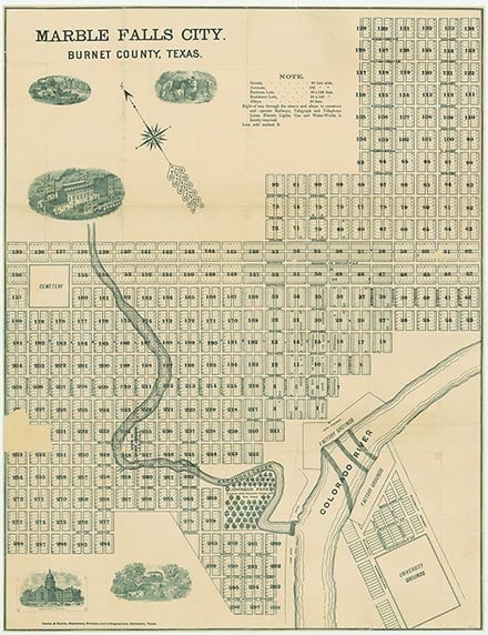
Marble Falls, Texas
Marble Falls in Burnett County, Texas. Photo by Thomas Park on Unsplash.

Horseshoe Bay, Texas
The City Hall building in Horseshoe Bay, a city situated on the Lyndon B. Johnson Lake, primarily on Llano County but also one that extends eastward into Burnett County. Photograph by Larry D. Moore.

Burnet, Texas
View of the City Hall in Burnet, the seat of Burnet County, Texas. Photograph by Billy Hathorn.

Buchanan Dam was completed in 1938
Photo by Larry D. Moore, CC by SA 4.0

Inks Lake is in the Texas Hill Country
Photo by Carol M. Highsmith for the Library of Congress, Public Domain

Honeymoon Ranch lies on the shore of Lake Lyndon B. Johnson
Photo by Carol M. Highsmith for the Library of Congress. Public Domain

Max Starcke Dam was completed in 1951
Photo by Larry D. Moore, CC 3

A View of Lake Travis
Lake Travis is a popular weekend destination. Photo by Beckybot, CC by SA 4.0
Proud to call Texas home?
Put your name on the town, county, or lake of your choice.
Search Places »