Cross Roads

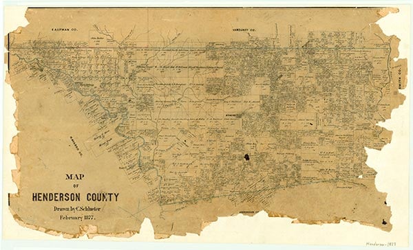
Cross Roads is at the junction of Farm roads 59 and 3441 in southwestern Henderson County. The area was originally settled in 1846. The earliest settlement was called Science Hill. In 1885 the Wildcat post office was opened at the site with George B. Thompson as postmaster. By 1892 the community had three cotton gins, a general store, and several other establishments, but the Wildcat post office closed in 1905. The community was also referred to as Thompson's Mill because of a water-powered mill built in 1871 by D. M. Thompson on Wildcat Creek. Cross Roads, as a named community, traces its origins to the early 1890s. A brush-arbor camp meeting of Baptists was held at the point where the road from Athens to Wildcat Ferry and the road from Malakoff to Palestine crossed, and gave the location the name "Cross Roads." The first permanent building in the area was a church, which was erected after the Union-Center school moved from Thompson's Mill to the Cross Roads location. In 1908 a one-room school was erected; it was taught by Sam Holland, who later became district judge of Henderson County. In the early part of the twentieth century numerous gins, gristmills, and other businesses supportive of an agricultural community thrived at Cross Roads. There was a post office there until World War I, and a courthouse was built to house the justice of the peace court.
In the mid-1920s, as a result of the merger of various smaller schools in the area, the Cross Roads Consolidated School was established. From the 1920s through the end of World War II the school was expanded and upgraded. The Work Projects Administration made several improvements to the school facility, and in the late 1940s the Cross Roads Independent School District was formed as the consolidation of eight common school districts in the general vicinity. After a disastrous fire in 1953 much of the school plant was rebuilt. In 1990 the Cross Roads Independent School District comprised 75,000 acres and had 500 students. Cotton and ranching were the most important agricultural activities in the district, particularly in the Trinity River bottom, but other areas produced various truck crops and fruit. Discoveries of oil and gas in the 1940s and 1950s contributed to a brief resurgence. A population of 135 was reported in 1988, 1990, and 2000.
Michael J. Vaughn | © TSHA

Adapted from the official Handbook of Texas, a state encyclopedia developed by Texas State Historical Association (TSHA). It is an authoritative source of trusted historical records.

- ✅ Adoption Status:
Belongs to
Cross Roads is part of or belongs to the following places:
Currently Exists
Yes
Place type
Cross Roads is classified as a Town
Associated Names
- (Science Hill)
- (Thompson's Mill)
- (Wildcat)
Location
Latitude: 32.04904730Longitude: -95.96746540
Has Post Office
No
Is Incorporated
No
Population Count, 2009
160
