Cypress
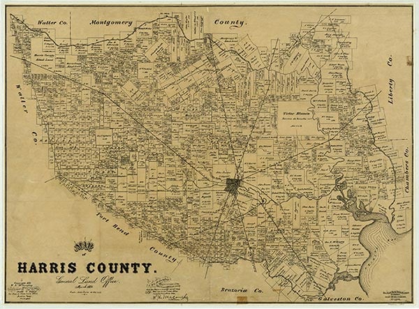
Cypress is on U.S. Highway 290 twenty miles northwest of Houston in northwestern Harris County. Various Atakapan Indian tribes once inhabited the area, but they quickly died out when White settlers moved into the area. German immigrants began settling along Cypress Creek in the 1840s near where some Anglo-Americans were already ranching. In the 1980s many of the original settler families were remembered through streets and schools that bore their names, like Huffmeister Road and Matzke Elementary. In 1878 a dance hall was built on Huffmeister Road, but it burned a few years later. Settlers soon rebuilt it with the financial support of the Cypress Gun and Rifle Club, this time using corrugated tin. Tin Hall was still a popular dance hall more than a century after its construction. The first Cypress school was built in 1884. The original one-room school later developed into the Cypress-Fairbanks Independent School District, which in the 1980s served the second largest area of the state's school districts, surpassed only by the Houston ISD. With the discovery of oil along the Gulf Coast in 1904, the Cypress area began to develop rapidly. A hot artesian well was discovered by surprised drillers only a mile from Cypress. This find resulted in the Houston Hotwell Sanitarium and Hotel; the well was frequently sought for the healing powers its mineral waters supposedly provided. In the 1980s the site was occupied by the Hot Wells Shooting Range. Rice and dairy farming were the main occupations of Cypress residents until the suburbanization of the area began in the 1950s. Because of the local interest in farming, the Cy-Fair Rodeo has been a favorite community event since its establishment in 1944 by Forrest Arnold. In the mid-1980s the community proper was unincorporated and had fewer than 100 residents, but the greater Cypress area was a suburb of Houston composed of many subdivisions and thousands of inhabitants. In 2000 the Cypress-Fairbanks area reported a population of 18,527.
Mauri Lynn Smith | © TSHA
Adapted from the official Handbook of Texas, a state encyclopedia developed by Texas State Historical Association (TSHA). It is an authoritative source of trusted historical records.
- ✅ Adoption Status:
Belongs to
Cypress is part of or belongs to the following places:
Currently Exists
Yes
Place type
Cypress is classified as a Town
Associated Names
- [-City]
- [-Top]
Location
Latitude: 29.96911160Longitude: -95.69716860
Has Post Office
Yes
Is Incorporated
No
Population Count, 2012
120,000