Encantada-Ranchito El Calaboz
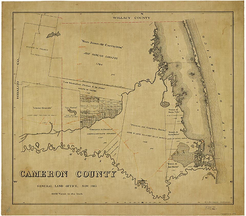
Encantada-Ranchito-El Calaboz, located off U. S. Highway 281 just north of the Rio Grande and about twelve miles northwest of Brownsville and six miles south of San Benito, was classified as a census-designated place in 1990. This community includes Encantada, a colonia that was shown on highway maps by the early 1960s, as well as the colonias of Ranchito and El Calaboz. In 1990 the population was 1,143. That figure increased to 2,100 in 2000. The area consists of primarily Hispanic, lower-income families and is part of the San Benito Consolidated Independent School District (see EL CALABOZ and RANCHITO).
Laurie E. Jasinski | © TSHA
Adapted from the official Handbook of Texas, a state encyclopedia developed by Texas State Historical Association (TSHA). It is an authoritative source of trusted historical records.
- ✅ Adoption Status:
Belongs to
Encantada-Ranchito El Calaboz is part of or belongs to the following places:
Currently Exists
Yes
Place type
Encantada-Ranchito El Calaboz is classified as a Town
Associated Names
- (Ranchito [El-)
- (Ranchita])
Location
Latitude: 26.03344220Longitude: -97.63307400
Has Post Office
No
Is Incorporated
No
Population Count, 2021 View more »
1,362