Haymond
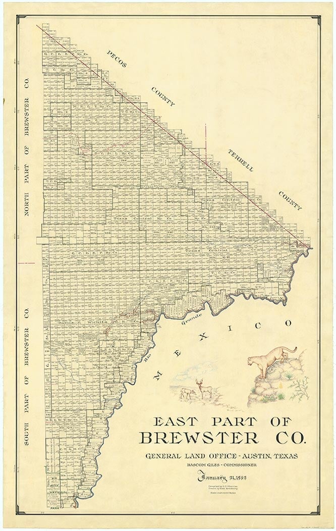
Haymond was a rail siding and station stop on the Southern Pacific line about sixteen miles southeast of Marathon in northeastern Brewster County. The location was originally named McLeary when a post office was established there in October 1883, but in January 1884 its name was changed in honor of Creed Haymond, a railroad attorney. The railroad built through the area in 1882, and by the early 1890s a small community had developed around the train station there. At the time, Haymond was the nearest railroad stop to Fort Stockton, and a stage line was established connecting the two locales. The community had a sizable train depot, a saloon, twenty-four-hour telegraph service, a mercantile store, a hotel, and a population estimated by one source at nearly 300. During the 1890s Haymond was larger than nearby Marathon, and at least one businessman from Alpine moved his establishment to Haymond thinking that it would become the region's principal railroad town. Haymond's population ranged from fifty to 100 in the 1890s, but the community failed to survive. Haymond probably declined largely as a combined result of the panic of 1893 and the severe drought of the mid-1890s, which drove out most of the dryland farmers who had settled in the area. When the Boquillas mines to the south began producing after 1894, the ore was hauled to Marathon for shipment, and one source reports that most of Haymond's residents moved to Marathon then. Other sources claim that most of its inhabitants moved to Sanderson to work on the railroad, while others left to work for the mines around Shafter. Although some residents remained, Haymond never recovered. In 1904 a new stage line connecting Fort Stockton with Monahans was opened, the line between Fort Stockton and Haymond was shut down, and the Haymond train station was closed. Mail service to the community ended in 1936, and in 1948 the Southern Pacific's section house was moved to Tesnus; the rail siding was abandoned in 1963. By the 1970s the only traces left of Haymond were a few scattered ruins and a signpost marking its location.
Richard Bruhn | © TSHA
Adapted from the official Handbook of Texas, a state encyclopedia developed by Texas State Historical Association (TSHA). It is an authoritative source of trusted historical records.
- ✅ Adoption Status:
Belongs to
Haymond is part of or belongs to the following places:
Currently Exists
No
Place type
Haymond is classified as a Town
Associated Names
- (McLeary)
Location
Latitude: 30.14379060Longitude: -103.01933030
Has Post Office
No
Is Incorporated
No