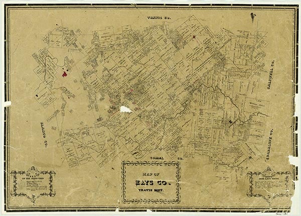
Hays County

Hays County, Texas

Hays County, Texas
Hays County occupies an area of 693.5 square miles in south central Texas; the center of the county is at 98°00' west longitude and 30°00' north latitude, twenty-three miles southwest of Austin. The county is located on the border between the Edwards Plateau and the southern Black Prairie region. The Balcones Escarpment divides it into hilly, tree-covered ranch country in the northwest three-quarters and grassy, agricultural plains in the southeast quarter. The principal natural grasses are big bluestem and Indian grass; trees commonly associated with Central Texas-including live oak, cedar, pecan, and mesquite-are indigenous to Hays County. The elevation rises from east to west, varying from 600 to over 1,400 feet. The county's numerous streams generally flow in an easterly direction; the principal waterways are Bear, Cypress, and Onion creeks and the Blanco and San Marcos rivers. The Edwards Aquifer underlies the eastern area, where San Marcos Springs, the second largest in Texas, delivers about 160 cubic feet per second. The soil varies from thin limestone to black, waxy, chocolate, and grey loam. The mean annual rainfall is 33.75 inches. The average maximum temperature in July is 96° F; the average minimum temperature in January is 40°. Hays County has a growing season of 254 days.
The many springs in the area that is now Hays County have attracted numerous visitors. Archeological findings indicate the presence of Paleo-Indian people near San Marcos Springs at least 8,000 years ago, and excavations at the Timmeron Site, west of Wimberley, reveal that Tonkawa Indians practiced farming in the area around A.D. 1200. During the Spanish period the region lay at the edge of the main route from San Antonio to East Texas, the Old San Antonio Road. In 1691 Domingo Terán de los Ríos crossed the southern edge of the county on his way to the East Texas missions and the Red River. The Espinosa-Olivares-Aguirre expedition explored the upper San Marcos River in 1709, and Louis Juchereau de St. Denis was attacked by Apaches in 1714 at the San Marcos River crossing. A mission to be called San Marcos was authorized in 1729 near the site of present San Marcos, but the authorization was later rescinded in favor of San Antonio. San Xavier Mission and San Francisco Xavier Presidio were located briefly at the site in 1755–56, but no permanent settlement was attempted until 1807, when some eighty persons were moved to the Old San Antonio Road crossing of the San Marcos River. San Marcos de Neve, one of a chain of defense settlements, was abandoned four years later, after flooding and attacks by Comanche and Tonkawa Indians. To encourage settlement after the Mexican War for Independence, the government of Coahuila and Texas issued land grants in the county to Juan Martín Veramendi in 1831, Juan Vicente Campos in 1832, and Thomas Jefferson Chambers in 1834. The first Anglo-American settler in Hays County, Thomas G. McGehee, was issued a league of land in 1835 by the Mexican government and was farming north of the site of present San Marcos in 1846.
Paul F. Cecil, Daniel P. Greene | © TSHA
Adapted from the official Handbook of Texas, a state encyclopedia developed by Texas State Historical Association (TSHA). It is an authoritative source of trusted historical records.
- ✅ Adoption Status:
- This place is available for adoption! Available for adoption!
- Adopted by:
- Your name goes here
- Dedication Message:
- Your message goes here
Currently Exists
Yes
Place type
Hays County is classified as a County
Altitude Range
550 ft – 1620 ft
Size
Land area does not include water surface area, whereas total area does
- Land Area: 678.0 mi²
- Total Area: 679.9 mi²
Temperature
January mean minimum:
38.7°F
July mean maximum:
94.3°F
Rainfall, 2019
35.7 inches
Population Count, 2019
230,191
Civilian Labor Count, 2019
118,060
Unemployment, 2019
7.9%
Property Values, 2019
$25,161,553,775 USD
Per-Capita Income, 2019
$43,719 USD
Retail Sales, 2019
$4,177,985,100 USD
Wages, 2019
$830,475,103 USD
County Map of Texas
Hays County
- Hays County
Places of Hays County
| Place | Type | Population (Year/Source) | Currently Exists |
|---|---|---|---|
| Town | 25 (2009) | Yes | |
| Town | – | – | |
| Town | 418 (2021) | Yes | |
| Town | 7,736 (2021) | Yes | |
| Town | – | – | |
| Town | – | – | |
| Town | – | – | |
| Town | 15,643 (2021) | Yes | |
| Town | – | – | |
| Town | – | – | |
| Town | – | – | |
| Town | – | – | |
| Town | – | – | |
| Town | – | – | |
| Town | 87 (2021) | Yes | |
| Town | 5,787 (2021) | Yes | |
| Town | – | – | |
| Town | – | – | |
| Town | – | – | |
| Town | – | – | |
| Town | – | – | |
| Town | – | – | |
| Town | – | – | |
| Town | – | – | |
| Town | – | – | |
| Town | 240 (2021) | Yes | |
| Town | – | – | |
| Town | – | – | |
| Town | 140 (2009) | Yes | |
| Town | – | – | |
| Town | – | – | |
| Town | – | – | |
| Town | – | – | |
| Town | – | – | |
| Town | – | – | |
| Town | 51,789 (2021) | Yes | |
| Town | – | – | |
| Town | – | – | |
| Town | – | – | |
| Town | – | – | |
| Town | – | – | |
| Town | – | – | |
| Town | – | – | |
| Town | 656 (2021) | Yes | |
| Town | – | – | |
| Town | – | – | |
| Town | 671 (2021) | Yes | |
| Town | – | – | |
| Town | – | – | |
| Town | – | – | |
| Town | – | – | |
| Town | – | – | |
| Town | – | – | |
| Town | 68,580 (2021) | Yes | |
| Town | – | – | |
| Town | – | – | |
| Town | – | – | |
| Town | – | – | |
| Town | 1,667 (2021) | Yes | |
| Town | – | – | |
| Town | – | – | |
| Town | 2,877 (2021) | Yes | |
| Town | – | – | |
| Town | 1,804 (2021) | Yes | |
| Town | – | – |
Proud to call Texas home?
Put your name on the town, county, or lake of your choice.
Search Places »