Jefferson County

Jefferson County, Texas

Jefferson County, Texas
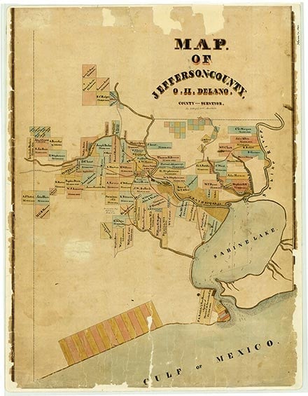
Jefferson County, on Interstate Highway 10 in the Coastal Plain or Gulf Prairie region of extreme southeastern Texas, is bounded by Orange County on the northeast, by Hardin County on the north, by Liberty and Chambers counties on the west, and by the Gulf of Mexico on the south. To the east the county line is formed by the Neches River, Sabine Lake, and Sabine Pass, and to the north by Pine Island Bayou. A series of lakes extends across the southern part of the county, and beaches overlook the Gulf. The Port Arthur ship canal, on the west shore of Sabine Lake, connects with the Neches and Sabine rivers to provide deepwater ports at Beaumont, Port Arthur, Nederland, and Port Neches. Deepwater transportation and petrochemical industries are among the county's economic mainstays. Beef cattle and rice yield major farm income, and the majority of wage earners are employed in the petrochemical, shipbuilding, and rubber industries. The county comprises 937 square miles, mainly of grassy plains, though a dense forest belt crosses the northwest part. The southern third of the county consists of marshy saltgrass terrain good for cattle raising, the middle third is coastal prairie used for grazing and rice culture, and the northern third is heavily forested with hardwoods and southern yellow pine. The terrain is low and flat, with altitudes rising from sea level to about fifty feet. Beach sands and ocean sediments make up soils along the coast. The northern border is surfaced by light-colored, loamy soils over deep, reddish clayey or loamy subsoils with hardened calcium deposits, and the remainder of the county has light to dark loamy surfaces over clayey subsoils or gray to black, clayey soils. Geologically, the county is noted for its Beaumont Clay formation and the Spindletop and Big Hill salt domes, which contain sulfur and petroleum. The mean annual temperature is 69° F, and the average annual rainfall is fifty-three inches. The subtropical, humid climate features warm, moist summers tempered by Gulf breezes. The growing season averages 225 days a year. Vegetation includes pine, white oak, red oak, pin oak, ash, beech, magnolia, gum, cypress, bunchgrasses, marsh millet, seashore saltgrass and cordgrasses. Between 1 and 10 percent of the land is considered prime farmland. Among the principal streams are Taylor's, Hillebrandt, and Pine Island bayous. Lake B. A. Steinhagen and Sam Rayburn Reservoir provide water for municipal use and industry, and the bayous are used for irrigation by rice growers. Natural resources in the county include ceramic clays, industrial sand, oil and gas, sulfur, and pine and hardwood. Three railroads — the Kansas City Southern, the Southwest Electric Power Company, and the Union Pacific — serve the county, and the Neches River provides water transport. The county seat, Beaumont, an important shipping point, petrochemical producer, and hospital and nursing home center, is located on the Neches River at the county's approximate midpoint (at 30°05' N, 94°06' W). Incorporated towns include Beaumont, Bevil Oaks, China, Groves, Nederland, Nome, Port Arthur, and Port Neches. Beaumont, Port Arthur, and neighboring Orange, cities of the "Golden Triangle," have been the principal cities of the Sabine area and major manufacturing centers.
Prehistoric habitation in the future Jefferson County began with the arrival of Atakapa Indians roughly 2,000 years ago; an Atakapan vase from the Marksville Culture has been dated between the year one and A.D. 500. Atakapas lived on the Lower Neches and Sabine rivers. They occupied two villages on opposite sides of the Neches near the site of present Beaumont in 1746. Orcoquiza Indians occupied the area from the Neches River to halfway between the Trinity and the Brazos. Six burial mounds have been discovered at Joseph Grigsby's plantation at Port Neches on the west bank of the Neches twelve miles below Beaumont, and pottery shards have been found at Sabine Lake and in many places throughout the area. Disappearance of the Indians has been attributed to migration or smallpox epidemics; Most were gone by the 1820s, when the first White settlers arrived.
Diana J. Kleiner | © TSHA
Adapted from the official Handbook of Texas, a state encyclopedia developed by Texas State Historical Association (TSHA). It is an authoritative source of trusted historical records.
- ✅ Adoption Status:
Currently Exists
Yes
Place type
Jefferson County is classified as a County
Altitude Range
0 ft – 49 ft
Size
Land area does not include water surface area, whereas total area does
- Land Area: 876.3 mi²
- Total Area: 1,112.7 mi²
Temperature
January mean minimum:
41.7°F
July mean maximum:
92.0°F
Rainfall, 2019
60.4 inches
Population Count, 2019
251,565
Civilian Labor Count, 2019
104,312
Unemployment, 2019
13.6%
Property Values, 2019
$30,074,990,260 USD
Per-Capita Income, 2019
$44,065 USD
Retail Sales, 2019
$4,211,278,251 USD
Wages, 2019
$1,861,770,471 USD
County Map of Texas
Jefferson County
- Jefferson County
Places of Jefferson County
| Place | Type | Population (Year/Source) | Currently Exists |
|---|---|---|---|
| Town | – | – | |
| Town | – | – | |
| Town | – | – | |
| Town | – | – | |
| Town | 112,556 (2021) | Yes | |
| Town | 864 (2021) | Yes | |
| Town | 1,058 (2021) | Yes | |
| Town | – | – | |
| Town | – | – | |
| Town | – | – | |
| Town | – | – | |
| Town | – | – | |
| Town | – | – | |
| Town | – | – | |
| Town | – | – | |
| Town | 3,377 (2021) | Yes | |
| Town | – | – | |
| Town | 1,096 (2014) | Yes | |
| Town | 1,240 (2021) | Yes | |
| Town | – | – | |
| Town | – | – | |
| Town | – | – | |
| Town | – | – | |
| Town | – | – | |
| Town | – | – | |
| Town | – | – | |
| Town | – | – | |
| Town | – | – | |
| Town | 2,290 (2021) | Yes | |
| Town | – | – | |
| Town | – | – | |
| Town | – | – | |
| Town | – | – | |
| Town | – | – | |
| Town | – | – | |
| Town | – | – | |
| Town | – | – | |
| Town | – | – | |
| Town | – | – | |
| Town | 16,915 (2021) | Yes | |
| Town | – | – | |
| Town | 1,420 (2021) | Yes | |
| Town | – | – | |
| Town | – | – | |
| Town | – | – | |
| Town | – | – | |
| Town | – | – | |
| Town | – | – | |
| Lake | – | Yes | |
| Town | – | – | |
| Town | 40 (2014) | Yes | |
| Town | – | – | |
| Town | – | – | |
| Town | – | – | |
| Town | – | – | |
| Town | – | – | |
| Town | – | – | |
| Town | 2,280 (2014) | Yes | |
| Town | – | – | |
| Town | – | – | |
| Town | – | – | |
| Town | – | – | |
| Town | – | – | |
| Town | 18,331 (2021) | Yes | |
| Town | – | – | |
| Town | 453 (2021) | Yes | |
| Town | – | – | |
| Town | – | – | |
| Town | – | – | |
| Town | – | – | |
| Town | – | – | |
| Town | – | – | |
| Town | – | – | |
| Town | – | – | |
| Town | 350 (2014) | Yes | |
| Town | – | Yes | |
| Town | 55,724 (2021) | Yes | |
| Town | 13,416 (2021) | Yes | |
| Town | – | – | |
| Town | – | – | |
| Town | – | Yes | |
| Town | – | – | |
| Town | – | – | |
| Town | – | – | |
| Town | – | – | |
| Town | – | – | |
| Town | – | – | |
| Town | – | – | |
| Town | – | – | |
| Town | 278 (2021) | Yes | |
| Town | – | – | |
| Town | – | – | |
| Town | – | – | |
| Town | – | – | |
| Town | – | – | |
| Town | – | – | |
| Town | – | – | |
| Town | – | – | |
| Town | – | – | |
| Town | – | – | |
| Town | – | – | |
| Town | – | – | |
| Town | – | – | |
| Town | – | – | |
| Town | – | – |
Proud to call Texas home?
Put your name on the town, county, or lake of your choice.
Search Places »