Jim Wells County

Jim Wells County, Texas

Jim Wells County, Texas
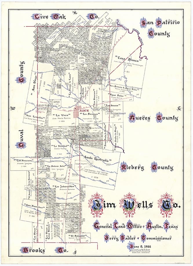
Jim Wells County is on U.S. Highway 281 west of Corpus Christi in the Rio Grande Plain region of South Texas. It is bordered by Live Oak and San Patricio counties on the north, Nueces and Kleberg counties on the east, Brooks County on the south, and Duval County on the west. Alice, the county seat and largest town, is located near the center of the county at 27°39' north latitude and 98°05' west longitude. Other communities include Orange Grove, Ben Bolt, Sandia, and Premont. The county covers 845 square miles. The terrain is flat, with elevations ranging from 200 to 400 feet. Soils are generally light to dark, with loamy surfaces over reddish, clayey subsoils and limestone forty inches below the surface. Gray to black, cracking, clayey soils are also found in some areas. The county's vegetation is typical of the South Texas Plains region, with grasslands, mesquite, post oak, live oak, and cacti predominating. Between 41 and 50 percent of the county is considered prime farmland. Natural resources include caliche, industrial sand, oil, and gas. The climate is subtropical-humid. Heavy rains from weakening tropical storms are common from June through October. Temperatures range from 44° F to 68° in January and 74° to 96° in July. The average annual temperature is 72°. Rainfall averages twenty-eight inches a year. Snow almost never occurs. The growing season lasts for 304 days of the year, with the last freeze in mid-February and the first freeze in early December.
The area that is now Jim Wells County has been the site of human habitation for perhaps 11,000 years. Among the oldest artifacts found in the region are stone implements and human remains dating from the Paleo-Indian period (9200 to 6000 B.C.). During the Archaic period (6000 B.C. to A.D. 1000) the local Indian population seems to have increased, and small bands of hunter-gatherers apparently spent time in the area. During this period the inhabitants subsisted mostly on game, wild fruits, seeds, and roots. Tools were carved from wood and stone by these early peoples, who also wove baskets and made rabbit-skin clothing. The hunting and gathering life persisted into the Late Prehistoric period (A.D. 1000 to the arrival of the Spanish), though during this time the Indians in the area, who included the Chaguanes and Payuguans, learned to make pottery and hunted with bows and arrows. These early groups, who belonged to the Coahuiltecan linguistic group, were driven out by the Lipan Apaches by 1775.
Alicia A. Garza | © TSHA
Adapted from the official Handbook of Texas, a state encyclopedia developed by Texas State Historical Association (TSHA). It is an authoritative source of trusted historical records.
- ✅ Adoption Status:
Currently Exists
Yes
Place type
Jim Wells County is classified as a County
Altitude Range
50 ft – 450 ft
Size
Land area does not include water surface area, whereas total area does
- Land Area: 865.0 mi²
- Total Area: 868.3 mi²
Temperature
January mean minimum:
44.9°F
July mean maximum:
97.2°F
Rainfall, 2019
28.4 inches
Population Count, 2019
40,482
Civilian Labor Count, 2019
17,132
Unemployment, 2019
14.3%
Property Values, 2019
$2,407,738,129 USD
Per-Capita Income, 2019
$40,570 USD
Retail Sales, 2019
$470,490,394 USD
Wages, 2019
$204,766,951 USD
County Map of Texas
Jim Wells County
- Jim Wells County
Places of Jim Wells County
| Place | Type | Population (Year/Source) | Currently Exists |
|---|---|---|---|
| Town | 274 (2021) | Yes | |
| Town | 17,761 (2021) | Yes | |
| Town | 241 (2021) | Yes | |
| Town | – | – | |
| Town | 125 (2021) | Yes | |
| Town | – | – | |
| Town | 1,555 (2021) | Yes | |
| Town | 15 (2009) | Yes | |
| Town | – | – | |
| Town | – | – | |
| Town | – | – | |
| Town | 894 (2021) | Yes | |
| Town | – | – | |
| Town | – | – | |
| Town | – | – | |
| Town | – | – | |
| Town | – | – | |
| Town | – | – | |
| Town | 456 (2021) | Yes | |
| Town | – | – | |
| Town | – | – | |
| Town | 70 (2009) | Yes | |
| Lake | – | Yes | |
| Town | 23 (2021) | Yes | |
| Town | – | – | |
| Town | – | – | |
| Town | – | – | |
| Town | – | – | |
| Town | 24 (2009) | Yes | |
| Town | – | – | |
| Town | – | – | |
| Town | 1,183 (2021) | Yes | |
| Town | 196 (2021) | Yes | |
| Town | 750 (2009) | Yes | |
| Town | – | – | |
| Town | 274 (2010) | Yes | |
| Town | 2,441 (2021) | Yes | |
| Town | 1,561 (2021) | Yes | |
| Town | – | – | |
| Town | 3,755 (2021) | Yes | |
| Town | 382 (2021) | Yes | |
| Town | – | – | |
| Town | 790 (2021) | – | |
| Town | – | – | |
| Town | – | – | |
| Town | – | – | |
| Town | – | – | |
| Town | 82 (2021) | Yes |
Photos Nearby:

San Diego, Texas
Train at San Diego, Texas, Historical photograph 1914. Photograph is a primary source, located at UNT's The Portal of Texas History: https://texashistory.unt.edu/ark:/67531/metapth703980/

Alice, Texas
View of downtown Alice, the seat of Jim Well County, Texas. Photograph by Terry Jeanson viaTexasEscapes.com.

A fishing pier on Lake Corpus Christi
Photo by Larry D. Moore, CC 3
Proud to call Texas home?
Put your name on the town, county, or lake of your choice.
Search Places »