Lajitas

The World Famous Mayor of Lajitas
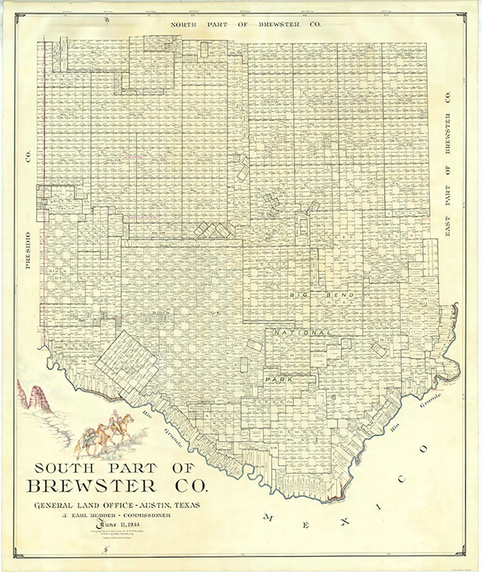
Lajitas is on the western edge of Big Bend National Park in southwestern Brewster County. It is at an altitude of 2,200 feet on a bluff overlooking the Rio Grande at the San Carlos ford of the old Comanche Trail, in the northern part of the Chihuahuan Desert. The name Lajitas is Spanish for "little flat rocks" and refers to the Boquillas flagstone of the area. The region was inhabited by Mexican Indians for many years. They were driven from the area by the Apaches and later by the Comanches during the eighteenth and nineteenth centuries. Anglo-Americans first arrived in the mid-1800s. In 1852 Lt. William H. Emory visited the site.
In the late 1890s quicksilver was discovered near Terlingua, eleven miles from Lajitas, and a rapid influx of people followed (see MERCURY MINING). At the same time a number of cattle ranches and mining enterprises appeared in northern Chihuahua and Coahuila. These activities increased commerce across the Rio Grande into Texas; consequently, by 1900 Lajitas was designated a substation port of entry. Farming along the narrow floodplain of the river served to bring in more families, and by 1912 the town had a store, a saloon, a school with fifty pupils, and a customhouse. The crossing, a smooth rock bottom all the way across the river, was the best between Del Rio and El Paso.
Evelyn Hilton | © TSHA
Adapted from the official Handbook of Texas, a state encyclopedia developed by Texas State Historical Association (TSHA). It is an authoritative source of trusted historical records.
- ✅ Adoption Status:
Belongs to
Lajitas is part of or belongs to the following places:
Currently Exists
Yes
Place type
Lajitas is classified as a Town
Associated Names
- [Lajites]
Location
Latitude: 29.26158730Longitude: -103.77657900
Has Post Office
No
Is Incorporated
No
Population Count, 2009
75