Llano County

Llano County, Texas

Llano County, Texas

Llano County, Texas
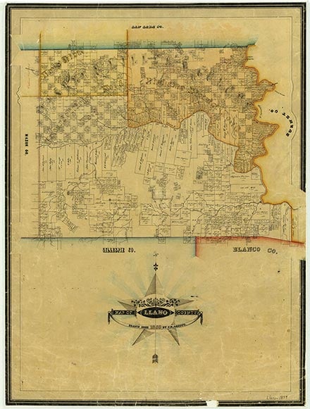
Llano County, in Central Texas, is bounded on the north by San Saba County, on the east by Burnet County, on the south by Gillespie County, and on the west by Mason County. Llano, the county seat, is seventy-two miles northwest of Austin and near the center point of the county, which lies at approximately 98'40° west longitude and 30'45° north latitude. Llano County comprises 941 square miles of the Hill Country on the eastern part of the Edwards Plateau. Altitudes range from 800 to 2,000 feet above sea level. The county drains into the Colorado River, either through the Llano River (from which the county gets its name), which runs from west to east through the center of the county, or through Sandy Creek, which flows across the southern part of the county. Ashe juniper trees grow on the hills, and mesquites, live oaks, post oaks, pecans, and elms grow in most of the county. The soil is sandy to sandy loam, although there are granite outcroppings throughout much of the county, including Enchanted Rock. Granite quarries and finishing sheds operate in the county, and talc, vermiculite, and feldspar have also been produced. Temperatures range from an average high of 98° F in July to an average low of 34° in January, rainfall averages 26.20 inches a year, and the growing season lasts 229 days.
Tonkawa Indians occupied Central Texas at the time the future Llano County was first explored, but it is uncertain how long they had lived there. The Tonkawas hunted and gathered along streams and did not farm. They were not warlike, however, and they apparently invited the Spaniards to establish missions that would help them against the fierce Comanches. The Comanches came into the Tonkawa area in the eighteenth century and eventually claimed territory as far southeast as San Antonio and Austin. During the Republic of Texas era, conflict between Whites and Comanches in the region was marked by such battles as a fight at Enchanted Rock in 1841.
Ernest B. Speck | © TSHA
Adapted from the official Handbook of Texas, a state encyclopedia developed by Texas State Historical Association (TSHA). It is an authoritative source of trusted historical records.
- ✅ Adoption Status:
- This place is available for adoption! Available for adoption!
- Adopted by:
- Your name goes here
- Dedication Message:
- Your message goes here
Currently Exists
Yes
Place type
Llano County is classified as a County
Altitude Range
825 ft – 2000 ft
Size
Land area does not include water surface area, whereas total area does
- Land Area: 934.0 mi²
- Total Area: 965.9 mi²
Temperature
January mean minimum:
32.2°F
July mean maximum:
97.7°F
Rainfall, 2019
27.7 inches
Population Count, 2019
21,795
Civilian Labor Count, 2019
8,272
Unemployment, 2019
6.0%
Property Values, 2019
$6,931,073,283 USD
Per-Capita Income, 2019
$47,476 USD
Retail Sales, 2019
$153,972,625 USD
Wages, 2019
$49,809,119 USD
County Map of Texas
Llano County
- Llano County
Places of Llano County
| Place | Type | Population (Year/Source) | Currently Exists |
|---|---|---|---|
| Town | – | – | |
| Town | – | – | |
| Town | – | – | |
| Town | – | – | |
| Town | – | – | |
| Town | – | – | |
| Town | – | – | |
| Town | 75 (2009) | Yes | |
| Town | – | – | |
| Town | – | – | |
| Town | 1,344 (2021) | Yes | |
| Town | 654 (2021) | Yes | |
| Town | – | – | |
| Town | – | – | |
| Town | – | – | |
| Town | 72 (2009) | Yes | |
| Town | – | – | |
| Town | – | – | |
| Town | – | – | |
| Town | – | – | |
| Town | – | – | |
| Town | – | – | |
| Town | – | – | |
| Town | – | – | |
| Town | – | – | |
| Town | – | – | |
| Town | – | – | |
| Town | – | – | |
| Town | – | – | |
| Town | – | – | |
| Town | – | – | |
| Town | – | – | |
| Town | – | – | |
| Town | 4,490 (2021) | Yes | |
| Town | – | – | |
| Lake | – | Yes | |
| Town | 6,917 (2021) | Yes | |
| Lake | – | Yes | |
| Lake | – | Yes | |
| Town | – | – | |
| Town | – | – | |
| Town | – | – | |
| Town | – | – | |
| Town | 3,347 (2021) | Yes | |
| Town | 50 (2009) | Yes | |
| Town | – | – | |
| Town | – | – | |
| Town | – | – | |
| Town | – | – | |
| Town | – | – | |
| Town | – | – | |
| Town | 18 (2009) | Yes | |
| Town | – | – | |
| Town | – | – | |
| Town | – | – | |
| Town | – | – | |
| Town | – | – | |
| Town | – | – | |
| Town | – | – | |
| Town | – | – | |
| Town | – | – | |
| Town | 85 (2009) | Yes | |
| Town | – | – | |
| Town | – | – | |
| Town | – | – | |
| Town | – | – | |
| Town | – | – | |
| Town | – | – | |
| Town | – | – | |
| Town | – | – | |
| Town | – | – | |
| Town | 766 (2021) | Yes | |
| Town | 162 (2021) | Yes | |
| Town | 50 (2009) | Yes | |
| Town | – | – |
Photos Nearby:

The City of Llano, Texas
The City of Llano is the seat of Llano County and is located about 65 miles northwest of Austin, the capital of Texas. Photograph by Larry D. Moore.

Sunrise Beach, Texas
Sunrishe Beach is a village in Llano County, Texas Photograph by Larry D. Moore.

Horseshoe Bay, Texas
The City Hall building in Horseshoe Bay, a city situated on the Lyndon B. Johnson Lake, primarily on Llano County but also one that extends eastward into Burnett County. Photograph by Larry D. Moore.

Buchanan Dam was completed in 1938
Photo by Larry D. Moore, CC by SA 4.0

Inks Lake is in the Texas Hill Country
Photo by Carol M. Highsmith for the Library of Congress, Public Domain

Honeymoon Ranch lies on the shore of Lake Lyndon B. Johnson
Photo by Carol M. Highsmith for the Library of Congress. Public Domain
Proud to call Texas home?
Put your name on the town, county, or lake of your choice.
Search Places »