Madison County

Madison County, Texas

Madison County, Texas
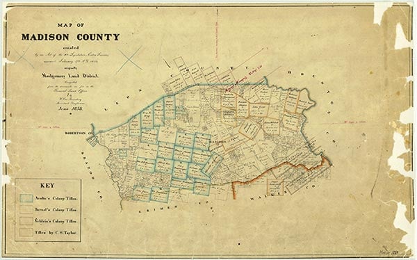
Madison County is located in central East Texas. Madisonville, the county seat and largest town, is near interstate Highway 45 about 100 miles northwest of Houston; the town is at 30°57' north latitude and 95°55' west longitude, close to the center of the county. Madison County includes 473 square miles primarily of post oak savannah, a mixture of post oak woods and grasslands. The northeast and south central parts of the county are in the Blackland Prairies region; the southeast corner of the county lies in the Piney Woods. Today, about one-fifth of the area is timbered, but early reports describe it as two-thirds timber and one-third prairie. It supported oak, cedar, elm, walnut, hickory, gum, pecan, ash, cypress, and pine. The terrain is undulating, with an elevation ranging from 213 to 364 feet above sea level. The rolling prairies drain to the waterways that form the county's boundaries: the Trinity River in the east, the Navasota River in the west, and Bedias Creek in the south. Numerous other creeks run through the county, notably the Caney, which bisects it. Several soil types are found in the county, which lies principally in the Claypan area. They range from black waxy to light sandy loam around creeks and lower lands, with dark chocolate mixed with sand on the prairie uplands. Almost the entire county is made up of soils with sandy surface layers and mottled yellow, red, and gray loamy subsoils. The northwest portion is surfaced by noncalcareous and calcareous cracking clayey soils and slightly acid soils with loamy surface layers and cracking clayey subsoils. Oil and gas are found in the county, as are lignite, sand, and gravel. Madison County has a mild climate, with an average growing season of 272 days. Its average annual rainfall is 41.50 inches, and temperatures range from a January minimum average of 40° F to a July maximum average of 94°.
The territory in present-day Madison County was occupied by members of two Indian groups, the Caddoes and the Atakapans. The Caddoes were among the most advanced of the Texas Indians and were considered wealthy as well as friendly. They lived in large villages and constructed beehive-shaped houses. The Bidais, who were the principal residents of the area now known as Madison County, belonged to the Atakapan group. They, along with the Deadose Indians, themselves also Atakapans, occupied the Trinity River valley in the heart of the county. The main village of the Bidais was located at the confluence of the Trinity River and Bedias Creek. Closely associated with the Caddoes, the Bidais were agriculturalists, known for raising corn. They also depended largely on hunting, especially of deer. Though they were never a large group, they were decimated by epidemics and incursions by hostile tribes. The Kickapoos, migrants from the east who settled among the remnants of the Caddo confederacies, also resided in the area at one time; Kickapoo Creek still bears their name.
Ann E. Hodges | © TSHA
Adapted from the official Handbook of Texas, a state encyclopedia developed by Texas State Historical Association (TSHA). It is an authoritative source of trusted historical records.
- ✅ Adoption Status:
- This place is available for adoption! Available for adoption!
- Adopted by:
- Your name goes here
- Dedication Message:
- Your message goes here
Currently Exists
Yes
Place type
Madison County is classified as a County
Altitude Range
131 ft – 420 ft
Size
Land area does not include water surface area, whereas total area does
- Land Area: 466.1 mi²
- Total Area: 472.4 mi²
Temperature
January mean minimum:
36.9°F
July mean maximum:
94.4°F
Rainfall, 2019
45.1 inches
Population Count, 2019
14,284
Civilian Labor Count, 2019
4,331
Unemployment, 2019
8.5%
Property Values, 2019
$2,130,996,089 USD
Per-Capita Income, 2019
$30,435 USD
Retail Sales, 2019
$283,144,205 USD
Wages, 2019
$44,523,005 USD
County Map of Texas
Madison County
- Madison County
Places of Madison County
| Place | Type | Population (Year/Source) | Currently Exists |
|---|---|---|---|
| Town | 15 (2014) | Yes | |
| Town | – | – | |
| Town | – | – | |
| Town | – | – | |
| Town | 50 (2014) | Yes | |
| Town | 20 (2014) | Yes | |
| Town | – | – | |
| Town | 40 (2014) | Yes | |
| Town | 75 (2014) | Yes | |
| Town | – | – | |
| Town | – | – | |
| Town | – | – | |
| Town | – | – | |
| Town | – | – | |
| Town | – | – | |
| Town | 50 (2014) | Yes | |
| Town | – | – | |
| Town | – | – | |
| Town | – | – | |
| Town | – | – | |
| Town | – | – | |
| Town | – | – | |
| Town | – | – | |
| Town | – | – | |
| Town | – | – | |
| Town | – | – | |
| Town | – | – | |
| Town | 36 (2014) | Yes | |
| Town | – | – | |
| Town | 10 (2014) | Yes | |
| Town | – | – | |
| Town | – | – | |
| Town | – | – | |
| Town | 4,565 (2021) | Yes | |
| Town | – | – | |
| Town | 48 (2009) | Yes | |
| Town | 184 (2021) | Yes | |
| Town | – | – | |
| Town | – | – | |
| Town | 506 (2021) | Yes | |
| Town | 600 (2009) | Yes | |
| Town | – | – | |
| Town | – | – | |
| Town | – | – | |
| Town | – | – | |
| Town | – | – | |
| Town | – | – | |
| Town | – | – | |
| Town | – | – | |
| Town | – | – | |
| Town | – | – | |
| Town | – | – | |
| Town | – | – | |
| Town | – | – | |
| Town | – | – | |
| Town | – | – | |
| Town | – | – | |
| Town | – | – | |
| Town | – | – | |
| Town | – | – | |
| Town | – | – | |
| Town | – | – | |
| Town | – | – |
Photos Nearby:

Midway, Madison County, Texas
Midway is a small community in Madison County, Texas. Photograhp by Colcholl.

Madisonville, Texas
View of downtown Madisonville, the seat of Madison County, Texas. Photograph by Renelibrary.
.jpg)
Proud to call Texas home?
Put your name on the town, county, or lake of your choice.
Search Places »