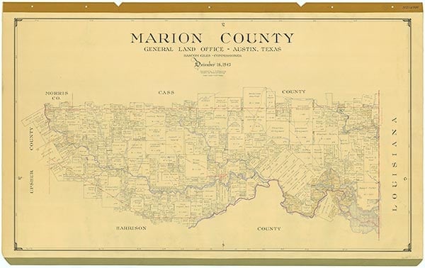
Marion County

.jpg)
Marion County, Texas

Marion County, Texas
Marion County is in northeastern Texas; its eastern boundary forms a portion of the Louisiana-Texas border. Jefferson, the county's largest town and its county seat, is seventeen miles north of Marshall, in Harrison County, and forty-six miles west of Shreveport, Louisiana. The county's center is at 32°47' north latitude and 94°20' west longitude. Marion County covers 380 square miles of the dense timberlands of East Texas. The land surface is a gently rolling, rich, sandy loam, underlain by a clay foundation and cloaked by pine, cypress, and oak forests. The elevation is 200 to 500 feet above sea level. The county is drained by the Red River basin via the watershed areas of Caddo Lake, Lake o' the Pines, and Big Cypress, Little Cypress, and Black Cypress bayous. The region's mineral deposits include oil, natural gas, clay, and lignite coal. Temperatures range from an average low of 32° F to an average high of 54° F in January and from 71° to 93° F in July. The growing season is 236 days in length, and the yearly rainfall is forty-four to forty-five inches. Marion County was demarked from the southern portion of Cass County by an act of the state legislature on February 8, 1860. Territorial additions in 1863 and 1874 extended its southern boundary to include both banks of Big Cypress Bayou. The county was named for American Revolutionary War hero Francis Marion, the "Swamp Fox."
Due to a large natural log-jam and collection of snags on the Red River, known as the Red River Raft, which formed a series of navigable lakes and bayous in the river valleys of Marion County, Jefferson, founded in the early 1840s, rapidly developed a booming river trade with New Orleans. Jefferson quickly became the favored inland Texas port for the deposit and transport of North Texas agricultural produce. Thus, Marion County became the commercial conduit for frontier Texas and did not relinquish this position until the establishment of transcontinental rail links that bypassed its wharves in the mid-1870s. Another important attribute of Marion County's early character was the geographical and cultural origins of its residents. Ninety percent of them migrated from the Deep South and the border states of Tennessee, Arkansas, and Missouri, bringing with them the slave economy of their former environment. In 1860 the slave population of Marion County constituted 51 percent of the total population. Slaveholders, though small in number (213), held 60 percent of the county's wealth and dominated its political institutions. Marion County sent two of its prominent citizens, James H. Rogers and William S. Todd, to the Secession Convention, and the county's voters unanimously approved the Ordinance of Secession in 1861.
Mark Howard Atkins | © TSHA
Adapted from the official Handbook of Texas, a state encyclopedia developed by Texas State Historical Association (TSHA). It is an authoritative source of trusted historical records.
- ✅ Adoption Status:
- This place is available for adoption! Available for adoption!
- Adopted by:
- Your name goes here
- Dedication Message:
- Your message goes here
Currently Exists
Yes
Place type
Marion County is classified as a County
Altitude Range
168 ft – 523 ft
Size
Land area does not include water surface area, whereas total area does
- Land Area: 380.9 mi²
- Total Area: 420.3 mi²
Temperature
January mean minimum:
32.7°F
July mean maximum:
92.6°F
Rainfall, 2019
49.0 inches
Population Count, 2019
9,854
Civilian Labor Count, 2019
4,059
Unemployment, 2019
9.8%
Property Values, 2019
$1,078,333,870 USD
Per-Capita Income, 2019
$38,063 USD
Retail Sales, 2019
$51,892,052 USD
Wages, 2019
$17,623,533 USD
County Map of Texas
Marion County
- Marion County
Places of Marion County
| Place | Type | Population (Year/Source) | Currently Exists |
|---|---|---|---|
| Town | – | – | |
| Town | – | – | |
| Town | – | – | |
| Town | 200 (2009) | Yes | |
| Town | – | – | |
| Town | – | – | |
| Town | – | – | |
| Town | – | – | |
| Lake | – | Yes | |
| Town | – | – | |
| Town | – | – | |
| Town | – | – | |
| Town | – | – | |
| Town | – | – | |
| Town | – | – | |
| Town | – | – | |
| Town | – | – | |
| Town | – | – | |
| Town | – | – | |
| Town | – | – | |
| Town | – | – | |
| Town | – | – | |
| Town | – | – | |
| Town | – | – | |
| Town | – | – | |
| Town | – | – | |
| Town | 12 (2009) | Yes | |
| Town | – | – | |
| Town | – | – | |
| Town | – | – | |
| Town | – | – | |
| Town | – | – | |
| Town | 1,849 (2021) | Yes | |
| Town | – | – | |
| Lake | – | Yes | |
| Town | – | – | |
| Town | 75 (2009) | Yes | |
| Town | – | – | |
| Lake | – | Yes | |
| Town | – | – | |
| Town | 60 (2009) | Yes | |
| Town | – | – | |
| Town | – | – | |
| Town | 175 (2009) | Yes | |
| Town | – | – | |
| Town | – | – | |
| Town | – | – | |
| Town | – | – | |
| Town | – | – | |
| Town | – | – | |
| Town | – | – | |
| Town | – | – | |
| Town | – | – | |
| Town | – | – | |
| Town | – | – | |
| Town | – | – | |
| Town | – | – | |
| Town | – | – | |
| Town | – | – | |
| Town | 809 (2021) | Yes | |
| Town | – | – | |
| Town | – | – | |
| Town | – | – | |
| Town | – | – | |
| Town | – | – | |
| Town | – | – | |
| Town | – | – | |
| Town | – | – | |
| Town | – | – | |
| Town | – | – | |
| Town | – | – | |
| Town | – | – | |
| Town | 179 (2009) | Yes | |
| Town | – | – | |
| Town | – | – | |
| Town | – | – | |
| Town | – | – | |
| Town | – | – | |
| Town | – | – | |
| Town | – | – | |
| Town | – | – | |
| Town | – | – | |
| Town | – | – | |
| Town | – | – | |
| Town | – | – | |
| Town | – | – | |
| Town | – | – |
Photos Nearby:

Jefferson, Marion County, Texas
The Historic Post Office in the city of Jefferson is one of the most iconic landmarks in Marion County, Texas. Photograph by Renelibrary.

Sunset on Lake O' the Pines
Photo by Audreylski, CC3

Cypress trees at Caddo Lake
Photo by Thomas and Dianne Jones, CC by 2.0
Proud to call Texas home?
Put your name on the town, county, or lake of your choice.
Search Places »