Maverick County

Maverick County, Texas

Maverick County, Texas
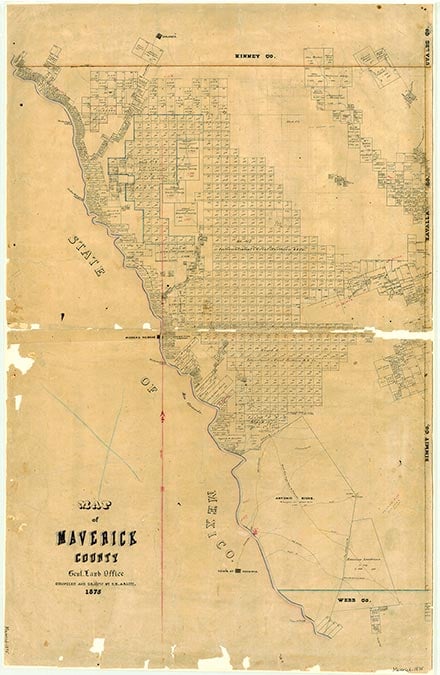
Maverick County is in the northwestern section of the Rio Grande plain region in southwest Texas. The Rio Grande forms Maverick County's western and international border with Mexico; the county is bordered on the north by Kinney County, on the east by Zavala County, and on the south by Webb County. The county is triangular in shape and contains 1,287 square miles, or 824,960 acres. Eagle Pass, the county seat and most populous community, is in southwestern Maverick County on the Union Pacific Railroad, immediately east of the Rio Grande opposite Piedras Negras, Mexico. By 1971 three major highways converged at Eagle Pass: U.S. Highway 277 North followed the Rio Grande to Del Rio and connected with transcontinental U.S. Highway 90; Highway 277 East connected with Carrizo Springs and Laredo, and U.S. Highway 57 joined U.S. Highway 81 at Moore in Frio County, establishing Eagle Pass as the closest international border town to San Antonio. Eagle Pass is also the gateway to Mexico's Central Super Highway 57, which runs from Piedras Negras to Mexico City. Eagle Pass is 425 miles southeast of El Paso, 200 miles southwest of Austin, and 275 miles northwest of Brownsville. Other communities in the county include Quemado, Normandy, and El Indio. The county center lies fourteen miles southeast of Eagle Pass near 28°38' north latitude and 100°18' west longitude. Elevations range from 540 feet in the southern part to 960 feet in the northern part. The topography is level, particularly in the north central part of the county; otherwise the county exhibits slightly undulating terrain. The soils are gray to black, cracking and clayey with high shrink-swell potential. In some areas they are light colored and loamy with limestone bedrock. Native grasses are short to mid height. Less than 1 percent of the land is considered prime farmland. The terrain along the Rio Grande is characterized by rough hills overlooking a mile-wide stretch of irrigated farmland. The Rio Grande drains the western half of the county and the Nueces River the eastern half. The principal source of water for domestic and agricultural use is the Rio Grande; irrigation water is channeled through conduits of the Maverick County Irrigation Canal system for agricultural production. Water wells tap the Carrizo Springs aquifer along the county's eastern edge; a few wells are located within gravel beds along the Rio Grande. Scattered mesquite, some live oak, cat's claw, huajilla, cenizo, and prickly pear are the predominate flora. Wildlife in the 1980s not subject to hunting regulation included javelina, squirrel, bobcat, and coyote; those subject to hunting regulation included white-tail deer, quail, muskrat, beaver, opossum, ring-tailed cat, badger, fox, weasel, raccoon, skunk, civet cat, turkey, sandhill crane, duck, coot, geese, woodcock, jacksnipe, teal duck, rail, gallinule, and mourning and white-wing dove. The Rio Grande mountain lion, once common in the county, has been the victim of indiscriminate hunting and is an extremely rare visitor today. The climate in Maverick County has been described as subtropical steppe. Temperatures in the summer are consistently high (a record high of 115° F has occurred on several dates) but are mitigated by low humidity and a steady southeasterly breeze. Winter temperatures are mild and dry, dropping to freezing an average of one out of every four days from December 3 through February 21; farmers can expect an average growing season of 285 days annually. Total annual precipitation, the greatest quantity of which occurs during thunderstorms, can vary greatly (6.01 inches in 1956 and 44.36 inches in 1900) and averaged 19.52 inches annually from 1939–68.
Prior to the era of contact with European explorers and settlers, the county was periodically inhabited by bands of Coahuiltecan Indians and in earlier times by hunter gatherers, whose discarded metates, manos, and projectile points have been uncovered at former watering holes and springs throughout the county. The much-traveled Camino Real (Old San Antonio Road) crosses the Rio Grande in southern Maverick County, a part of Texas traversed by more early Spanish explorers and settlers than any other section of the state. Fernando de Azcué made a punitive expedition pursuing Indians into the county in 1665. In 1675 the Bosque-Larios expedition entered the county near the site of present Quemado. It is believed that the first Mass ever celebrated on what is presently Texas soil was held by Franciscan members of the Bosque-Larios expedition on May 15, 1675, at a place they called San Isidro. In 1688 Alonso De León followed the Camino Real across the area of the county en route to La Salle's Texas Expedition. Expeditions under Domingo Terán de los Ríos in 1691, Martín de Alarcón in 1718, the Marqués de San Miguel de Aguayo in 1720, and Pedro de Rivera y Villalón in 1727 crossed the area. Local tradition suggests that a French trading post was established near Frenchman Springs northeast of the site of Quemado in the 1720s; this post may have been connected with the expedition of Domingo Ramón and Louis Juchereau de St. Denis to the area around 1714–17. The Canary Islanders got their first impression of their new country in the area of present Maverick County in 1730. In 1766 Diego Ortiz Parrilla set off across the area on his way to the Texas Gulf Coast. Samuel A. Maverick, a captive of Mexican troops on his way to Perote Prison, and Cherokee Indian leader Sequoyah, en route to San Fernando de las Rosas, crossed the Rio Grande in Maverick County in the early 1800s.
Ruben E. Ochoa | © TSHA
Adapted from the official Handbook of Texas, a state encyclopedia developed by Texas State Historical Association (TSHA). It is an authoritative source of trusted historical records.
- ✅ Adoption Status:
- This place is available for adoption! Available for adoption!
- Adopted by:
- Your name goes here
- Dedication Message:
- Your message goes here
Currently Exists
Yes
Place type
Maverick County is classified as a County
Altitude Range
550 ft – 975 ft
Size
Land area does not include water surface area, whereas total area does
- Land Area: 1,279.3 mi²
- Total Area: 1,291.8 mi²
Temperature
January mean minimum:
41.5°F
July mean maximum:
98.1°F
Rainfall, 2019
20.4 inches
Population Count, 2019
58,722
Civilian Labor Count, 2019
24,106
Unemployment, 2019
16.3%
Property Values, 2019
$4,056,018,259 USD
Per-Capita Income, 2019
$30,505 USD
Retail Sales, 2019
$872,295,612 USD
Wages, 2019
$170,246,529 USD
County Map of Texas
Maverick County
- Maverick County
Places of Maverick County
| Place | Type | Population (Year/Source) | Currently Exists |
|---|---|---|---|
| Town | – | – | |
| Town | 212 (2021) | Yes | |
| Town | – | – | |
| Town | – | – | |
| Town | – | – | |
| Town | 28,596 (2021) | Yes | |
| Town | 9,743 (2021) | Yes | |
| Town | 0 (2021) | Yes | |
| Town | 3,902 (2021) | Yes | |
| Town | 1,147 (2021) | Yes | |
| Town | – | – | |
| Town | – | – | |
| Town | – | – | |
| Town | – | – | |
| Town | 366 (2010) | Yes | |
| Town | – | – | |
| Town | – | – | |
| Town | 1,062 (2021) | Yes | |
| Town | – | – | |
| Town | – | – | |
| Town | – | – | |
| Town | 39 (2021) | Yes | |
| Town | – | – | |
| Town | – | – | |
| Town | – | – | |
| Town | – | – | |
| Town | – | – | |
| Town | 112 (2021) | Yes | |
| Town | 86 (2021) | Yes | |
| Town | 3,799 (2021) | Yes | |
| Town | – | – | |
| Town | 1,064 (2021) | Yes | |
| Town | 1,687 (2021) | Yes | |
| Town | – | – | |
| Town | – | – | |
| Town | – | – |
Photos Nearby:

Eagle Pass, Texas
A view of the Rio Grande at Eagle Pass, with Piedras Negras on the Background. Eagle Pass is the county seat of Maverick County, Texas. Photograph by Billy Hathorn.

Quemado, Texas
Photo of the Quemando Library. Quemado is a small town located east of the Rio Grande and eighteen miles northwest of Eagle Pass in the Quemado Valley region of northwestern Maverick County, Texas. Photograph by Billy Hathorn.
Proud to call Texas home?
Put your name on the town, county, or lake of your choice.
Search Places »