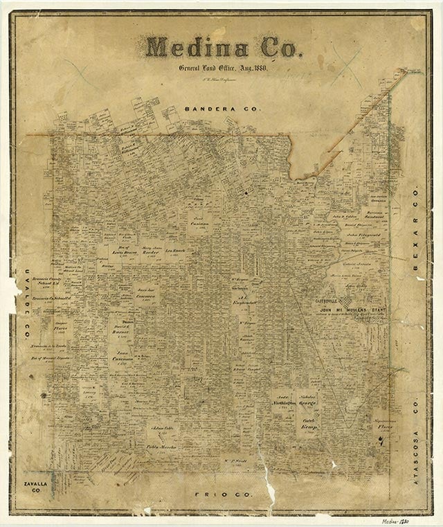
Medina County
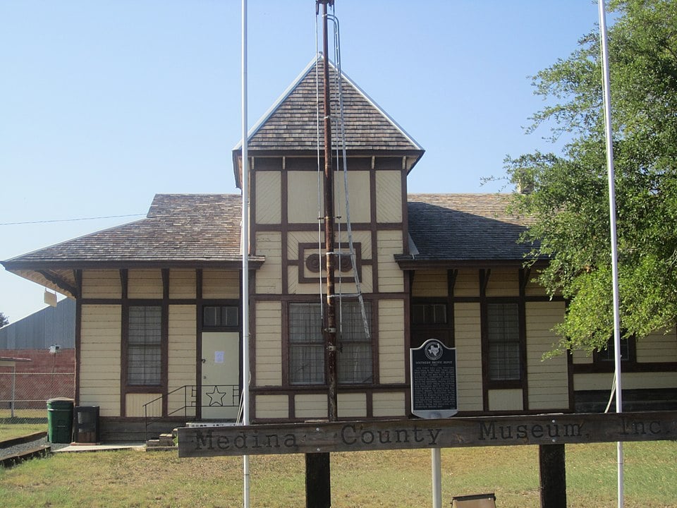
Medina County, Texas
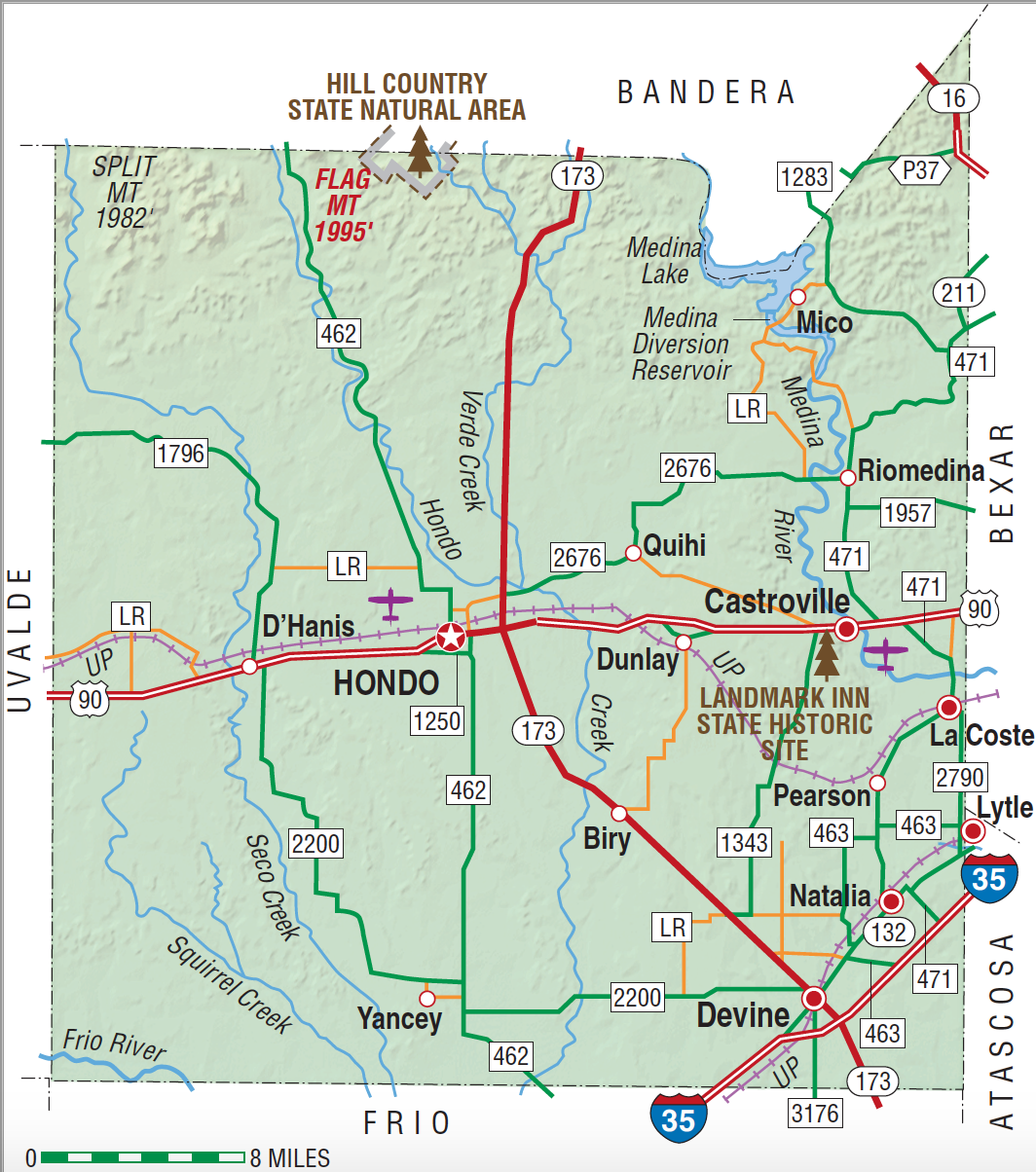
Medina County, Texas
Medina County is immediately west of Bexar County in southwest Texas. Hondo, the county seat, is located near the geographic center of the county at 29°17' north latitude and 99°02' west longitude, 100 miles from the Mexican border at Eagle Pass. The Medina River, from which the county derives its name, traverses the northeastern portion of the county. The western part is drained by the Frio River. Medina County covers 1,331 square miles with elevations ranging from 1,995 feet in the northern Hill Country to as low as 635 feet in the southern region. The county is divided from east to west by the Balcones Escarpment, which separates the Edwards Plateau and Hill Country to the north from the Rio Grande Plains to the south. The climate is subtropical and subhumid; the summers are hot and dry. Annual rainfall averages 28.43 inches; average relative humidity is 81 percent at 6 A.M. and 49 percent at 6 P.M. The temperature averages a low of 42° F in the winter and a high of 96° in the summer. The annual growing season is 263 days. The northern Hill Country region has black waxy and limestone soils that support grasses, brush, junipers, mesquite, shinnery oaks, and live oaks. The larger southern region has sandy loam and clay soils that support bluestem, buffalo, and Arizona cottontop grasses, as well as post oak, live oak, and mesquite. Cypress and pecan trees are commonly found on the banks of rivers and creeks. Approximately 45 percent of the land in the county is considered prime farmland. Medina Lake Reservoir, completed in 1913 in the northeastern part of the county, furnishes impounded Medina River water for an extensive irrigation system throughout the eastern half of the county. Other man-made surface reservoirs have been built on Chacon, Parkers, Squirrel, Live Oak, and Elm creeks. Ranchers keep local stock tanks for water. Most subsurface or ground waters in Medina County are artesian; two major subsurface water belts are the Edwards Aquifer and the Carrizo Sand Aquifer. The county can be divided from north to south into three geological sections, the Lower Cretaceous of the Edwards Plateau, Lampasas Cut Plain, and the Comanche Plateau; the Upper Cretaceous of the Blackland Belt; and the older Tertiary of the Gulf Coast Plain. Mineral resources within the county include oil, gas, clay, sand, and gravel. High-quality clays for the production of bricks and tile are found in the D'Hanis area of western Medina County. Limestone, readily available and of good quality, is used extensively for buildings and hand-carved tombstones. Crushed limestone, flintstone, igneous pebbles, caliche, and clay are found in the county and are used widely as road materials. Bat guano is commercially mined in the limestone hills north of Hondo and marketed as a high-quality natural fertilizer. The guano mined at Ney's Cave, claimed to be one of the largest bat habitats in the world, was used in the manufacture of gun powder during the Civil War.
Medina County is in an area that has been the site of human habitation for many thousands of years. Evidence of early man has been discovered at a site known as Scorpion Cave on the Medina River in the northeastern part of the county. Archeologists believe that ancestors of either Coahuiltecan or Tonkawa Indians occupied this cave continuously for several thousand years before the arrival of the first Europeans. The first Spaniard to set foot in the region was probably Alonso De León, governor of Coahuila, who passed through the area in 1689 en route to East Texas, and named the Medina River and Hondo and Seco creeks. Two years later Domingo Terán de los Ríos, the first provincial governor of Texas, tracked across southern Medina County, laying the foundation for El Camino Real (Old San Antonio Road). The Upper Presidio Road, as the Camino Real was known in 1807, purposely skirted the Indian strongholds of the Hill Country beyond the Balcones Escarpment. Throughout the 1700s the area was frequented by roving bands of Lipan Apaches and Comanches, whose seasonal raiding parties traveled south from the plains area of North and West Texas and New Mexico on their way to Mexico. From this vantage point the Apache-Comanche Indians would attack San Antonio with impunity. The Republic of Texas was convinced that if this large block of land were settled it would provide a protective zone against any invasion forces approaching San Antonio from the south and west. They negotiated an empresarial contract with Frenchman Henri Castro on February 15, 1842, to settle the area. One of Castro's land grants began four miles west of the Medina River. He purchased the sixteen leagues between his granted concessions and the river from John McMullen of San Antonio. The Old San Antonio Road to Laredo and the main road from San Antonio to Eagle Pass both crossed the land grant.
Ruben E. Ochoa | © TSHA

Adapted from the official Handbook of Texas, a state encyclopedia developed by Texas State Historical Association (TSHA). It is an authoritative source of trusted historical records.

- ✅ Adoption Status:
- This place is available for adoption! Available for adoption!
- Adopted by:
- Your name goes here
- Dedication Message:
- Your message goes here
Currently Exists
Yes
Place type
Medina County is classified as a County
Altitude Range
570 ft – 1995 ft
Size
Land area does not include water surface area, whereas total area does
- Land Area: 1,325.4 mi²
- Total Area: 1,334.4 mi²
Temperature
January mean minimum:
39.1°F
July mean maximum:
94.9°F
Rainfall, 2019
30.3 inches
Population Count, 2019
51,584
Civilian Labor Count, 2019
21,361
Unemployment, 2019
7.3%
Property Values, 2019
$6,383,076,946 USD
Per-Capita Income, 2019
$39,403 USD
Retail Sales, 2019
$643,601,528 USD
Wages, 2019
$104,991,839 USD
County Map of Texas
Medina County
- Medina County
Places of Medina County
| Place | Type | Population (Year/Source) | Currently Exists |
|---|---|---|---|
| Town | – | – | |
| Town | – | – | |
| Town | – | – | |
| Town | – | – | |
| Town | 24 (2009) | Yes | |
| Town | – | – | |
| Town | – | – | |
| Town | – | – | |
| Town | – | – | |
| Town | 3,005 (2021) | Yes | |
| Town | – | – | |
| Town | – | – | |
| Town | – | – | |
| Town | – | – | |
| Town | 615 (2021) | Yes | |
| Town | – | – | |
| Town | 4,410 (2021) | Yes | |
| Town | 145 (2009) | Yes | |
| Town | – | – | |
| Town | – | – | |
| Town | – | – | |
| Town | – | – | |
| Town | – | – | |
| Town | – | – | |
| Town | – | – | |
| Town | – | – | |
| Town | – | – | |
| Town | – | – | |
| Town | – | – | |
| Town | 8,387 (2021) | Yes | |
| Town | 1,107 (2021) | Yes | |
| Town | – | – | |
| Town | – | – | |
| Town | 2,965 (2021) | Yes | |
| Town | – | – | |
| Town | – | – | |
| Lake | – | Yes | |
| Town | – | – | |
| Town | 107 (2009) | Yes | |
| Town | – | – | |
| Town | – | – | |
| Town | – | – | |
| Town | – | – | |
| Town | – | – | |
| Town | 1,271 (2021) | Yes | |
| Town | – | – | |
| Town | – | – | |
| Town | – | – | |
| Town | 24 (2009) | Yes | |
| Town | 125 (2009) | Yes | |
| Town | – | – | |
| Town | 60 (2009) | Yes | |
| Town | – | – | |
| Town | – | – | |
| Town | – | – | |
| Town | – | – | |
| Town | – | – | |
| Town | – | – | |
| Town | – | – | |
| Town | – | – | |
| Town | – | – | |
| Town | – | – | |
| Town | – | – | |
| Town | – | – | |
| Town | – | – | |
| Town | 384 (2021) | Yes | |
| Town | – | – | |
| Town | – | – |
Photos Nearby:
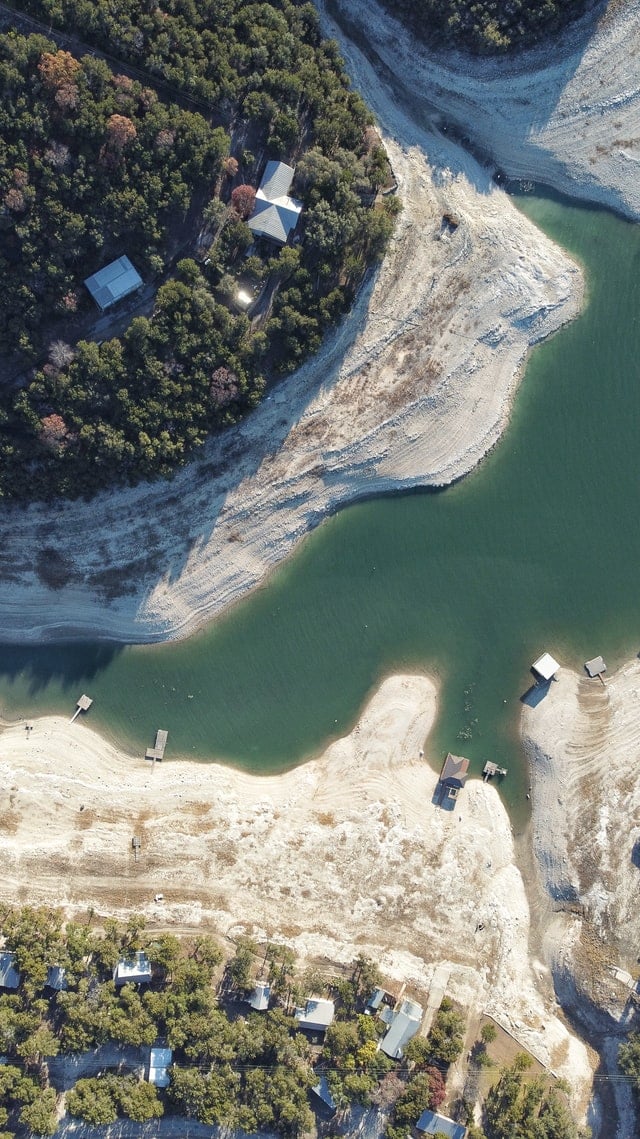
Medina Lake, Texas
Medina Lake, Texas Photo by Jae Estrada on Unsplash
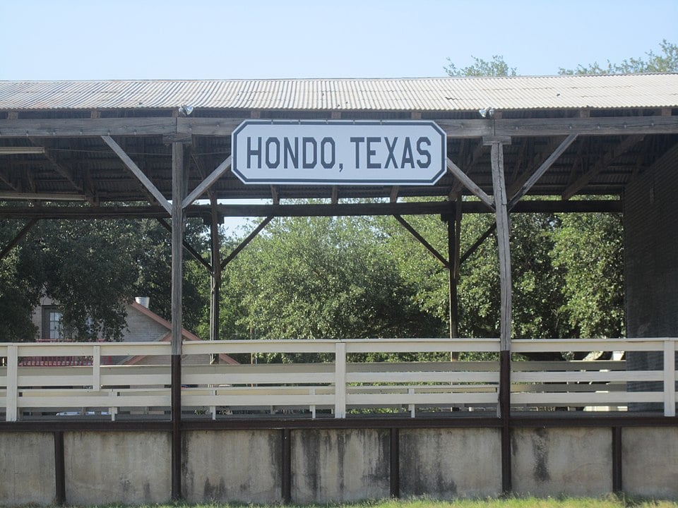
Hondo, Texas
Hondo, the seat of Medina County, is located approximately 40 miles west of downtown San Antonio. Photograph by Billy Hathorn.
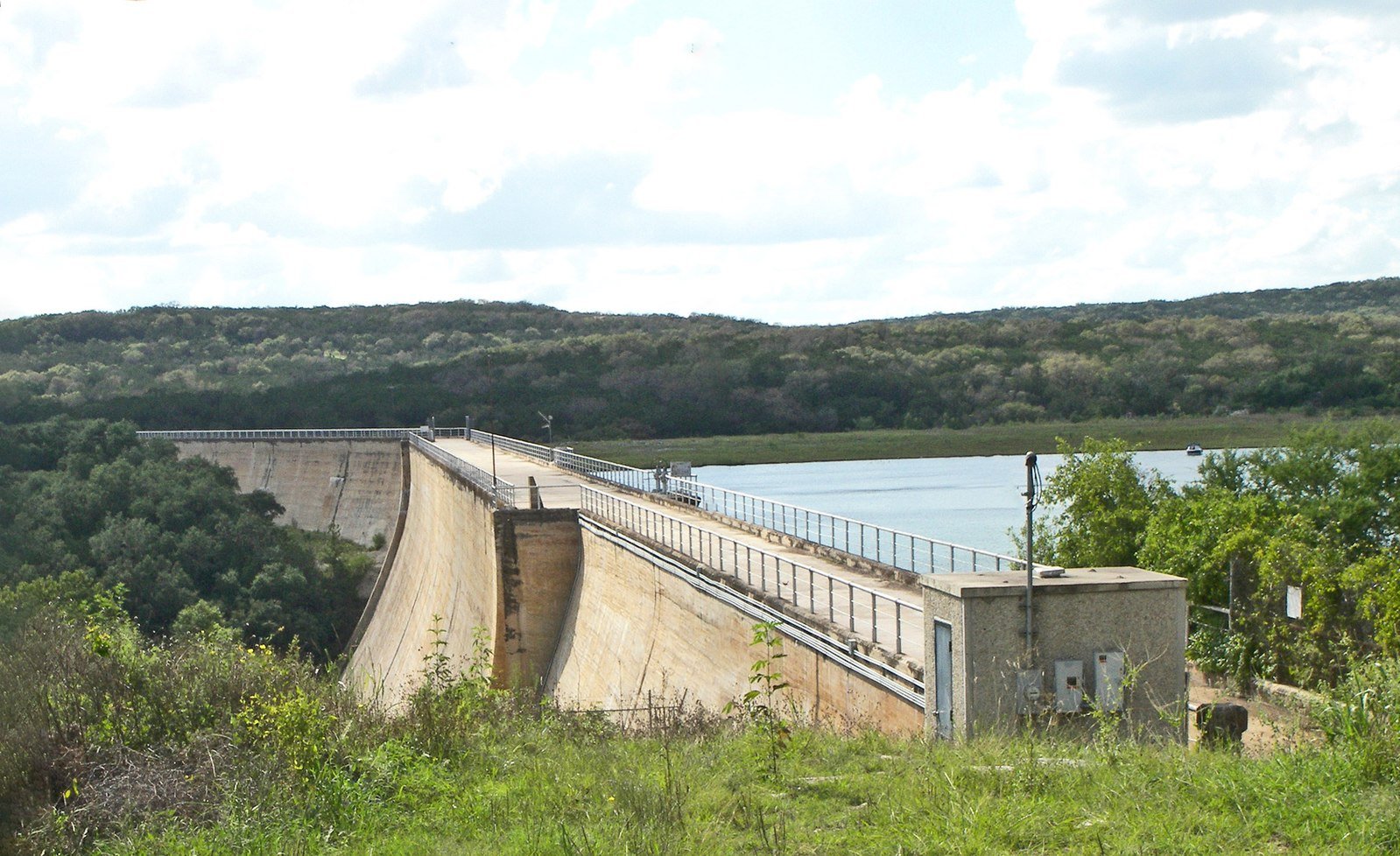
The dam at Medina Lake
Photo by Larry D. Moore, CC by SA 3

Proud to call Texas home?
Put your name on the town, county, or lake of your choice.
Search Places »

