Menard County

Menard County, Texas

Menard County, Texas
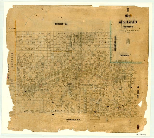
Menard County, in Central Texas about 250 miles inland from the Gulf of Mexico, is bordered by Concho, McCulloch, Mason, Kimble, Sutton, Schleicher, and Tom Green counties. Menard, the county seat, is on the San Saba River at the intersection of U.S. Highway 83 and State Highway 29, about 130 miles northwest of San Antonio. The county's center is about three miles southwest of Menard at 30°54' north latitude and 99°50' west longitude. The county comprises 902 square miles of rolling terrain on the Edwards Plateau at elevations ranging from 1,700 to 2,400 feet above sea level. The dark, loamy soils are alkaline and support such vegetation as live oak, juniper, mesquite, and grasses. The county lies entirely within the Colorado River basin and is drained primarily by the San Saba River, which crosses the county from west to east. Wildlife in the area includes deer, turkey, javelina, squirrel, coyote, bobcat, beaver, opossum, badger, fox, raccoon, and skunk, as well as a variety of birds, fish, and reptiles. Among the county's mineral resources are dolomite, oil, and gas. The climate is subtropical, with an average minimum temperature in January of 32° F and an average high temperature in July of 97°. The growing season averages 220 days annually, and the rainfall averages about twenty-two inches.
Central Texas, including what is now Menard County, has supported human habitation for several thousand years. Archeological evidence suggests that hunting-and-gathering peoples established themselves in the area as early as 10,000 years ago. Early Spanish explorers found the Apache Indians in Central and West Texas in the sixteenth century, and the Comanches began moving down from the north in the eighteenth century. The Spanish began exploring the San Saba valley in 1753 and 1754. In April 1757, Father Alonso Giraldo de Terreros founded Santa Cruz de San Sabá Mission, hoping to Christianize the Apache Indians. Though San Luis de las Amarillas Presidio, under the command of Diego Ortiz Parrilla, was established nearby to provide protection for the mission, in March 1758 the Comanche Indians and their allies burned the mission to the ground. In 1761, Felipe de Rábago y Terán, who replaced Ortiz Parrilla, improved the presidio by replacing wooden structures with stone ones. The Marqués de Rubí visited the site during his inspection of Spanish frontier settlements in 1766. Living conditions were poor at the presidio, and after the Indians succeeded in cutting the supply lines Rábago y Terán abandoned it without orders in 1768. The presidio was reoccupied for a short time in early 1770, but the Spanish soon abandoned it for good.
Vivian Elizabeth Smyrl | © TSHA
Adapted from the official Handbook of Texas, a state encyclopedia developed by Texas State Historical Association (TSHA). It is an authoritative source of trusted historical records.
- ✅ Adoption Status:
- This place is available for adoption! Available for adoption!
- Adopted by:
- Your name goes here
- Dedication Message:
- Your message goes here
Currently Exists
Yes
Place type
Menard County is classified as a County
Altitude Range
1690 ft – 2436 ft
Size
Land area does not include water surface area, whereas total area does
- Land Area: 902.0 mi²
- Total Area: 902.3 mi²
Temperature
January mean minimum:
29.3°F
July mean maximum:
93.1°F
Rainfall, 2019
23.3 inches
Population Count, 2019
2,138
Civilian Labor Count, 2019
817
Unemployment, 2019
6.6%
Property Values, 2019
$1,091,932,220 USD
Per-Capita Income, 2019
$35,311 USD
Retail Sales, 2019
$17,158,458 USD
Wages, 2019
$3,499,511 USD
County Map of Texas
Menard County
- Menard County
Places of Menard County
| Place | Type | Population (Year/Source) | Currently Exists |
|---|---|---|---|
| Town | – | – | |
| Town | – | – | |
| Town | – | – | |
| Town | – | – | |
| Town | 27 (2009) | Yes | |
| Town | 50 (2009) | Yes | |
| Town | 75 (2009) | Yes | |
| Town | – | – | |
| Town | 1,355 (2021) | Yes | |
| Town | 70 (2009) | Yes | |
| Town | – | – | |
| Town | – | – | |
| Town | – | – |
Proud to call Texas home?
Put your name on the town, county, or lake of your choice.
Search Places »