Ochiltree County

Ochiltree, Texas

Ochiltree County, Texas
Ochiltree County is in the far northern Panhandle, bordered on the north by Oklahoma, on the east by Lipscomb County, on the south by Roberts County, and on the west by Hansford County. The county is in the heart of the High Plains, with its center at 36°17' north latitude and 100°49' west longitude. Perryton, the county seat, is in the north central part of the county, 120 miles northeast of Amarillo. The area was named for William Beck Ochiltree, a Republic of Texas judge, secretary of treasury, and an officer in the army of the Confederacy. The county occupies 907 square miles of level prairies cut by Wolf Creek, which runs eastward from the center of the county; by South Wolf Creek, which runs northward into Wolf Creek from the south central part of the county; and by Palo Duro and Chiquita creeks, which flow northward into Oklahoma from the northwestern corner of the county. These streams are all intermittent. The rich clay and loam soils support abundant native grasses as well as wheat, grain sorghum, corn, and alfalfa. Oil and gas are produced in substantial quantities. Elevations range from 2,600 to 3,100 feet above sea level, and the county's annual average rainfall is 20.48 inches. Temperatures range from an average minimum of 18° F in January to an average maximum of 93° F in July. The average growing season lasts 191 days. A modern highway system focusing on Perryton developed between the 1930s and the 1950s. U.S. Highway 83 runs from Liberal, Kansas, to Perryton, then on to Canadian, and U.S. Highway 70 runs from Perryton south to Pampa. State Highway 15 runs east to west across the county, parallel to the Santa Fe Railroad, and various farm-to-market roads link the major routes to the rural area.
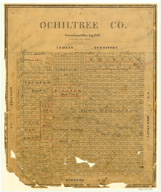
Prehistoric cultures occupied this region, then the Plains Apaches appeared. The historic-era Apaches arrived, then were pushed out of the region in the early eighteenth century by the Comanche Indians, who dominated the Texas Panhandle until the 1870s. The Red River War of 1874–75 led to the removal of the nomadic Indians to Indian Territory, which in turn led to the arrival of the ranching era. In 1876 the Texas legislature established Ochiltree County from lands formerly assigned to the Bexar District. Ranching arrived a little later in Ochiltree County than it did farther south in the Panhandle. By 1885 Henry W. Cresswell had purchased or leased most of the county and established the Cresswell Ranch (Bar CC) on Wolf Creek in the eastern part of the county and moved its headquarters from Roberts County to the new site on Wolf Creek. His company, the Cresswell Land and Cattle Company of Colorado, was syndicated as the Cresswell Ranch and Cattle Company by 1885. The Cresswell Ranch controlled most of the land in the county. Dee Eubank and Tom Connell, who arrived on Wolf Creek in 1879, controlled much smaller acreages in the eastern part of Ochiltree and the western part of Lipscomb counties. After the blizzards of 1886–87 county lands were opened to settlement by stock farmers who operated on a much smaller scale. The availability of land in Ochiltree County coincided with the proximity of a new railroad. In 1887 the Southern Kansas Railway Company of Texas, a Santa Fe subsidiary, built a line from Kansas through Oklahoma into the Panhandle via Canadian and Panhandle. This line passed through Lipscomb County, thirty to forty miles east of Ochiltree. Thus the county was only one or two days' travel from the railroad. Proximity to the railroad brought an influx of settlers into the county, especially after 1900, and the ranching economy evolved into a stock-farming system. Between 1890 and 1900 the number of ranches in the area increased from forty-seven to seventy-one, and the number of cattle grew from 10,000 to 84,000. At the same time the area's population rose from 198 to 267. Almost no crops were grown in the area at the beginning of the twentieth century, though some ranchers did grow corn and vegetables for their own consumption. Between 1900 and 1910, however, stock farming began to give way to wheat farming. As local stock farmers determined that wheat was a viable crop and new settlers moved into the area, the local economy shifted. By 1910 there were 264 farms and ranches in the area, encompassing almost 226,000 acres, including more than 53,000 acres reported to be "improved." That year the agricultural census reported 9,000 acres planted in wheat in the county; another 2,075 acres were planted in corn, and 7,400 acres were devoted to sorghum. By the beginning of World War I Ochiltree County possessed a diversified agricultural economy poised for expansion. By 1920 there were 336 farms and ranches; almost 42,000 acres were planted in wheat, and 14,500 acres devoted to sorghum. Poultry raising was also becoming significant to the economy by this time; in 1920 23,000 chickens were reported on county farms. Cattle ranching continued but was less important than it once had been. About 24,000 cattle were reported in the county that year.
Donald R. Abbe | © TSHA
Adapted from the official Handbook of Texas, a state encyclopedia developed by Texas State Historical Association (TSHA). It is an authoritative source of trusted historical records.
- ✅ Adoption Status:
Currently Exists
Yes
Place type
Ochiltree County is classified as a County
Altitude Range
2550 ft – 3120 ft
Size
Land area does not include water surface area, whereas total area does
- Land Area: 917.6 mi²
- Total Area: 918.1 mi²
Temperature
January mean minimum:
19.0°F
July mean maximum:
92.4°F
Rainfall, 2019
22.1 inches
Population Count, 2019
9,836
Civilian Labor Count, 2019
3,982
Unemployment, 2019
6.9%
Property Values, 2019
$2,013,724,258 USD
Per-Capita Income, 2019
$57,287 USD
Retail Sales, 2019
$92,938,558 USD
Wages, 2019
$57,938,798 USD
County Map of Texas
Ochiltree County
- Ochiltree County
Places of Ochiltree County
| Place | Type | Population (Year/Source) | Currently Exists |
|---|---|---|---|
| Town | – | – | |
| Town | – | – | |
| Town | 1,365 (2021) | Yes | |
| Town | – | – | |
| Town | – | – | |
| Town | – | – | |
| Town | – | – | |
| Town | 25 (2021) | Yes | |
| Town | – | – | |
| Town | – | – | |
| Town | – | – | |
| Town | – | – | |
| Town | 22 (2009) | Yes | |
| Town | – | – | |
| Town | – | – | |
| Town | – | – | |
| Town | – | – | |
| Town | – | – | |
| Town | – | – | |
| Town | – | – | |
| Town | – | – | |
| Town | 8,289 (2021) | Yes | |
| Town | – | – | |
| Town | – | – | |
| Town | – | – | |
| Town | 22 (2009) | Yes | |
| Town | 114 (2021) | Yes | |
| Town | – | – |
Proud to call Texas home?
Put your name on the town, county, or lake of your choice.
Search Places »