Presidio County

Presidio County, Texas

Presidio County, Texas
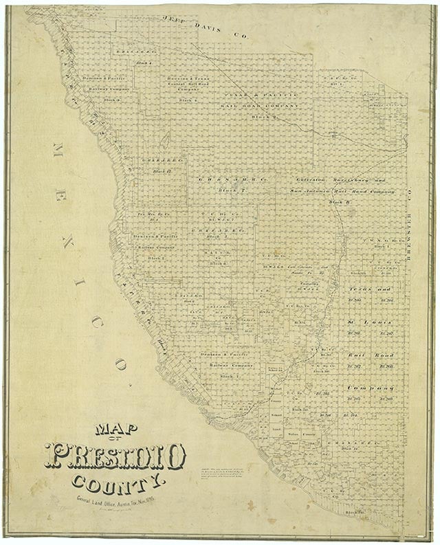
Presidio County is in the Trans-Pecos region of southwest Texas and is named for the ancient border settlement of Presidio del Norte. Presidio County is triangular in shape and is bounded on the east by Brewster County, on the north by Jeff Davis County, and on the south and west for 135 miles by the Rio Grande and Mexico. Marfa, the county seat, is 190 miles southeast of El Paso and 150 miles southwest of Odessa. The center of the county lies at 30°30' north latitude and 104°15' west longitude. Presidio County comprises 3,857 square miles of contrasting topography, geology, and vegetation. In the north and west clay and sandy loams cover the rolling plains known as the Marfa Plateau and the Highland Country, providing good ranges of grama grasses for the widely acclaimed Highland Herefords. In the central, far western, and southeastern areas of the county some of the highest mountain ranges in Texas are found. These peaks are formed of volcanic rock and covered with loose surface rubble. They support desert shrubs and cacti and dominate a landscape of rugged canyons and numerous springs. The spring-fed Capote Falls, with a drop of 175 feet the highest in Texas, is located in western Presidio County. In the southern and western parts of the county the volcanic cliffs of the Candelaria Rimrock (also called the Sierra Vieja) rise perpendicular and run parallel to the river, separating the highland prairies from the desert floor hundreds of feet below them. The gravel pediment, which allows only the growth of desert shrubs and cacti, extends from the Rimrock to the flood plain of the river. Along the river irrigation allows the farming of vegetables, grains, and cottons. There are no permanent streams in the county, although many dry arroyos become raging torrents during heavy rainfalls. Major ones are Alamito Creek, Cibolo Creek, Capote Creek, and Pinto Canyon. San Esteban Dam was built across Alamito Creek and on the site of a historic spring-fed tinaja in 1911 as an irrigation and land promotion project. The prairies, mountains, desert, and river give Presidio County an unusual beauty. Altitudes in the county vary from 2,518 to 7,728 feet above sea level. Temperatures, moderated by the mountains, vary from 33° F in January to 100° F in July. Average rainfall is only twelve inches per year, but it comes mainly in June, July, and August. The growing season extends for 238 days. Natural resources under production in 1982 were perlite, crushed rhyolite, sand, and gravel. Silver mining contributed greatly to the economy of the county from the 1880s to the 1940s. Presidio County has no oil or gas production.
The area around the present town of Presidio on the Rio Grande, known as La Junta de los Ríos, is believed to be the oldest continuously cultivated farmland in Texas. About 1500 B.C. corn farmers of the Cochise culture settled there to use the abundant water, fertile farmland, and bountiful game. Since La Junta was located on an ancient and heavily traveled north-south trade route, its settlers absorbed the cultures of passersby. By A.D. 900 the Cochise culture was replaced by the Mogollón, which later merged with the Anasazi culture. Before the Spaniards appeared in La Junta the natives formed two main tribes, the Julimes and the Jumanos. The first Spaniards probably reached La Junta in December 1535 when Álvar Núñez Cabeza de Vaca crossed on his trek across Texas. They found the Indians living in pueblos and raising large crops of corn, beans, squash, pumpkins, and melons. Both the Julimes and Jumanos later succumbed to Spanish influence. The Julimes vanished in an attempt to remain aloof from the Spaniards. The Jumanos lost their identity and self-sufficiency by becoming good subjects of the Spanish crown. After Cabeza de Vaca's visit a number of Spanish expeditions came to present Presidio County, the first in 1581. The entrada of Juan Domínguez de Mendoza and Father Nicolás López in 1683–84 established seven missions at seven pueblos along the river in the La Junta area. In 1683 Father López celebrated the first Christmas Mass ever observed in Texas at La Junta. Although Spaniards explored the area of present Presidio County, they established no settlements there because they could not control the Apache and Comanche Indians. Indian depredations continued under the Mexican government, but the first White settlement in the area of present Presidio County was established on Cibolo Creek three miles north of the site of Presidio in January 1832 by the family of Lt. Col. José Ygnacio Ronquillo, his soldiers, and laborers. Located on the Ronquillo Land Grant and called El Cíbolo, the settlement was abandoned in November 1832 when the soldiers were called away to fight Indians.
Julia Cauble Smith | © TSHA
Adapted from the official Handbook of Texas, a state encyclopedia developed by Texas State Historical Association (TSHA). It is an authoritative source of trusted historical records.
- ✅ Adoption Status:
Currently Exists
Yes
Place type
Presidio County is classified as a County
Altitude Range
2400 ft – 7728 ft
Size
Land area does not include water surface area, whereas total area does
- Land Area: 3,855.2 mi²
- Total Area: 3,855.9 mi²
Temperature
January mean minimum:
23.2°F
July mean maximum:
88.5°F
Rainfall, 2019
15.4 inches
Population Count, 2019
6,704
Civilian Labor Count, 2019
3,200
Unemployment, 2019
17.2%
Property Values, 2019
$1,252,737,310 USD
Per-Capita Income, 2019
$42,848 USD
Retail Sales, 2019
$65,026,983 USD
Wages, 2019
$24,779,518 USD
County Map of Texas
Presidio County
- Presidio County
Places of Presidio County
| Place | Type | Population (Year/Source) | Currently Exists |
|---|---|---|---|
| Town | 5 (2009) | Yes | |
| Town | – | – | |
| Town | – | – | |
| Town | – | – | |
| Town | – | – | |
| Town | – | – | |
| Town | – | – | |
| Town | – | – | |
| Town | 55 (2009) | Yes | |
| Town | 8 (2009) | Yes | |
| Town | – | – | |
| Town | 8 (2009) | Yes | |
| Town | – | – | |
| Town | – | – | |
| Town | – | – | |
| Town | – | – | |
| Town | – | – | |
| Town | – | – | |
| Town | – | – | |
| Town | 10 (2009) | Yes | |
| Town | – | – | |
| Town | – | – | |
| Town | 5 (2009) | Yes | |
| Town | – | – | |
| Town | – | – | |
| Town | – | – | |
| Town | – | – | |
| Town | – | – | |
| Town | 1,750 (2021) | Yes | |
| Town | – | – | |
| Town | – | – | |
| Town | – | – | |
| Town | – | – | |
| Town | – | – | |
| Town | – | – | |
| Town | – | – | |
| Town | – | – | |
| Town | – | – | |
| Town | – | – | |
| Town | – | – | |
| Town | – | – | |
| Town | – | – | |
| Town | – | – | |
| Town | – | – | |
| Town | 3 (2009) | Yes | |
| Town | 3,301 (2021) | Yes | |
| Town | – | – | |
| Town | – | – | |
| Town | – | – | |
| Town | 43 (2021) | Yes | |
| Town | 18 (2009) | Yes | |
| Town | – | – | |
| Town | – | – | |
| Town | – | – | |
| Lake | – | Yes | |
| Town | – | – | |
| Town | 57 (2009) | Yes | |
| Town | – | – | |
| Town | – | – | |
| Town | – | – | |
| Town | – | – |
Photos Nearby:

Marfa, Texas
Marfa, Texas Photo by Mick Haupt on Unsplash

Presidio, Texas
Presidio, Texas. Photography by Yuan Yufei.
Proud to call Texas home?
Put your name on the town, county, or lake of your choice.
Search Places »