Randall County


Randall County, Texas
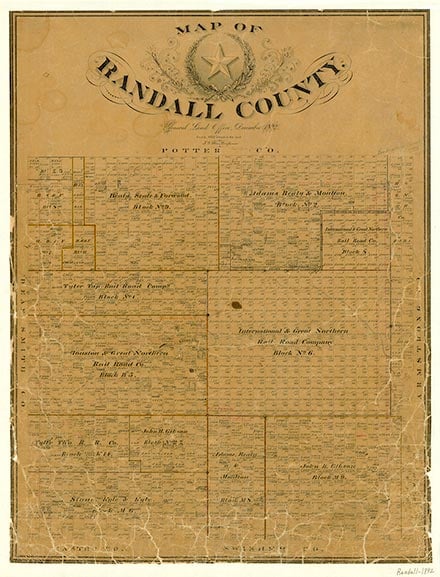
Randall County, on the Llano Estacado near the center of the Panhandle , is bordered by Potter County to the north, Carson County to the northeast, Armstrong County to the east, Swisher County to the southeast, Castro County to the southwest, Deaf Smith County to the west, and Oldham County to the northwest. The county center lies at 34°57' north latitude and 101°54' west longitude. Randall County has an area of 922 square miles that extends over an eastward sloping tableland broken by the Prairie Dog Town Fork of the Red River, which flows through Palo Duro Canyon, and its tributaries, Palo Duro and Tierra Blanca creeks. The elevation is 3,000 to 3,800 feet above mean sea level; the canyons range from 50 to 1,750 feet in depth. Annual rainfall averages 20.16 inches. Temperatures range from an average low of 23° F in January to an average high of 92° in July; the average growing season lasts 195 days. The soil is Amarillo silty clay loam, easily cultivated and suitable for diversified farming. Native short grass and scant growths of cedar and cottonwood made the area a buffalo and antelope range before colonization. Fossil remains of prehistoric animals have been found in both Palo Duro and Cita canyons.
Evidence of human habitation in the area extends back some 10,000 years to Paleo-Indian cultures. During the historical period, various nomadic Plains Indian tribes, including the Comanche, Kiowa, and Cheyenne, hunted buffalo in the area and utilized the canyons as winter camping grounds. The expedition of Francisco Vázquez de Coronado crossed the area in 1541 and probably camped for a fortnight in Palo Duro Canyon. Pedro Vial crossed the northeast corner of the county on his way from San Antonio to Santa Fe in 1786, and in July 1788 Vial and Santiago Fernández traversed the canyon as they returned to Santa Fe from the Jumano country. One division of the Texan–Santa Fe expedition of 1841 crossed the southeastern part of what is now Randall County near South Cita Canyon. In 1852, while surveying possible routes for a Pacific railroad, Capt. Randolph B. Marcy and Capt. George B. McClellan followed the Red River into Palo Duro Canyon before turning northward to the Canadian River.
H. Allen Anderson, Mark Odintz | © TSHA
Adapted from the official Handbook of Texas, a state encyclopedia developed by Texas State Historical Association (TSHA). It is an authoritative source of trusted historical records.
- ✅ Adoption Status:
- This place is available for adoption! Available for adoption!
- Adopted by:
- Your name goes here
- Dedication Message:
- Your message goes here
Currently Exists
Yes
Place type
Randall County is classified as a County
Altitude Range
2700 ft – 3890 ft
Size
Land area does not include water surface area, whereas total area does
- Land Area: 911.5 mi²
- Total Area: 922.4 mi²
Temperature
January mean minimum:
21.5°F
July mean maximum:
91.7°F
Rainfall, 2019
20.2 inches
Population Count, 2019
137,713
Civilian Labor Count, 2019
68,280
Unemployment, 2019
5.6%
Property Values, 2019
$11,402,684,135 USD
Per-Capita Income, 2019
$47,966 USD
Retail Sales, 2019
$2,167,259,179 USD
Wages, 2019
$397,259,102 USD
County Map of Texas
Randall County
- Randall County
Places of Randall County
| Place | Type | Population (Year/Source) | Currently Exists |
|---|---|---|---|
| Town | 201,234 (2021) | Yes | |
| Lake | – | Yes | |
| Lake | – | Yes | |
| Town | 15,221 (2021) | Yes | |
| Town | – | – | |
| Town | – | – | |
| Town | – | – | |
| Town | – | – | |
| Town | – | – | |
| Town | 613 (2021) | Yes | |
| Town | – | – | |
| Town | – | – | |
| Town | – | – | |
| Town | – | – | |
| Town | 706 (2021) | Yes | |
| Town | – | – | |
| Town | – | – | |
| Town | 275 (2021) | Yes | |
| Town | – | – | |
| Town | – | – | |
| Town | – | – | |
| Town | – | – | |
| Town | – | – | |
| Town | 1,445 (2021) | Yes | |
| Town | 445 (2021) | Yes | |
| Town | 72 (2021) | Yes | |
| Town | – | – |
Photos Nearby:

Canyon, Texas
Downtown view of Cayon, the seat of Randall County, Texas. Photograph by Renelibrary.
.jpg)

Amarillo, Texas
Amarillo, Texas Photo by K. Mitch Hodge on Unsplash
Proud to call Texas home?
Put your name on the town, county, or lake of your choice.
Search Places »