Sherman County

Sherman County Texas

Sherman County, Texas
Sherman County is in the High Plains region of the northern Panhandle on the Oklahoma border. The county's center lies at 36°50' north latitude and 102°30' west longitude. Stratford, the county seat, is in the northwestern part of the county eighty miles north of Amarillo. The county, named for Sidney Sherman, a veteran of the Texas Revolution, extends across 923 square miles of nearly level land covered by prairie grasses, some sagebrush, and yucca; elevations range from 3,200 to 3,800 feet above sea level. The area is drained by the North Fork of the Canadian River, which cuts across the northwestern corner of the county, and by Frisco, Coldwater, and North Palo Duro creeks. The area's soils are dark and loamy, with clayey subsoils that contain hardened calcium deposits. Temperatures vary from an average low of 31° F in January to an average high of 97° in July. The area receives an average of twenty inches of precipitation each year; the average growing season lasts 182 days. In 1982, 98 percent of the county's land was in farms and ranches, 45 percent of the agricultural land was cultivated, and 59 percent of the cultivated land was irrigated. Approximately 66 percent of agricultural receipts were from livestock and livestock products, especially cattle and hogs. Wheat, corn, barley, sorghum, and soybeans are the main crops, and mineral resources include caliche, natural gas, and petroleum. The county's road network includes U.S. Highway 54, which runs across the northwestern corner of the county; U.S. Highway 287, which runs north to south in the western sections; and State Highway 15, which crosses east to west across the center of the county and terminates at Stratford. Two railroad lines, the Atchison, Topeka and Santa Fe Railway and the Southern Pacific, pass through the county and intersect at Stratford.
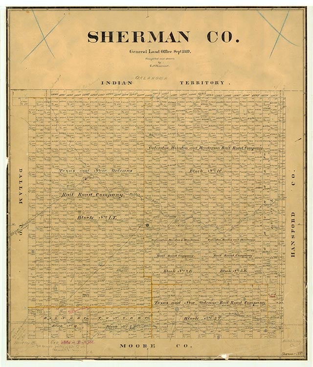
In prehistoric times the Panhandle-Plains area was occupied by an Apachean culture; the modern Apaches occupied the area until about 1700, when they were pushed out by the Comanches, who dominated the Panhandle until the mid-1870s. During the early 1870s buffalo hunters entered the area and wiped out the great herds that once roamed the region. In 1876 the Texas state legislature established Sherman County from lands formerly assigned to Bexar County. The area was attached to Oldham County for administrative purposes until 1889. When first surveyed in 1874, alternate sections of the land were given to railroads as compensation for the survey, and the even-numbered sections were reserved for homesteaders. Partly because of the area's limited surface water and its distance from existing settlements, however, the population grew slowly. J. W. Rawlings built a bachelor's quarters near the Coldwater springs in 1874, and by 1880 cattlemen had begun to move in to graze their herds on the open range. The county was organized in 1889. Coldwater, a small settlement founded by the Loomis family near the center of the county, was designated the county seat by 1890. According to the United States census, there were thirty-four people living in Sherman County in 1890. The agricultural census for that year reported eight farms, encompassing 6,400 acres. There were about 500 cattle in the area, and no crops were reported. A small rock courthouse was built at Coldwater in 1891, and soon C. F. Randolf began to publish the Sherman County Banner, the area's first newspaper, there. During the 1890s much of the land in the county was incorporated into large ranches by men such as Dick Pincham, J. M. Turner, and William B. Slaughter. John Lanners, who settled on a claim under the Four-Section Act, ran a mule-drawn freight line between 1890 and 1898 to supply the area's ranchers. By 1900 there were eighteen ranches and farms, encompassing 195,000 acres, in the county, and the population had increased to 104. Cattle ranching dominated the local economy. Almost 30,000 cattle were reported that year, but only 2,880 acres were described as "improved," and no crops were reported. Farmers began to move into the area in numbers during the first years of the twentieth century, especially after 1901, when the Chicago, Rock Island and Gulf Railway built across the northwest corner of the county. Growth was also encouraged by the introduction of mechanized water-well drilling. The D. D. Spurlocks settled in the south central part of the county about this time, and the J. T. Brown family moved in with well-drilling equipment in 1902. The Norton family, from Kentucky, bought ninety-six sections of railroad land, which were managed for them by Walter Colton. Efforts to move the county seat to a site on the railroad began before the tracks were laid. Walter Colton, who owned a section of land on the line, formed a partnership with C. F. Rudolph to form a townsite (called Stratford) and to make it the new county seat. Their hopes were realized in an election held in May 1901, when voters chose to move the local government to Stratford. Opposition to the move was so strong that county officials transferred the county records in the middle of the night and held court in a tent in Stratford after midnight to make the move official. Bitterness between the factions caused Governor Joseph D. Sayers to order Texas Rangers to Stratford to keep the peace. By the time the rangers arrived, however, the district court suit had been dismissed and Stratford was generally accepted as the new site. A new newspaper, the Stratford Star, began to be published about this time.
Selma Pendleton | © TSHA
Adapted from the official Handbook of Texas, a state encyclopedia developed by Texas State Historical Association (TSHA). It is an authoritative source of trusted historical records.
- ✅ Adoption Status:
- This place is available for adoption! Available for adoption!
- Adopted by:
- Your name goes here
- Dedication Message:
- Your message goes here
Currently Exists
Yes
Place type
Sherman County is classified as a County
Altitude Range
3200 ft – 3805 ft
Size
Land area does not include water surface area, whereas total area does
- Land Area: 923.0 mi²
- Total Area: 923.2 mi²
Temperature
January mean minimum:
19.5°F
July mean maximum:
91.5°F
Rainfall, 2019
17.8 inches
Population Count, 2019
3,022
Civilian Labor Count, 2019
1,274
Unemployment, 2019
3.3%
Property Values, 2019
$1,051,961,900 USD
Per-Capita Income, 2019
$49,508 USD
Retail Sales, 2019
$52,329,447 USD
Wages, 2019
$12,313,479 USD
County Map of Texas
Sherman County
- Sherman County
Places of Sherman County
| Place | Type | Population (Year/Source) | Currently Exists |
|---|---|---|---|
| Town | – | – | |
| Town | – | – | |
| Town | – | – | |
| Town | – | – | |
| Town | – | – | |
| Town | – | – | |
| Town | – | – | |
| Town | – | – | |
| Town | – | – | |
| Town | – | – | |
| Town | – | – | |
| Town | – | – | |
| Town | – | – | |
| Town | 1,953 (2021) | Yes | |
| Town | – | – | |
| Town | 259 (2021) | Yes | |
| Town | – | – |
Proud to call Texas home?
Put your name on the town, county, or lake of your choice.
Search Places »