Stonewall County

Stonewall County, Texas

Stonewall County, Texas
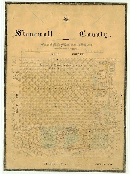
Stonewall County is in Northwest Texas, in the central part of the North Central Plains and southeast of the Caprock. It is bounded on the north by King County, on the east by Haskell County, on the south by Fisher and Jones counties, and on the west by Kent County. The center of the county lies at approximately 33°12' north latitude and 100°15' west longitude. Aspermont, the county seat, is just southwest of the county's center and sixty miles north-northwest of Abilene. The county was named for Confederate general Thomas J. (Stonewall) Jackson. It encompasses 926 square miles of the Rolling Plains region of Texas. Its soils range from neutral to slightly alkaline, calcareous sandy loams of dark brown to reddish brown color in the western part, to clay and clay loams in the east. These soils generally support mesquite savanna or bunchgrass, short grasses, and mesquite. Cedar, hackberry, cottonwood, chinaberry, and shin oak trees are also found in the county. The average annual precipitation is 22.36 inches. Temperatures range from an average minimum of 30° F in January to an average maximum of 99° in July. The average growing season lasts 220 days. The county is framed by two forks of the Brazos River. The Salt Fork crosses the northern half, while the Double Mountain Fork flows near the southern boundary, turns to the north, and joins the Salt Fork after curving through western Haskell County. There are also many tributaries, such as Tonk and Croton creeks, which contribute to the rough, broken country. The county's topography varies from rolling plains to mountainous terrain, with 50 to 80 percent of the area gently sloping. Elevations range from 1,500 to 2,400 feet, the latter being the elevation of Double Mountain, one of the outstanding geographical features of the county. Kiowa Peak, in the northeastern corner, and Flat Top Mountain in the southeast were important landmarks to Indians and later to early explorers who traversed the area. In 1982, 94 per cent of the county's land was in farms and ranches; about 52 percent of its agricultural income was derived from crops, especially wheat, cotton, oats, sorghum, hay, and peanuts. Cattle and livestock products are also important to the local economy, and there is large-scale ranching over much of the county, especially the southern part. Mineral resources include gypsum, sand, gravel, petroleum, and natural gas. The county's main transportation routes are U.S. Highway 83, which runs north to south through the center of the county, and U.S. Highway 380, which crosses from east to west.
Indians that roamed the area included the nomadic Comanches, Kiowas, and Tonkawas. Their names remain on such landmarks as Kiowa Peak and Tonk Creek. Early explorers José Mares and Pedro Vial traveled through the area during the eighteenth century. Mares apparently wintered on the Double Mountain Fork in February 1788 on his trip for the Spanish governor of New Mexico. The following year Vial also probably followed the Double Mountain Fork for several days as his party advanced westward from Bexar to Santa Fe. In advance of the westward migration of the nineteenth century, Capt. Randolph Barnes Marcy led an expedition to open a route through Indian Territory. On October 12, 1849, he camped by the Double Mountain Fork during a norther. In 1854 Marcy was selected to explore the Texas frontier for the purpose of locating suitable sites for Indian reservations. On this trip he passed through the northeastern part of the county near Kiowa Peak, crossed the Salt Fork on the eastern edge, and continued over a valley toward Flat Top Mountain, which he recognized from his previous trip in 1849. An Indian reservation that Marcy helped to locate failed to eliminate the devastation the Comanches and Kiowas continued to inflict upon the White settlers along the Texas frontier. In an effort to stop the raids, in 1871 Col. Ranald Slidell Mackenzie led a force of cavalry against the Indians in the area. In 1872 Miner K. Kellogg became the first artist to represent pictorially the country beyond the Brazos. He accompanied the Texas Land and Copper Association's expedition to Texas to survey, explore, and locate land for the company; the expedition made trips to Kiowa Peak and Double Mountain in search of copper. In addition to his sketches Kellogg also wrote descriptions of the topography and vegetation of the region.
Joan Druesedow Griggs | © TSHA
Adapted from the official Handbook of Texas, a state encyclopedia developed by Texas State Historical Association (TSHA). It is an authoritative source of trusted historical records.
- ✅ Adoption Status:
Currently Exists
Yes
Place type
Stonewall County is classified as a County
Altitude Range
1450 ft – 2580 ft
Size
Land area does not include water surface area, whereas total area does
- Land Area: 916.3 mi²
- Total Area: 920.2 mi²
Temperature
January mean minimum:
28.5°F
July mean maximum:
97.0°F
Rainfall, 2019
23.8 inches
Population Count, 2019
1,350
Civilian Labor Count, 2019
532
Unemployment, 2019
6.0%
Property Values, 2019
$744,522,120 USD
Per-Capita Income, 2019
$53,416 USD
Retail Sales, 2019
$20,442,009 USD
Wages, 2019
$4,936,575 USD
County Map of Texas
Stonewall County
- Stonewall County
Places of Stonewall County
| Place | Type | Population (Year/Source) | Currently Exists |
|---|---|---|---|
| Town | – | – | |
| Town | – | – | |
| Town | 759 (2021) | Yes | |
| Town | – | – | |
| Town | – | – | |
| Town | – | – | |
| Town | – | – | |
| Town | 20 (2009) | Yes | |
| Town | – | – | |
| Town | 5 (2009) | Yes | |
| Town | – | – | |
| Town | 3 (2009) | Yes | |
| Town | – | – | |
| Town | – | – | |
| Town | – | – | |
| Town | – | – | |
| Town | – | – | |
| Town | – | – | |
| Town | – | – | |
| Town | – | – | |
| Town | – | – | |
| Town | – | – | |
| Town | – | – | |
| Town | – | – | |
| Town | 100 (2009) | Yes | |
| Town | – | – | |
| Town | – | – | |
| Town | 100 (2009) | Yes | |
| Town | – | – | |
| Town | – | – | |
| Town | – | – | |
| Town | – | – | |
| Town | – | – | |
| Town | 3 (2009) | Yes | |
| Town | – | – | |
| Town | – | – | |
| Town | 80 (2009) | Yes | |
| Town | – | – | |
| Town | – | – | |
| Town | – | – | |
| Town | – | – | |
| Town | – | – |
Proud to call Texas home?
Put your name on the town, county, or lake of your choice.
Search Places »