Wharton County

Wharton County, Texas

Wharton County, Texas
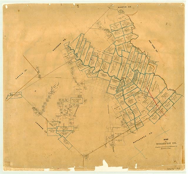
Wharton County, named for brothers William H. and John A. Wharton, is southwest of Houston on U.S. Highway 59 on the Coastal Plain of southeast Texas at the coastal bend. The county is bounded by Matagorda, Colorado, and Jackson counties and the San Bernard River, which forms its northeastern border and the Fort Bend county line. Wharton County comprises 1,086 square miles and is divided primarily between prairie and timber land. The Colorado River, which traverses the county from northwest to southeast, divides it roughly in half and flows through Wharton and Glen Flora. The county lands are drained by Mustang Creek in the extreme west, the Colorado River in the central portions, and the San Bernard River and West Bernard Creek in the eastern portions. Major creeks west of the Colorado River are the Blue and Jones creeks; those east of the Colorado River are the Peach and Caney creeks. Level to undulating plains rise toward the north and are marked by a timber belt of ash, pecan, live oak, and other varieties of hardwood trees along the river; closer to the Gulf, in an area referred to as Bay Prairie, prairie and bunch grasses, mesquite, and oak predominate. The upper northeastern portion, Lissie Prairie, is treeless with prairie and bunch grasses. Altitude varies from 50 to 200 feet. The climate is considered subtropical humid, and rainfall averages forty-two inches annually. The average temperature is 93° F in the summer and 44° in the winter months. Occasional snow falls, and the growing season lasts 268 days per year. The county originally had bear, fox, wolves, raccoon, possum, deer, armadillos, rabbits, ducks, geese, crane, quail, and dove; it continues to permit hunting. Loam, sand, coastal clay, and alluvial soils predominate in Wharton County. Natural resources include salt domes, sand and gravel, oil, gas, and sulphur; all have been tapped for commercial and industry use. The county is served by State Highway 60, U.S. Highway 90 A, Interstate Highway 59, and State Highway 71. The Southern Pacific and Atchison, Topeka and Santa Fe railroads own the remaining rail lines in the county. The county's incorporated and largest communities are Wharton, the county seat, located at the center of the county (at 29°19' N, 96°06' W) east of the Colorado River, and El Campo, located west of the Colorado.
The land was inhabited as early as the Paleo-Indian period, and a stable occupation pattern lasted through the Late Prehistoric period for as long as 10,000 years. The Karankawa Indians, a Coco band, occupied the area that became Wharton County until the late eighteenth century, using the region for hunting and settlement along the Bernard, Caney, Peach, Mustang, and Colorado waterways as late as 1823. The Tonkawas came into the area on occasions, as their lower range overlapped the upper range of the Karankawas. Skirmishes with White settlers continued as late as 1840, but by 1850 most of the Indians had retreated out of this area into Mexico. Wharton County is in the section of Texas first explored by Europeans. In 1687 René Robert Cavelier, Sieur de la Salle, traversed the area on the last exploration he made before his death. Alonso De León passed through on his third and fourth trips in search of the La Salle colony in 1688 and 1689, and in 1718 Martín de Alarcón came to inspect East Texas missions after exploring Espiritu Santo Bay. Pedro de Rivera y Villalón crossed the area in 1727, and between 1745 and 1746 Prudencio Orobio y Basterra explored the coastal area. Spain controlled the territory until Mexico achieved independence in 1821, and Anglo-American colonization began under a program sponsored by the Mexican government in 1823, when thirty-one of Stephen F. Austin's Old Three Hundred received titles to land in the area of present Wharton County. The main transportation trails across the county originally passed along the Colorado River and Caney and Peach creeks from Matagorda to San Felipe, bisected by a trail across the Colorado near Egypt that connected Richmond with Texanna; the Old Spanish Trail crossed the San Bernard River to East Bernard connecting Richmond with Columbus.
Merle R. Hudgins | © TSHA
Adapted from the official Handbook of Texas, a state encyclopedia developed by Texas State Historical Association (TSHA). It is an authoritative source of trusted historical records.
- ✅ Adoption Status:
- This place is available for adoption! Available for adoption!
- Adopted by:
- Your name goes here
- Dedication Message:
- Your message goes here
Currently Exists
Yes
Place type
Wharton County is classified as a County
Altitude Range
50 ft – 165 ft
Size
Land area does not include water surface area, whereas total area does
- Land Area: 1,086.2 mi²
- Total Area: 1,094.4 mi²
Temperature
January mean minimum:
43.0°F
July mean maximum:
92.2°F
Rainfall, 2019
47.5 inches
Population Count, 2019
41,556
Civilian Labor Count, 2019
20,953
Unemployment, 2019
7.6%
Property Values, 2019
$5,988,038,767 USD
Per-Capita Income, 2019
$41,473 USD
Retail Sales, 2019
$915,342,091 USD
Wages, 2019
$180,715,384 USD
County Map of Texas
Wharton County
- Wharton County
Places of Wharton County
| Place | Type | Population (Year/Source) | Currently Exists |
|---|---|---|---|
| Town | – | – | |
| Town | – | – | |
| Town | – | – | |
| Town | 1,148 (2021) | Yes | |
| Town | 44 (2009) | Yes | |
| Town | – | – | |
| Town | – | – | |
| Town | – | – | |
| Town | – | – | |
| Town | – | – | |
| Town | 61 (2009) | Yes | |
| Town | – | – | |
| Town | – | – | |
| Town | – | – | |
| Town | – | – | |
| Town | – | – | |
| Town | 2,248 (2021) | Yes | |
| Town | 26 (2009) | Yes | |
| Town | 12,290 (2021) | Yes | |
| Town | 76 (2009) | Yes | |
| Town | – | – | |
| Town | – | – | |
| Town | – | – | |
| Town | 210 (2009) | Yes | |
| Town | – | – | |
| Town | – | – | |
| Town | – | – | |
| Town | 51 (2009) | Yes | |
| Town | 92 (2021) | Yes | |
| Town | 17 (2021) | Yes | |
| Town | – | – | |
| Town | – | – | |
| Town | – | – | |
| Town | – | – | |
| Town | 111 (2009) | Yes | |
| Town | – | – | |
| Town | – | – | |
| Town | 72 (2009) | Yes | |
| Town | – | – | |
| Town | 1,061 (2021) | Yes | |
| Town | – | – | |
| Town | 42 (2009) | Yes | |
| Town | – | – | |
| Town | – | – | |
| Town | – | – | |
| Town | – | – | |
| Town | – | – | |
| Town | – | – | |
| Town | – | – | |
| Town | 10 (2009) | Yes | |
| Town | 10 (2009) | Yes | |
| Town | – | – | |
| Town | – | – | |
| Town | – | – | |
| Town | 51 (2009) | Yes | |
| Town | – | – | |
| Town | – | – | |
| Town | – | – | |
| Town | – | – | |
| Town | – | – | |
| Town | – | – | |
| Town | – | – | |
| Town | – | – | |
| Town | – | – | |
| Town | – | – | |
| Town | – | – | |
| Town | – | – | |
| Town | – | – | |
| Town | – | – | |
| Town | – | – | |
| Town | – | – | |
| Town | – | – | |
| Town | 8,589 (2021) | Yes | |
| Town | – | – |
Proud to call Texas home?
Put your name on the town, county, or lake of your choice.
Search Places »