Foard County

Foard County, Texas

Foard County, Texas
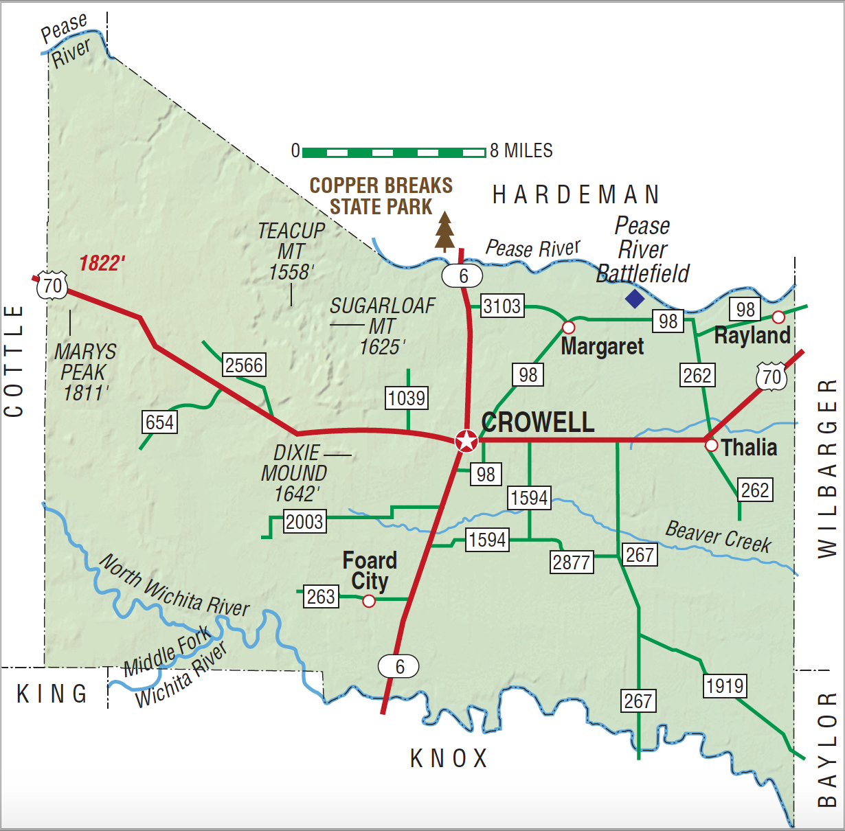
Foard County, in north central Texas on the rolling plains east of the base of the Panhandle, is bounded on the north by Hardeman County, on the west by Cottle County, on the south by Knox County, and on the east by Wilbarger and Baylor Counties. The county's center lies at 33°58' north latitude and 99°45' west longitude. The county, named for Robert L. Foard, a lawyer and former Confederate officer, covers an area of 703 square miles ranging from 1,400 to 1,700 feet in altitude. The Wichita River forms part of the southern boundary of the county, and the Pease River forms part of the northern border. Soils vary from deep sand in the east and along the Pease River in the north, to rich loam in the central section, and to rough pasture land in the south and west; the diversity of soils makes possible an unusual diversification in agriculture. The annual rainfall averages 23.93 inches, temperatures range from 28° F average minimum in January to 98° average maximum in July, and the growing season lasts an average of 219 days.
Evidences of prehistoric animals and primitive man have been unearthed in Foard County. In the eighteenth and nineteenth centuries, the abundance of wild fruits and herbs made this area a favorite haunt of Comanche and Kiowa bands, who frequently camped there during the winter as they followed the migrating buffalo herds. Pedro Vial is thought to have come through the area in 1786. The Comanche chief Peta Nocona staged several raids on White settlements from a favorite winter campground on the Pease River near its junction with Mule Creek; he paid the price on December 18, 1860, when Capt. Lawrence S. (Sul) Ross and his Texas Rangers attacked his camp and captured his wife, the White captive Cynthia Ann Parker, and her infant daughter. As Indian power was being broken during the 1870s, hide hunters came into the region on the "Buffalo Road" from Henrietta and points east and killed off the great herds that once roamed the region.
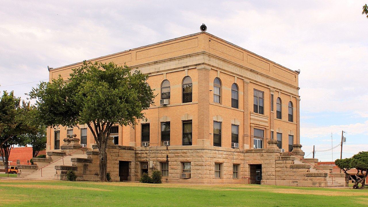
John Leffler | © TSHA

Adapted from the official Handbook of Texas, a state encyclopedia developed by Texas State Historical Association (TSHA). It is an authoritative source of trusted historical records.

- ✅ Adoption Status:
- This place is available for adoption! Available for adoption!
- Adopted by:
- Your name goes here
- Dedication Message:
- Your message goes here
Currently Exists
Yes
Place type
Foard County is classified as a County
Altitude Range
1210 ft – 1822 ft
Size
Land area does not include water surface area, whereas total area does
- Land Area: 704.4 mi²
- Total Area: 707.7 mi²
Temperature
January mean minimum:
26.0°F
July mean maximum:
98.0°F
Rainfall, 2019
27.3 inches
Population Count, 2019
1,155
Civilian Labor Count, 2019
555
Unemployment, 2019
4.7%
Property Values, 2019
$617,522,640 USD
Per-Capita Income, 2019
$42,954 USD
Retail Sales, 2019
$6,428,755 USD
Wages, 2019
$2,910,332 USD
County Map of Texas
Foard County
- Foard County
Places of Foard County
| Place | Type | Population (Year/Source) | Currently Exists |
|---|---|---|---|
| Town | – | – | |
| Town | – | – | |
| Town | 749 (2021) | Yes | |
| Town | – | – | |
| Town | – | – | |
| Town | 10 (2009) | Yes | |
| Town | – | – | |
| Town | – | – | |
| Town | – | – | |
| Town | – | – | |
| Town | 50 (2009) | Yes | |
| Town | – | – | |
| Town | – | – | |
| Town | – | – | |
| Town | – | – | |
| Town | 30 (2009) | Yes | |
| Town | – | – | |
| Town | – | – | |
| Town | – | – | |
| Town | – | – | |
| Town | 50 (2009) | Yes | |
| Town | – | – | |
| Town | – | – | |
| Town | – | – | |
| Town | – | – |

Proud to call Texas home?
Put your name on the town, county, or lake of your choice.
Search Places »

