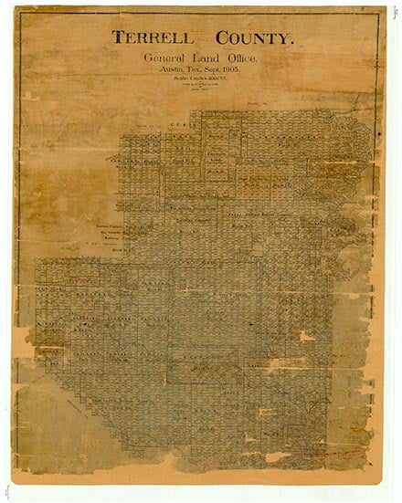
Terrell County

Terrell County, Texas

Terrell County, Texas
Terrell County is in the Big Bend area of southwestern Texas, bordered on the south by Mexico, on the east by Val Verde and Crockett counties, on the north by Pecos County, and on the west by both Pecos and Brewster counties. The center point of the county is at 30°15' north latitude and 102°03' west longitude. Sanderson, the county seat, is about halfway between San Antonio and El Paso. The county was named for Alexander Watkins Terrell. Terrell County comprises 2,357 square miles of rocky terrain with elevations ranging from 1,300 to 4,000 feet above sea level. The soils are of limestone origin. Most of the county is situated in the Stockton Plateau, a part of the Western Mountain region. The eastern and northeastern parts of the county consist of gently rolling to level plains. In the western part the land slopes much more and the rolling terrain becomes mountainous, with narrow canyons and valleys. In the southern portion, the rocky lands near the Rio Grande are cut by deep canyons that carry floodwater into the muddy Rio Grande, which defines the county's southern boundary. Deep canyons also traverse the eastern plains and empty into the Pecos river, which runs along the county's northeastern border. While the Pecos and Rio Grande are the principal waterways in the county, their accessibility to livestock is severely limited in many places by steep cliffs and deep canyons. There are a number of springs in the county, including Independence, King, Myers, Cedar and Geddes springs. Generally, windmill wells and tanks provide water for livestock. With an annual rainfall of only about fifteen inches, Terrell County lands generally are suited only for the grazing of livestock. Less than 1 percent of land in the area is prime farmland. The only trees of any size, primarily walnut and hackberry, grow along the dry creekbeds. The draws and creekbeds often are choked with underbrush that provides good browse for sheep and goats. The hills grow varieties of grama grass, sotol, juniper, lechuguilla, and various varieties of brush. Out on the grassy flats grow the ojasen (tarbush or greasewood), the gobernadora (creosote bush), and the ubiquitous mesquite. A number of plants that grow wild in the area are gathered for medicinal and other purposes. Ojasen and gobernadora leaves are used by many of the local people as medicinal teas, and the popotillo is highly regarded by some as a tonic for the liver and gall bladder. The candelilla is a good source of wax, and guayule has been used in the manufacture of rubber. Mule and whitetail deer are the principal game animals in Terrell County. Other game species are the javalina (collared peccary), wild turkey, mourning dove, white-winged dove, and blue quail. Furbearers include the grey fox, coyote, raccoon, bobcat, ringtailed cat, and mountain lion. Many varieties of ducks and other birds use Terrell County's stock ponds and pastures as resting and nesting places during their seasonal migrations.
Almost all of the area's agricultural income derives from livestock, especially Angora goats and sheep; mohair and wool are the most important agricultural products. Some cattle are also raised in the area, and some local growers produce pecans. Mineral resources include limestone, salt, natural gas, and petroleum. In 1982 almost 31,016,000 cubic feet of gas-well gas, about 398,000,000 cubic feet of casinghead gas, and 47,330 barrels of crude oil were produced in the county. The county is on the main line of the Southern Pacific Railroad, and U.S. Highway 90 crosses the southern part of the county east to west.
Walter G. Downie | © TSHA
Adapted from the official Handbook of Texas, a state encyclopedia developed by Texas State Historical Association (TSHA). It is an authoritative source of trusted historical records.
- ✅ Adoption Status:
- This place is available for adoption! Available for adoption!
- Adopted by:
- Your name goes here
- Dedication Message:
- Your message goes here
Currently Exists
Yes
Place type
Terrell County is classified as a County
Altitude Range
1180 ft – 3765 ft
Size
Land area does not include water surface area, whereas total area does
- Land Area: 2,358.0 mi²
- Total Area: 2,358.1 mi²
Temperature
January mean minimum:
31.5°F
July mean maximum:
92.2°F
Rainfall, 2019
14.7 inches
Population Count, 2019
776
Civilian Labor Count, 2019
347
Unemployment, 2019
5.8%
Property Values, 2019
$650,101,194 USD
Per-Capita Income, 2019
$48,024 USD
Retail Sales, 2019
$2,202,343 USD
Wages, 2019
$3,100,797 USD
County Map of Texas
Terrell County
- Terrell County
Places of Terrell County
| Place | Type | Population (Year/Source) | Currently Exists |
|---|---|---|---|
| Town | – | – | |
| Town | – | – | |
| Town | – | – | |
| Town | – | – | |
| Town | 13 (2009) | Yes | |
| Town | – | – | |
| Town | – | – | |
| Town | – | – | |
| Town | – | – | |
| Town | – | – | |
| Town | – | – | |
| Town | – | – | |
| Town | – | – | |
| Town | – | – | |
| Town | – | – | |
| Town | – | – | |
| Town | – | – | |
| Town | 853 (2021) | Yes | |
| Town | – | – | |
| Town | – | – | |
| Town | – | – | |
| Town | – | – | |
| Town | – | – | |
| Town | – | – |
Proud to call Texas home?
Put your name on the town, county, or lake of your choice.
Search Places »