Nueva Dolores
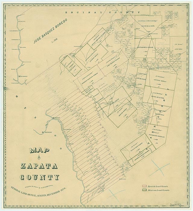
Nueva Dolores is on high land above the Rio Grande just west of U.S. Highway 83 twenty miles south of Laredo in the northwestern corner of Zapata County. It is on land that originally belonged to José Vázquez Borrego, who established a ranch, Nuestra Señora de los Dolores Hacienda (also known as Nuestra Señora de Dolores), on the north bank of the Rio Grande in 1750. Nueva Dolores is two miles upriver from the original ranch headquarters, known as Dolores.
In 1859 Cosmé Martínez of Guerrero, formerly Revilla, in Tamaulipas, Mexico, purchased one-fourth of the Dolores ranch and established a community of laborers at Nueva Dolores, apparently the site of a former settlement. Members of the Martínez and Vidaurri families (the latter were descendants of José Vásquez Borrego) lived there as well. The settlement had a population of forty to fifty in Cosmé Martínez's day, and a total of fifteen stone houses by 1900. The residents tended livestock and raised corn, cotton, pumpkins, squash, and melons. By 1902 there was a thatch-roofed school in the village and a resident teacher. But there was not much else in the community, and the trip to Laredo took six hours. In 1932 a nearby ranch started the large-scale cultivation of onions, and the higher pay there attracted ranchhands from Nueva Dolores. In 1933 the school burned and was not replaced. The settlement was abandoned in the late 1930s, and most of the residents moved to Laredo.
John Hazelton | © TSHA
Adapted from the official Handbook of Texas, a state encyclopedia developed by Texas State Historical Association (TSHA). It is an authoritative source of trusted historical records.
- ✅ Adoption Status:
Belongs to
Nueva Dolores is part of or belongs to the following places:
Currently Exists
No
Place type
Nueva Dolores is classified as a Town
Location
Latitude: 27.25192800Longitude: -99.44036100
Has Post Office
No
Is Incorporated
No