Pulaski
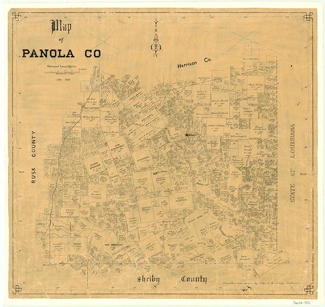
Pulaski was situated on a bluff on the east bank of the Sabine River about nine miles east of present-day Carthage and due west of present-day Deadwood. Initially known as Walnut Bluff, Pulaski was an early settlement, probably dating back to the mid-1830s. It was a ferry crossing on the Sabine River and a significant town by the early 1840s. It even had wharves and served as a port for flatboat traffic on the Sabine. The community served briefly as the county seat for Harrison County, probably from about 1841 to 1842, and as the seat for Panola County when it was formed in 1846. A newspaper, the Sabine Advocate, was published in Pulaski from spring to late summer of 1842. The community acquired a United States post office in 1847 and was home to a Masonic Lodge by the late 1840s. However, Pulaski declined swiftly after the county seat was moved to Carthage in 1848, and by 1850 the population was only thirty-three. The community returned briefly to the limelight in 1864–65, when it became an inland port for shipping cotton down the Sabine in order to avoid Yankee-occupied New Orleans. The post office closed in 1867. By 1900 Pulaski was a ghost town.
Jim Tiller | © TSHA
Adapted from the official Handbook of Texas, a state encyclopedia developed by Texas State Historical Association (TSHA). It is an authoritative source of trusted historical records.
- ✅ Adoption Status:
Belongs to
Pulaski is part of or belongs to the following places:
Currently Exists
No
Place type
Pulaski is classified as a Town
Location
Latitude: 32.22980600Longitude: -94.22920200
Has Post Office
No
Is Incorporated
No