Refugio County

Refugio County, Texas

Refugio County, Texas
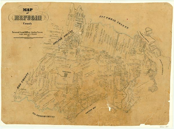
Refugio County (re-FYOO-ri-o) is on the lower Gulf Coast in the Coastal Prairies region, bounded on the south by San Patricio County, on the west by Bee and Goliad counties, on the north by Victoria and Calhoun counties, and on the east by Aransas County and by Hynes and Copano bays. The county's center lies at 28°19' north latitude and 97°09' west longitude. The town of Refugio, the county's seat of government and largest urban center, is thirty-five miles north of Corpus Christi. The county was named for Nuestra Señora del Refugio Mission. Refugio County covers 771 square miles of generally flat land covered with tall prairie grasses and spotted in some areas with mesquite, live oak, prickly pear, and huisache. Elevations range from sea level at the shore to 100 feet in the northwest section. Sandy loam soils are found along the coast; waxy soils predominate in the upper portion of the county. The county is drained by the Aransas River, which forms its southern border, and by the converging Guadalupe and San Antonio rivers, which form its northern boundary. The Mission River, Copano Creek, and Willow Creek also flow through the area. The county has a humid subtropical climate and averages thirty-seven inches of rain annually. Temperatures range from an average low of 45° F in January to an average high of 93° F in July; the growing season lasts 309 days. The county harbors a wide variety of wildlife species, including deer, javelina, bobcat, quail, muskrat, beaver, mink, ring-tailed cat, badger, fox, turkey, duck, geese, jacksnipe, and sandhill crane. The endangered whooping crane nests under the protection of federal law in the Aransas National Wildlife Refuge. In 1982, 91 percent of the land in the county was being used for farms and ranches; about 18 percent of the farmland was under cultivation. About 54 percent of the area's agricultural income that year derived from livestock, particularly cattle and hogs; crops included sorghum, cotton, corn, wheat, and hay. Watermelons and pecans are also grown in the area. Natural resources include petroleum, natural gas, and industrial sand. In 1982, 56,470,457,000 cubic feet of gas-well gas, 39,920 barrels of condensate, 23,483,771 barrels of crude oil, and 50,934,814,000 cubic feet of casinghead gas were produced in the county. Refugio County is joined to the rest of Texas by U.S. Highway 77, which runs southwesterly across the western part of the county, and by State Highway 35, which runs north to south across the eastern section of the area. The Missouri Pacific Railroad also serves as a major transportation artery.
The region was originally inhabited by the Karankawa Indians, a nomadic tribe. The site of the modern town of Refugio was a favorite camping ground of the tribe, and in time a permanent village developed there. Comanche and Lipan Apache Indians occasionally raided the area in the nineteenth century. The first Europeans in the area were probably Álvar Núñez Cabeza de Vaca and his companions; the coastline was charted by Alonso Álvarez de Pineda in 1520. In 1722 Spaniards established Nuestra Señora del Espíritu Santo de Zúñiga Mission (often called La Bahía Mission) at the site of present Goliad to minister to the Karankawa Indians and to cement the Spanish claim to the Texas coast; the mission came to be surrounded by ranchos that supported a growing Spanish population. La Bahía was in territory that became part of the original Refugio County but is not within the present county limits. In 1793 Nuestra Señora del Refugio Mission was founded at the juncture of the San Antonio and Guadalupe rivers. After a destructive Indian raid in 1794, however, the mission was moved to another site; and in 1795 the mission was moved to a location on the Mission River, at the site of the present town of Refugio. Though the mission attracted few Indians, it was the last Spanish mission to be secularized after the Mexican War of Independence. The mission remained in continuous operation until February 7, 1830, when the last services were held. By then, the area was home to at least 100 Mexicans living on the ranchos they had established, and a small village may already have grown around the site of the old mission.
John Leffler | © TSHA
Adapted from the official Handbook of Texas, a state encyclopedia developed by Texas State Historical Association (TSHA). It is an authoritative source of trusted historical records.
- ✅ Adoption Status:
Currently Exists
Yes
Place type
Refugio County is classified as a County
Altitude Range
0 ft – 100 ft
Size
Land area does not include water surface area, whereas total area does
- Land Area: 770.4 mi²
- Total Area: 818.2 mi²
Temperature
January mean minimum:
44.3°F
July mean maximum:
92.0°F
Rainfall, 2019
36.9 inches
Population Count, 2019
6,948
Civilian Labor Count, 2019
3,060
Unemployment, 2019
9.4%
Property Values, 2019
$1,532,707,420 USD
Per-Capita Income, 2019
$42,606 USD
Retail Sales, 2019
$84,585,266 USD
Wages, 2019
$25,387,801 USD
County Map of Texas
Refugio County
- Refugio County
Places of Refugio County
| Place | Type | Population (Year/Source) | Currently Exists |
|---|---|---|---|
| Town | 118 (2021) | Yes | |
| Town | 275 (2021) | Yes | |
| Town | – | – | |
| Town | 97 (2009) | Yes | |
| Town | – | – | |
| Town | – | – | |
| Town | – | – | |
| Town | – | – | |
| Town | – | – | |
| Town | – | – | |
| Town | – | – | |
| Town | – | – | |
| Town | – | – | |
| Town | – | – | |
| Town | – | – | |
| Town | – | – | |
| Town | – | – | |
| Town | – | – | |
| Town | – | – | |
| Town | 2,790 (2021) | Yes | |
| Town | – | – | |
| Town | – | – | |
| Town | – | – | |
| Town | 645 (2021) | Yes | |
| Town | – | – | |
| Town | – | – | |
| Town | – | – | |
| Town | 1,299 (2021) | Yes |
Proud to call Texas home?
Put your name on the town, county, or lake of your choice.
Search Places »