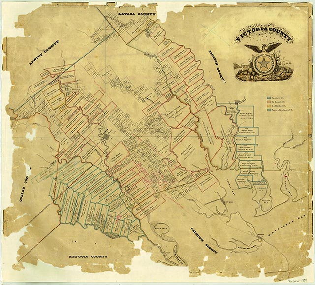
Victoria County

Victoria County, Texas

Victoria County, Texas
Victoria County is located in southeastern Texas on the Coastal Plain about midway between the southern and eastern extremities of the Texas Gulf Coast. Victoria, the county's largest town, is the county seat. There roads converge 120 miles from Houston, 102 miles from San Antonio, 110 miles from Austin, and 75 miles from Corpus Christi; hence the town's nickname, the "crossroads of South Texas." The county's center lies at approximately 28°47' north latitude and 96°57' west longitude. Victoria County comprises 887 square miles of nearly level to gently rolling coastal prairie, surfaced primarily with dark clay loams and clays that support bluestems and tall grasses, oak forest, huisache, mesquite, prickly pear, and other vegetation. The northwestern part of the county lies in the Post Oak Belt and thus marks the southernmost extension of the East Texas timberlands. The soils there, primarily sandy loams and sands, support post oak, blackjack oak, elm, and pecan trees. The elevation ranges from sea level in the southeast to 300 feet near Mission Valley in the northwest. The climate is humid and subtropical, with a temperature range from an average high of 92° F in July to an average low of 46° in January; records of 110° and 9° were set in 1939 and 1930, respectively. The average annual length of the frost-free season is 290 days; the annual precipitation range is from thirty-two to forty inches. The northeastern half of the county drains into Lavaca Bay, principally through Garcitas, Arenosa, and Placedo creeks, and the southwestern area is drained by the Guadalupe and San Antonio rivers and Coleto Creek. Prehistoric fossils of mammoths, horses, camels, sloths, and bison of the Late Pleistocene era have been unearthed in the county, as well as artifacts from the Paleo-Indian period. Despite a variety of archeological excavations, however, little is known of the early hunting and gathering occupants except that they made the change from spear to bow and arrow after A.D. 1000. By the era of contact with the West at least four distinct groups were living in the county: the Karankawas, last seen at Kemper's Bluff before fleeing to Mexico in 1842; the Aranamas; the Tamiques; and the Tonkawas. Comanche, Lipan, and Tawakoni raids were common in the area by the early nineteenth century as well, the most infamous being the great Comanche raid of 1840, which destroyed the port of Linnville (see LINNVILLE RAID OF 1840).
Álvar Núñez Cabeza de Vaca traversed the area in 1528. Fort St. Louis, established in 1685 by René Robert Cavelier, Sieur de La Salle, was probably on Garcitas Creek in what became Victoria County; if that was its location, the French fort was the county's first settlement. Alonso De León discovered and named the Guadalupe River on April 14, 1689, at the approximate site of present Victoria while on a mission from the Spanish government to find and destroy La Salle's settlement. The establishment in April 1722 of Nuestra Señora de Loreto Presidio and Nuestra Señora del Espíritu Santo de Zúñiga Mission (La Bahía) near the ruins of Fort St. Louis marked the first Spanish settlement in what is now Victoria County. The mission and presidio were moved in August 1726 to the Guadalupe River near the site of present Mission Valley because of Indian depredations and an ill-commanded garrison. Until the mission was removed to the San Antonio River in the fall of 1749, the padres at La Bahía cultivated crops, produced enough hay and corn to export their excess to San Antonio and settlements in East Texas, and established in Victoria County the foundation of a characteristic Texas industry-raising cattle and horses. Although the number of livestock grazed on the Guadalupe River prairie is not known, the mission owned 3,220 branded cattle, 120 horses, and 1,600 sheep when inventoried in 1758, nine years after the move to the site of present Goliad. With the removal of La Bahía to the San Antonio River, no further permanent settlement occurred in Victoria County until the nineteenth century, although La Bahía Road, the most protected route to San Antonio and East Texas from the Rio Grande, provided constant activity. There were individual settlements, such as Carlos de la Garza's rancho at Anaqua (see CARLOS RANCHO, TEXAS) and Margaret Wright's homestead at Mission Valley, but colonization of the area occurred only in 1824 with the establishment of Nuestra Señora de Guadalupe de Jesús Victoria by the empresario Martín De León. The settlement, known as Guadalupe Victoria, prospered, and over 100 titles to land grants were issued by the Mexican government by 1835. In addition to the La Bahía ranch, De León, who had amassed about 5,000 branded cattle by the time he started his colony, established Victoria County's claim to be the "Cradle of the Texas Cattle Industry."
Craig H. Roell | © TSHA
Adapted from the official Handbook of Texas, a state encyclopedia developed by Texas State Historical Association (TSHA). It is an authoritative source of trusted historical records.
- ✅ Adoption Status:
Currently Exists
Yes
Place type
Victoria County is classified as a County
Altitude Range
0 ft – 230 ft
Size
Land area does not include water surface area, whereas total area does
- Land Area: 882.1 mi²
- Total Area: 888.8 mi²
Temperature
January mean minimum:
40.7°F
July mean maximum:
94.1°F
Rainfall, 2019
41.1 inches
Population Count, 2019
92,084
Civilian Labor Count, 2019
40,995
Unemployment, 2019
9.1%
Property Values, 2019
$8,601,947,171 USD
Per-Capita Income, 2019
$46,142 USD
Retail Sales, 2019
$1,907,829,764 USD
Wages, 2019
$465,996,356 USD
County Map of Texas
Victoria County
- Victoria County
Places of Victoria County
| Place | Type | Population (Year/Source) | Currently Exists |
|---|---|---|---|
| Town | – | – | |
| Town | – | – | |
| Town | – | – | |
| Town | 1,321 (2021) | Yes | |
| Town | – | – | |
| Town | – | – | |
| Town | – | – | |
| Town | – | – | |
| Town | – | – | |
| Town | – | – | |
| Town | – | – | |
| Lake | – | Yes | |
| Town | – | – | |
| Town | – | – | |
| Town | – | – | |
| Town | – | – | |
| Town | 89 (2014) | Yes | |
| Town | – | – | |
| Town | – | – | |
| Town | – | – | |
| Town | 18 (2014) | Yes | |
| Town | – | – | |
| Town | 70 (2014) | Yes | |
| Town | – | – | |
| Town | – | – | |
| Town | – | – | |
| Town | – | – | |
| Town | 2,385 (2021) | Yes | |
| Town | – | – | |
| Town | – | – | |
| Town | 16 (2014) | Yes | |
| Town | – | – | |
| Town | – | – | |
| Town | – | – | |
| Town | 50 (2009) | Yes | |
| Town | 225 (2014) | Yes | |
| Town | – | – | |
| Town | 600 (2014) | Yes | |
| Town | 443 (2021) | Yes | |
| Town | 1,454 (2021) | Yes | |
| Town | 85 (2014) | Yes | |
| Town | – | – | |
| Town | – | – | |
| Town | – | – | |
| Town | 700 (2014) | Yes | |
| Town | – | – | |
| Town | 65,377 (2021) | Yes | |
| Town | 35 (2014) | Yes |
Photos Nearby:

Victoria, Texas
View of the downtown area of the city of Victoria, the county seat of Victoria County, Texas. Photograph by Billy Hathorn.

A pier at Coleto Creek Reservoir
Photo by Kylelovesyou, Public Domain
Proud to call Texas home?
Put your name on the town, county, or lake of your choice.
Search Places »