Cooke County

Cooke County, Texas

Cooke County, Texas
Cooke County is located in north central Texas, on the Oklahoma border. The approximate center of the county is at 33°40' north latitude and 97°15' west longitude. Gainesville, the county seat and largest population center, is located seven miles south of the Red River and seventy-one miles north of Dallas. The county comprises 905 square miles. The central section of the county is part of the Grand Prairie; it is flanked by a small section of the Eastern Cross Timbers on the east and the Western Cross Timbers on the West. The rolling terrain is surfaced by mixed soils ranging from sandy to loam and from red to black. Grassy prairie predominates in the west. The county is forested mainly with blackjack oak, post oak, and hackberry, and with elm, pecan, walnut, and cottonwood along the creeks and rivers. The altitude increases from 700 feet on the eastern border to nearly 1,000 feet in the west. The northern quarter of Cooke County drains into the Red River, and the remaining three-quarters is part of the watershed of the Elm Fork of the Trinity River. Three lakes are found within the county's boundaries: Lake Kiowa, Hubert H. Moss Lake, and Lake Texoma. A fourth lake, Lake Ray Roberts, dammed in Denton County, covers much of southeastern Cooke County. Temperatures range from an average high of 96° F in July to an average low of 32° in January. The average rainfall is about thirty-four inches a year. The growing season extends for 226 days.
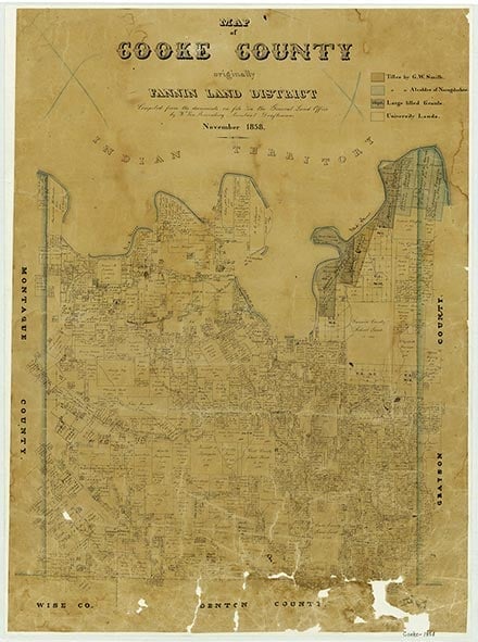
Before the coming of Anglo-American settlement Cooke County stood on the borderlands between the Caddo Indians to the east and the Comanches in the west. The first Europeans to visit the county may have been Spaniards on expeditions during the sixteenth, seventeenth, and eighteenth centuries, but no permanent settlements were made. The county was included in the Cameron land grant, a Mexican grant of 1828, but no settlers came.
Robert Wayne McDaniel | © TSHA
Adapted from the official Handbook of Texas, a state encyclopedia developed by Texas State Historical Association (TSHA). It is an authoritative source of trusted historical records.
- ✅ Adoption Status:
Currently Exists
Yes
Place type
Cooke County is classified as a County
Altitude Range
617 ft – 1217 ft
Size
Land area does not include water surface area, whereas total area does
- Land Area: 874.8 mi²
- Total Area: 898.4 mi²
Temperature
January mean minimum:
31.3°F
July mean maximum:
93.4°F
Rainfall, 2019
42.7 inches
Population Count, 2019
41,257
Civilian Labor Count, 2019
19,584
Unemployment, 2019
7.6%
Property Values, 2019
$6,254,703,065 USD
Per-Capita Income, 2019
$54,174 USD
Retail Sales, 2019
$710,022,590 USD
Wages, 2019
$187,653,807 USD
County Map of Texas
Cooke County
- Cooke County
Places of Cooke County
| Place | Type | Population (Year/Source) | Currently Exists |
|---|---|---|---|
| Town | – | – | |
| Town | – | – | |
| Town | – | – | |
| Town | – | – | |
| Town | – | – | |
| Town | – | – | |
| Town | – | – | |
| Town | – | – | |
| Town | – | – | |
| Town | 3 (2009) | Yes | |
| Town | 45 (2009) | Yes | |
| Town | 320 (2021) | Yes | |
| Town | – | – | |
| Town | – | – | |
| Town | – | – | |
| Town | – | – | |
| Town | – | – | |
| Town | – | – | |
| Town | – | – | |
| Town | – | – | |
| Town | – | – | |
| Town | – | – | |
| Town | – | – | |
| Town | – | – | |
| Town | – | – | |
| Town | – | – | |
| Town | – | – | |
| Town | – | – | |
| Town | 12 (2009) | Yes | |
| Town | – | – | |
| Town | – | – | |
| Town | 150 (2009) | Yes | |
| Town | – | – | |
| Town | – | – | |
| Town | – | – | |
| Town | – | – | |
| Town | 17,576 (2021) | Yes | |
| Town | – | – | |
| Town | – | – | |
| Town | – | – | |
| Town | – | – | |
| Town | – | – | |
| Town | 13 (2009) | Yes | |
| Town | – | – | |
| Town | – | – | |
| Lake | – | Yes | |
| Town | 2,409 (2021) | Yes | |
| Lake | – | Yes | |
| Lake | – | Yes | |
| Town | 20 (2009) | Yes | |
| Town | 1,069 (2021) | Yes | |
| Town | 10 (2009) | Yes | |
| Town | – | – | |
| Town | 12 (2009) | Yes | |
| Town | – | – | |
| Town | – | – | |
| Town | – | – | |
| Town | – | – | |
| Town | – | – | |
| Town | – | – | |
| Town | 600 (2009) | Yes | |
| Town | 1,580 (2021) | Yes | |
| Town | 382 (2021) | Yes | |
| Town | – | – | |
| Town | – | – | |
| Town | – | – | |
| Town | – | – | |
| Town | 253 (2021) | Yes | |
| Town | – | – | |
| Town | – | – | |
| Town | – | – | |
| Town | – | – | |
| Town | – | – | |
| Town | – | – | |
| Town | 22 (2009) | Yes | |
| Town | – | – | |
| Lake | – | Yes | |
| Town | – | – | |
| Town | – | – | |
| Town | 779 (2021) | Yes | |
| Town | 75 (2009) | Yes | |
| Town | – | – | |
| Town | – | – | |
| Town | – | – | |
| Town | 36 (2009) | Yes | |
| Town | 10 (2009) | Yes | |
| Town | – | – | |
| Town | 759 (2021) | Yes | |
| Town | – | – | |
| Town | – | – | |
| Town | 45 (2009) | Yes | |
| Town | – | – | |
| Town | – | – | |
| Town | – | – | |
| Town | – | – | |
| Town | 250 (2009) | Yes |
Photos Nearby:
.jpg "The Gainesville War Memorial at Gainesville, Texas")
The Gainesville War Memorial at Gainesville, Texas
The Gainesville War Memorial at Leonard Park in Gainesville, Texas. Photograph by Michael Barera.
.jpg)

Sunset over Ray Roberts Lake
Photo by Morcup, CC by SA 4

Sightseers watching water on the spillway at Lake Texoma
Photo by Brendajane, Public Domain
Proud to call Texas home?
Put your name on the town, county, or lake of your choice.
Search Places »