Zavala County

Zavala County, Texas

Zavala County, Texas

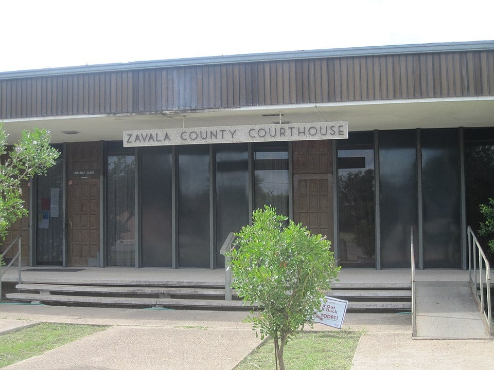
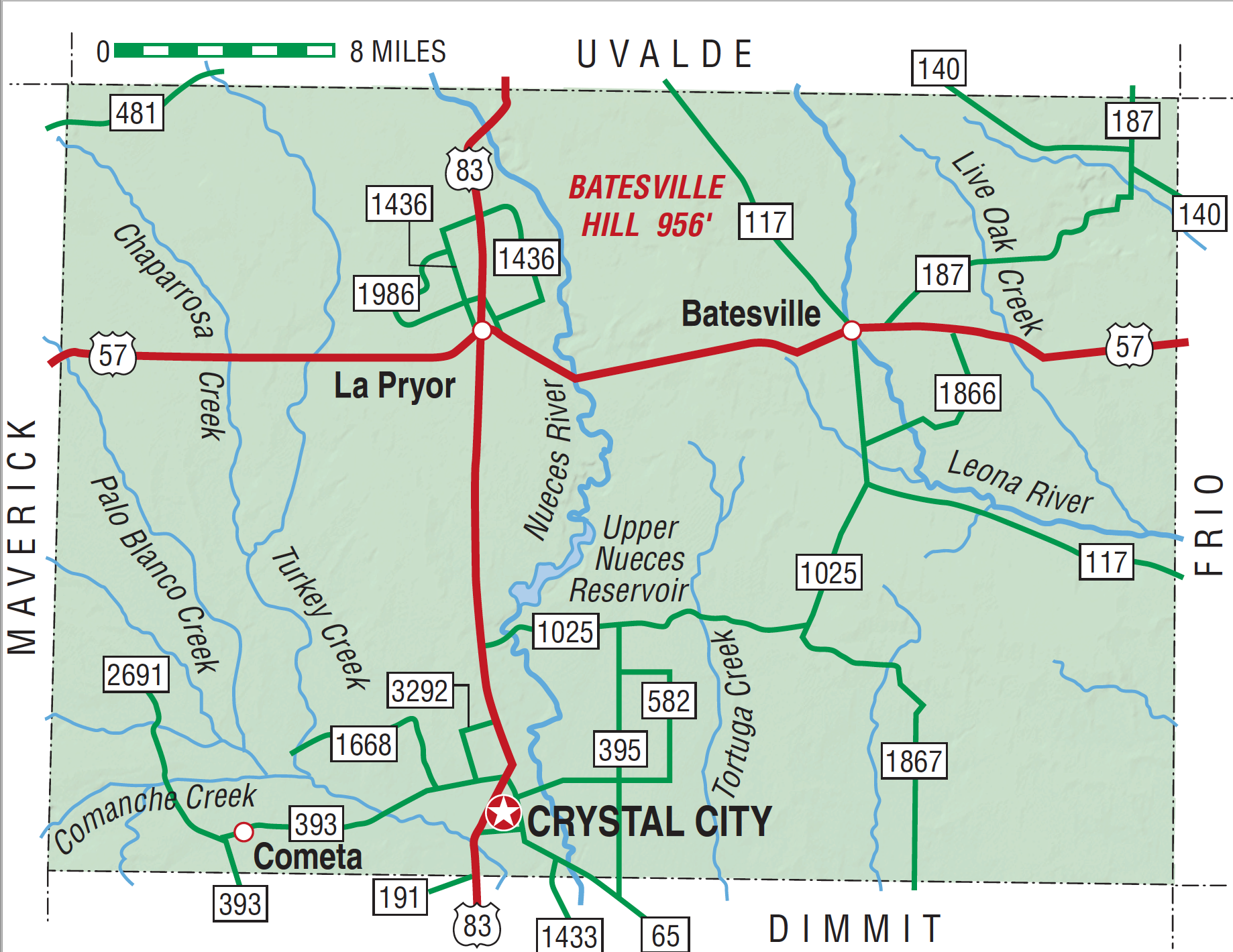
Zavala County, in the Winter Garden Region of Southwest Texas, is 170 miles northwest of Corpus Christi. It borders Maverick, Uvalde, Frio, and Dimmit counties. Its center point is at 28°51' north latitude and 99°45' west longitude. Crystal City, the county seat, is in south central Zavala County on U.S. Highway 83. The rectangular county has an area of 1,298 square miles. The Nueces River drains the central and western region, and the Leona and Frio rivers drain the eastern. Comanche Lake, six miles west of Crystal City, is popular with sportsmen and is believed to be the site of the last Indian raid in Texas. The Carrizo-Wilcox Aquifer, which underlies much of Zavala County, provides water for irrigation and public and industrial uses. Zavala County is in the Rio Grande Plain region, a brushland with dry streams. Most of the county was once a grassland, with numerous perennial streams lined with trees. Changes in the local environment are believed to have been influenced by ranching and farming practices as well as the spread of mesquite and thorny shrubs from northeastern Mexico. The climate is continental, semiarid, and influenced by winds from the Gulf of Mexico; the average annual rainfall is 21.87 inches. Zavala County farmers can expect a growing season of 282 days, with the last freeze in late February and the first freeze in early December. Rainfall, often occurring in the form of thunderstorms in the spring and fall, is impounded in earth reservoirs to supply water for livestock and for irrigation of some crops. The climate is extremely favorable for the cultivation of winter vegetables. Temperatures in winter are generally mild; summers are hot and humid, with temperatures often above 100° F. The topography of the county consists of generally flat land and slightly undulating plains. Elevations range from 580 feet above sea level in the south to 964 feet in the north. The northern part of the county is surfaced by light-colored, well-drained soils, and the southeast and most of the southern section has deep to moderately deep light-colored loamy surfaces over clayey subsoils, with limestone within forty inches of the surface. Marsh life, both of flora and fauna, predominated in prehistoric times. Fauna reported in early historic times that no longer inhabit the region include buffalo, witnessed by the Bosque-Larios expedition in 1675 and by the expedition of Domingo Terán de los Ríos in 1691, and bear and antelope, noted by William Bollaert in northeastern Zavala County in the 1840s. Mesquite, black brush, retama, guayacan, and huisache dominate the vegetation; oak, elm, ash, hackberry, pecan, and persimmon trees grow beside the streams. The native fauna includes whitetail deer, javelinas, coyotes, rabbits, turkeys, quail, hawks and other birds, snakes, lizards, and tortoises. The proliferation of nutritious grasses, including the grama, buffalo, and mesquite species, form the basis for Zavala County's successful ranching industry.
Evidence of early human habitation has been discovered at the Holdsworth Site, northeast of Crystal City. At the Stewart Site, in southwestern Zavala County, people of the Archaic period ate mussels and snails from nearby springs and creeks. More than 100 archeological sites have been identified by researchers of the University of Texas at San Antonio at the Chaparrosa Ranch near La Pryor. Many Coahuiltecan Indian groups lived in the vicinity. Tonkawans were also known to have ventured into the area from Central Texas, and Lipan and Mescalero Apache Indians escaped into the region in the 1700s ahead of fierce Comanches. In 1716 Domingo Ramón recorded a large deserted ranchería (Indian village) near the site of present La Pryor. The Old San Antonio Road traversed the county from west to east. The Marqués de San Miguel de Aguayo is believed to have stopped at Comanche Creek in southwest Zavala County in 1720. On his way to the Alamo in 1836, Gen. Antonio López de Santa Anna crossed the Nueces River near the site of present-day Crystal City.
Ruben E. Ochoa | © TSHA

Adapted from the official Handbook of Texas, a state encyclopedia developed by Texas State Historical Association (TSHA). It is an authoritative source of trusted historical records.

- ✅ Adoption Status:
Currently Exists
Yes
Place type
Zavala County is classified as a County
Pronunciations
- zuh VoL uh
Altitude Range
540 ft – 956 ft
Size
Land area does not include water surface area, whereas total area does
- Land Area: 1,297.4 mi²
- Total Area: 1,301.7 mi²
Temperature
January mean minimum:
43.6°F
July mean maximum:
97.2°F
Rainfall, 2019
19.6 inches
Population Count, 2019
11,840
Civilian Labor Count, 2019
3,225
Unemployment, 2019
17.0%
Property Values, 2019
$2,531,093,184 USD
Per-Capita Income, 2019
$29,202 USD
Retail Sales, 2019
$60,849,951 USD
Wages, 2019
$26,211,501 USD
County Map of Texas
Zavala County
- Zavala County
Places of Zavala County
| Place | Type | Population (Year/Source) | Currently Exists |
|---|---|---|---|
| Town | 51 (2021) | Yes | |
| Town | 1,090 (2021) | Yes | |
| Town | 625 (2021) | Yes | |
| Town | – | – | |
| Town | 10 (2014) | Yes | |
| Town | – | – | |
| Town | 6,335 (2021) | Yes | |
| Town | – | – | |
| Town | – | – | |
| Town | – | – | |
| Town | – | – | |
| Town | – | – | |
| Town | 973 (2021) | Yes | |
| Town | – | – | |
| Town | 165 (2021) | Yes | |
| Town | – | – | |
| Town | – | – | |
| Town | – | – | |
| Town | – | – | |
| Town | – | – | |
| Town | – | – | |
| Town | – | – | |
| Lake | – | Yes | |
| Town | – | – | |
| Town | – | – | |
| Town | – | – |

Proud to call Texas home?
Put your name on the town, county, or lake of your choice.
Search Places »
