Tarrant County

Tarrant County, Texas

Tarrant County, Texas
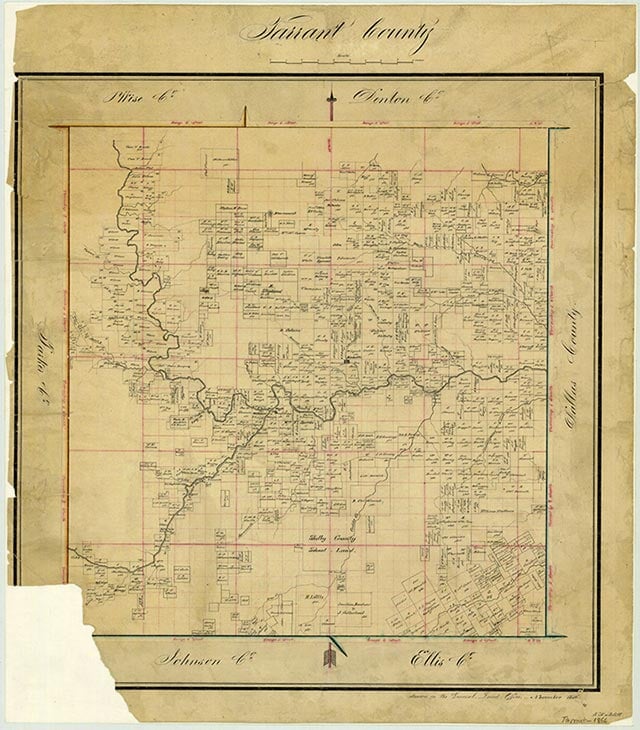
Tarrant County is in north central Texas. The geographic center of the county lies at 32°45' north latitude and 97°17' west longitude, three miles east and slightly south of downtown Fort Worth, the county seat. Tarrant County consists of 898 square miles of gently sloping to level terrain with elevation ranging from 420 feet in the southeast to 960 feet in the northwest. The Trinity River is the major watercourse and flows from the northwest to the southeast across the county, with the Clear Fork and the West Fork draining the western half and other smaller tributaries draining the eastern half. Major lakes in the county include Arlington, Benbrook, Eagle Mountain, Grapevine, and Worth. Four natural regions are found from east to west: the Blackland Prairie in the southeast is a rolling grassland with rich clayey and loamy soil, the Eastern Cross Timbers is made up of deep loamy soil that supports blackjack oak and post oak, the Grand Prairie has shallow, clayey soil and alternating layers of limestone and marl, and the Western Cross Timbers has very shallow to deep loamy and clayey soils that support shinnery oak and post oak. Hardwoods such as American elm, pecan, and box elder are found throughout most of the county along rivers and creeks. Exposed rock formations in the area are almost exclusively of the Cretaceous period. Mineral resources are sand, gravel, stone, and natural gas. Temperatures range from an average low of 35° F in January to an average high of 96° in July. Rainfall averages a little more than thirty-two inches per year, and the growing season extends for 230 days.
Little is known of the Indians who inhabited the area of present-day Tarrant County before the coming of European explorers in the sixteenth century. Groups thought to have been in the area were the Tonkawas and the Hasinai Caddos. By the late 1700s the Comanches, Kiowas, and Wichitas had also moved into the region. When White settlers came they clashed with the native population. The battle of Village Creek occurred in 1841. A seventy-man force, led by Gen. Edward H. Tarrant, seized and destroyed three Indian villages. Although this expedition and others like it cleared permanent Indian settlements from the area, trouble with the Comanches and Kiowas continued into the 1870s. In August 1841 General Tarrant ordered a military outpost built near Village Creek. The post, named Fort Bird after Capt. Jonathan Bird, was abandoned in less than a year because of a threatened Comanche attack. The spot was reoccupied later and in 1843 was the site of a treaty negotiation dividing the area between the Anglo settlers and the Indians. After the treaty was signed immigrants from Tennessee, Virginia, and Kentucky settled in the region. They found abundant water and good farmland. The Texas Congress encouraged settlement by offering large grants to companies such as the Peters Land Company, which eventually obtained the land that would become Tarrant County. In 1845 a group from Missouri settled to the south of the present northern Tarrant County line, and another group founded Birdville on the banks of Big Fossil Creek. Settlement began in the vicinity of present day Azle in 1846. In the late 1840s Middleton Tate Johnson founded Johnson's Station thirteen miles southeast of the site of the present Tarrant County Courthouse. These settlements pushed the frontier westward, and the need for a military post was recognized. In 1849 Bvt. Maj. Ripley Arnold chose a site at the confluence of the Clear Fork and West Fork of the Trinity River. He named the post Camp Worth in honor of Gen. William Jenkins Worth, who had won fame in the Mexican War, and the camp was officially named Fort Worth. The Texas legislature recognized the importance of the area. On December 20, 1849, the county was founded and named after Tarrant, who had been instrumental in driving out the Indians. It was formally organized in August 1850, when the first elections were held.
W. Kellon Hightower | © TSHA
Adapted from the official Handbook of Texas, a state encyclopedia developed by Texas State Historical Association (TSHA). It is an authoritative source of trusted historical records.
- ✅ Adoption Status:
Currently Exists
Yes
Place type
Tarrant County is classified as a County
Altitude Range
420 ft – 960 ft
Size
Land area does not include water surface area, whereas total area does
- Land Area: 863.6 mi²
- Total Area: 902.3 mi²
Temperature
January mean minimum:
32.4°F
July mean maximum:
95.5°F
Rainfall, 2019
35.5 inches
Population Count, 2019
2,102,515
Civilian Labor Count, 2019
1,078,015
Unemployment, 2019
8.8%
Property Values, 2019
$210,610 USD
Per-Capita Income, 2019
$51,239 USD
Retail Sales, 2019
$35,443,962,098 USD
Wages, 2019
$13,931,152,221 USD
County Map of Texas
Tarrant County
- Tarrant County
Places of Tarrant County
| Place | Type | Population (Year/Source) | Currently Exists |
|---|---|---|---|
| Town | 392,786 (2021) | Yes | |
| Town | – | – | |
| Town | – | – | |
| Town | – | – | |
| Town | – | – | |
| Town | – | – | |
| Town | – | – | |
| Town | 13,518 (2021) | Yes | |
| Town | – | – | |
| Town | 49,187 (2021) | Yes | |
| Town | 24,605 (2021) | Yes | |
| Lake | – | Yes | |
| Town | – | – | |
| Town | – | – | |
| Town | – | – | |
| Town | – | – | |
| Town | 2,359 (2021) | Yes | |
| Town | – | – | |
| Town | – | – | |
| Town | – | – | |
| Town | – | – | |
| Town | – | – | |
| Town | 5,635 (2021) | Yes | |
| Town | – | – | |
| Town | – | – | |
| Town | 51,618 (2021) | Yes | |
| Town | – | – | |
| Town | – | – | |
| Town | – | – | |
| Town | – | – | |
| Town | – | – | |
| Town | – | – | |
| Town | 25,986 (2021) | Yes | |
| Town | – | – | |
| Town | 19,333 (2021) | Yes | |
| Town | – | – | |
| Town | 2,273 (2021) | Yes | |
| Town | – | – | |
| Town | – | – | |
| Town | – | – | |
| Town | – | – | |
| Town | – | – | |
| Town | – | – | |
| Town | – | Yes | |
| Lake | – | Yes | |
| Town | – | – | |
| Town | – | – | |
| Town | – | – | |
| Town | – | – | |
| Town | 3,761 (2021) | Yes | |
| Town | – | – | |
| Town | – | – | |
| Town | – | – | |
| Town | 60,500 (2021) | Yes | |
| Town | – | – | |
| Town | 6,067 (2021) | Yes | |
| Town | – | – | |
| Town | 13,818 (2021) | Yes | |
| Town | 935,508 (2021) | Yes | |
| Town | – | – | |
| Town | – | – | |
| Town | – | – | |
| Town | – | – | |
| Town | 197,347 (2021) | Yes | |
| Town | 50,872 (2021) | Yes | |
| Lake | – | Yes | |
| Town | – | – | |
| Town | 45,746 (2021) | Yes | |
| Town | – | – | |
| Town | – | – | |
| Town | 2,371 (2021) | Yes | |
| Town | – | – | |
| Town | – | – | |
| Town | – | – | |
| Town | – | – | |
| Town | 40,055 (2021) | Yes | |
| Town | – | – | |
| Town | – | – | |
| Town | – | – | |
| Town | – | – | |
| Town | – | – | |
| Town | – | – | |
| Lake | – | Yes | |
| Town | – | – | |
| Town | 45,397 (2021) | Yes | |
| Town | 8,463 (2021) | Yes | |
| Town | – | – | |
| Town | – | – | |
| Lake | – | Yes | |
| Town | 4,674 (2021) | Yes | |
| Lake | – | Yes | |
| Town | 1,624 (2021) | Yes | |
| Town | – | – | |
| Town | – | – | |
| Town | – | – | |
| Town | – | – | |
| Town | – | – | |
| Town | – | – | |
| Town | 74,368 (2021) | Yes | |
| Town | – | – | |
| Town | – | – | |
| Town | – | – | |
| Town | – | – | |
| Town | – | – | |
| Town | – | – | |
| Town | – | – | |
| Town | – | – | |
| Town | – | – | |
| Town | – | – | |
| Town | – | – | |
| Town | – | – | |
| Town | – | – | |
| Town | – | – | |
| Town | 70,209 (2021) | Yes | |
| Town | – | – | |
| Town | – | – | |
| Town | – | – | |
| Town | – | – | |
| Town | – | – | |
| Town | – | – | |
| Town | – | – | |
| Town | – | – | |
| Town | – | – | |
| Town | – | – | |
| Town | 2,528 (2021) | Yes | |
| Town | 4,250 (2021) | Yes | |
| Town | – | – | |
| Town | 2,236 (2021) | Yes | |
| Town | – | – | |
| Town | – | – | |
| Town | – | – | |
| Town | – | – | |
| Town | – | – | |
| Town | – | – | |
| Town | – | – | |
| Town | – | – | |
| Town | – | – | |
| Town | 14,597 (2021) | Yes | |
| Town | 3,100 (2021) | Yes | |
| Town | 780 (2009) | Yes | |
| Town | 8,484 (2021) | Yes | |
| Town | 7,524 (2021) | Yes | |
| Town | – | – | |
| Town | – | – | |
| Town | – | – | |
| Town | 24,011 (2021) | Yes | |
| Town | 5,388 (2021) | Yes | |
| Town | – | – | |
| Town | – | – | |
| Town | – | – | |
| Town | – | – | |
| Town | 31,105 (2021) | Yes | |
| Town | – | – | |
| Town | – | – | |
| Town | – | – | |
| Town | – | – | |
| Town | – | – | |
| Town | – | – | |
| Town | – | – | |
| Town | – | – | |
| Town | – | – | |
| Town | 23,313 (2021) | Yes | |
| Town | – | – | |
| Town | – | – | |
| Town | 1,683 (2021) | Yes | |
| Town | – | – | |
| Town | 641 (2021) | Yes | |
| Town | 2,602 (2021) | Yes | |
| Town | 175 (2009) | Yes | |
| Town | 18,084 (2021) | Yes | |
| Town | – | – | |
| Town | – | – |
Photos Nearby:

Fort Worth, Texas
Fort Worth, Texas Photo by Alton Stephens on Unsplash

The visitor's center in downtown Grapevine
Photo by Renelibrary, CC by SA 4.0

The train depot in Saginaw
Photo by Nicholas Henderson, CC 2

Sailing on Lake Arlington
Photo by Ulster Project Arlington, Flickr, CC 2

Campers can get a beautiful sunset at Benbrook Lake
Photo by Larry Mathias, Flickr, CC by ND 2

A view of the lake from Tarrant County
Photo by Gordon Reid, CC 3

Fourth of July fireworks on Grapevine Lake
Photo by Shiva Shenoy, Flickr, CC2

A view of Lake Worth from Lone Point Shelter
Photo by Larry D. Moore, CC by SA 4

An aerial view of Joe Pool Lake and Dam
Photo by U.S. Army Corps of Engineers, Public Domain
Proud to call Texas home?
Put your name on the town, county, or lake of your choice.
Search Places »