Reeves County

Reeves County, Texas

Reeves County, Texas
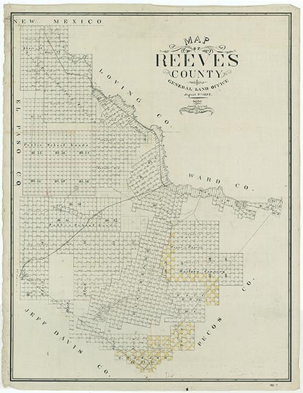
Reeves County is on Interstate Highway 20 in the Trans-Pecos region of West Texas with the northern edge of its irregular shape touching New Mexico. On the northeast it borders the Pecos River, which separates it from Loving and Ward counties. It is bounded on the southeast by Pecos County, on the southwest by Jeff Davis County, and on the west by Culberson County. Pecos, the county seat, is seventy-four miles southwest of Odessa. The center of the county lies at 31°20' north latitude and 103°40' west longitude. Reeves County comprises 2,626 square miles of land with flat and undulating terrain in its northern part and mountainous topography in the extreme south. Altitudes, including those in the Davis Mountains, vary from 2,538 to 4,210 feet above sea level. The Barrilla Hills rise abruptly with steep slopes to a height of 150 to 200 feet above the surrounding plain. About 85 percent of the county is covered by a broad gently-sloping plain topped by outwash material from the mountains. Surface geology is mostly Quaternary, except for the extreme southeastern corner, which is Igneous, and the western and eastern edges, which are Cretaceous. Soils are light reddish-brown to brown sands, clay loams, clays, and rough stony lands. The average annual temperature is 64° F. The growing season extends 226 days. Rainfall, which averages ten inches per year, runs into several intermittent lakes in the west central area of the county. These shallow playas fill with water after downpours, but shrink and sometimes disappear through evaporation between rains. Toyah Lake is the largest playa in the county, with walls formed by cliffs of ten to forty feet in height. The entire county is drained by the Pecos River. The main tributaries are Salt and Toyah creeks and Four Mile, Horsehead, and Salt draws. Two lakes provide water for recreation and irrigation: Red Bluff Reservoir on the Pecos River in extreme northwestern Reeves County and Balmorhea Lake in the southwest. Vegetation consists of sparse grasses, scrub brush, creosotebush, cacti, oak, juniper, and mesquite, which provides the area's only timber. Natural resources include gypsum, limestone, salt, oil, gas, and volcanic ash. Other minerals include brine, sand, gravel, and recovered sulphur. Less than 1 percent of the land is considered prime farmland.
The first people to inhabit Reeves County lived in the rock shelters and caves around the edge of the Barrilla Hills and built permanent camps near Phantom Lake, San Solomon Spring, and Toyah Creek. These prehistoric people left behind artifacts and pictographs as evidence of their presence. The Jumano Indians irrigated crops of corn and peaches from San Solomon Spring, where Balmorhea State Recreation Area is now located. Three Jumanos met the expedition of Antonio de Espejo near Toyah Lake in 1583, and guided explorers to La Junta by a better route. Settlers of Mexican descent farmed in the county's Madera Valley from early times. In 1849 John S. Ford traveled along Toyah Creek and noted the productive land upon which the Mescalero Indians cultivated corn. Farmers of Mexican descent who irrigated from San Solomon Spring in the last half of the nineteenth century found a lucrative market for grains, vegetables, and beef at Fort Davis. The first Anglo farmers arrived in Toyah Valley in 1871, when George B. and Robert E. Lyle began irrigating crops from Toyah Creek. Open range ranching first attracted White settlers to the Davis Mountains in 1875.
Julia Cauble Smith | © TSHA
Adapted from the official Handbook of Texas, a state encyclopedia developed by Texas State Historical Association (TSHA). It is an authoritative source of trusted historical records.
- ✅ Adoption Status:
Currently Exists
Yes
Place type
Reeves County is classified as a County
Altitude Range
2460 ft – 5115 ft
Size
Land area does not include water surface area, whereas total area does
- Land Area: 2,635.4 mi²
- Total Area: 2,642.1 mi²
Temperature
January mean minimum:
30.3°F
July mean maximum:
94.4°F
Rainfall, 2019
13.5 inches
Population Count, 2019
15,976
Civilian Labor Count, 2019
12,013
Unemployment, 2019
6.3%
Property Values, 2019
$12,240,360,214 USD
Per-Capita Income, 2019
$39,418 USD
Retail Sales, 2019
$497,565,617 USD
Wages, 2019
$154,483,242 USD
County Map of Texas
Reeves County
- Reeves County
Places of Reeves County
| Place | Type | Population (Year/Source) | Currently Exists |
|---|---|---|---|
| Town | – | – | |
| Town | – | – | |
| Town | – | – | |
| Town | 398 (2021) | Yes | |
| Lake | – | Yes | |
| Town | – | – | |
| Town | – | – | |
| Town | – | – | |
| Town | – | – | |
| Town | – | – | |
| Town | – | – | |
| Town | – | – | |
| Town | – | – | |
| Town | – | – | |
| Lake | – | Yes | |
| Town | – | – | |
| Town | – | – | |
| Town | 905 (2021) | Yes | |
| Town | – | – | |
| Town | – | – | |
| Town | – | – | |
| Town | – | – | |
| Town | – | – | |
| Town | – | – | |
| Town | 80 (2009) | Yes | |
| Town | – | – | |
| Town | – | – | |
| Town | 12,673 (2021) | Yes | |
| Town | – | – | |
| Town | – | – | |
| Town | – | – | |
| Town | – | – | |
| Town | – | – | |
| Town | 40 (2009) | Yes | |
| Lake | – | Yes | |
| Town | – | – | |
| Town | – | – | |
| Town | – | – | |
| Town | – | – | |
| Town | – | – | |
| Town | – | – | |
| Town | 185 (2009) | Yes | |
| Town | 61 (2021) | Yes | |
| Town | 60 (2009) | Yes | |
| Town | – | – | |
| Town | 12 (2009) | Yes | |
| Town | – | – |
Photos Nearby:

Pecos, Texas
View of downtown the city of Pecos in Reeves County, Texas. Photograph by Talshiarr.

The still waters of Balmorhea Lake
Photo by William Blair, Flickr, CC2
Proud to call Texas home?
Put your name on the town, county, or lake of your choice.
Search Places »