Falls County

Falls County, Texas

Falls County, Texas
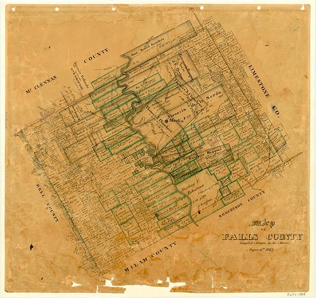
Falls County is located in Central Texas and is surrounded by Limestone, Robertson, Milam, Bell, and McLennan counties. Marlin, the largest town and county seat, is 24 miles south of Waco and 121 miles south of Dallas. The county's center lies at 31°15' north latitude and 96°54' west longitude. Falls County covers 765 square miles in the Blackland Prairie region. The gently rolling terrain consists of broad flatlands, with elevations ranging from 300 to 500 feet, and the Brazos River bisects the county. Over 70 percent of the county contains upland clayey and loamy soil used primarily for pasture and cultivated crops. The rest of the area has deep loamy or sandy and loamy soil which is used for specialized crops such as tomatoes and watermelons. The main natural resource is the land, but there are a few oil and gas wells. Mineral artesian wells in Marlin have made it a health center. Temperatures range from an average high of 93° F in July to an average low of 39° in January. The average yearly rainfall is slightly less than thirty-four inches and the growing season lasts 257 days.
The falls of the Brazos River have long been an important fording and camping area for Indians and White settlers. The first Americans in the area were sent in 1819 by Dr. James Long to establish a trading house. Because of problems with the Mexican government they did not stay long. In 1825 the area was included in the empresario grant to Robert Leftwich of the Texas Association, a group from Nashville, Tennessee, which sought permission from the Mexican government to settle in Texas. Colonization did not take place at that time, however. Until 1829 the falls area did not have a permanent Indian settlement but served as hunting grounds for several tribes, including Wacos, Tawakonis, and Anadarkos, who were often attacked from the north by the stronger Comanches. The Cherokees arrived in the early 1830s, after the other Indians had been weakened by internal wars in 1829–30. The Cherokees were alone in the area until 1834–35, when Sterling C. Robertson began bringing American settlers to his Nashville colony (later called Robertson's colony). Although it was illegal under new laws passed by the Mexican government, nine families had settled in the area by 1830. In 1833 Robertson established the capital of his Nashville colony and called it Sarahville de Viesca. At this time problems with the Indians were exacerbated by clashes with the Mexicans, and in 1835 the settlers prepared for war with Mexico. The change of name from Fort Viesca to Fort Milam reflected the shift away from Mexico. In early 1836 all the settlers fled during the Runaway Scrape, giving Viesca the name of "the town that died overnight." After the battle of San Jacinto families returned to the area, but Fort Milam never reached its former importance except as the head of the Brazos military operations against the Indians. By 1837–38 the Marlin family returned to Bucksnort, near Fort Milam, along with the Morgan family. By this time Indians had become a constant threat. In June 1837 several men were attacked and one killed. On January 1, 1839, the women and children at Morgan Point, the home of the Morgans, were killed in what came to be called Morgan's Massacre. On January 10 the same group of Indians attacked Fort Marlin and were repulsed. Six days later the men from Bucksnort attacked the Indians; each side lost ten men, but the Indians won the encounter. Later that year the Texas legislature authorized men to patrol the region, and conflicts with Indians soon ceased. Peace was officially declared in 1845.
Lisa C. Maxwell | © TSHA
Adapted from the official Handbook of Texas, a state encyclopedia developed by Texas State Historical Association (TSHA). It is an authoritative source of trusted historical records.
Currently Exists
Yes
Place type
Falls County is classified as a County
Altitude Range
282 ft – 731 ft
Size
Land area does not include water surface area, whereas total area does
- Land Area: 765.5 mi²
- Total Area: 773.8 mi²
Temperature
January mean minimum:
35.4°F
July mean maximum:
94.2°F
Rainfall, 2019
38.5 inches
Population Count, 2019
17,297
Civilian Labor Count, 2019
6,474
Unemployment, 2019
6.8%
Property Values, 2019
$1,802,426,847 USD
Per-Capita Income, 2019
$34,619 USD
Retail Sales, 2019
$117,741,945 USD
Wages, 2019
$32,849,933 USD
County Map of Texas
Falls County
- Falls County
Places of Falls County
| Place | Type | Population (Year/Source) | Currently Exists |
|---|---|---|---|
| Town | – | – | |
| Town | – | – | |
| Town | – | – | |
| Town | – | – | |
| Town | 58 (2009) | Yes | |
| Town | – | – | |
| Town | – | – | |
| Town | – | – | |
| Town | 36 (2014) | Yes | |
| Town | – | – | |
| Town | – | – | |
| Town | – | – | |
| Town | – | – | |
| Town | – | – | |
| Town | – | – | |
| Town | – | – | |
| Town | – | – | |
| Town | 90 (2009) | Yes | |
| Town | 42 (2014) | Yes | |
| Town | – | – | |
| Town | 988 (2021) | Yes | |
| Town | – | – | |
| Town | – | – | |
| Town | – | – | |
| Town | – | – | |
| Town | – | – | |
| Town | – | – | |
| Town | – | – | |
| Town | 17 (2014) | Yes | |
| Town | 54 (2009) | Yes | |
| Town | 19 (2014) | Yes | |
| Town | – | – | |
| Town | – | – | |
| Town | – | – | |
| Town | – | – | |
| Town | 667 (2021) | Yes | |
| Town | – | – | |
| Town | – | – | |
| Town | – | – | |
| Town | – | – | |
| Town | – | – | |
| Town | – | – | |
| Town | – | – | |
| Town | 20 (2014) | Yes | |
| Town | – | – | |
| Town | – | – | |
| Town | – | – | |
| Town | – | – | |
| Town | – | – | |
| Town | – | – | |
| Town | – | – | |
| Town | – | – | |
| Town | – | – | |
| Town | – | – | |
| Town | – | – | |
| Town | – | – | |
| Town | – | – | |
| Town | – | – | |
| Town | – | – | |
| Town | – | – | |
| Town | 668 (2021) | Yes | |
| Town | 5,543 (2021) | Yes | |
| Town | 30 (2014) | Yes | |
| Town | – | – | |
| Town | – | – | |
| Town | – | – | |
| Town | 96 (2014) | Yes | |
| Town | – | – | |
| Town | – | – | |
| Town | – | – | |
| Town | 15 (2014) | Yes | |
| Town | – | – | |
| Town | – | – | |
| Town | – | – | |
| Town | – | – | |
| Town | – | – | |
| Town | – | – | |
| Town | – | – | |
| Town | – | – | |
| Town | – | – | |
| Town | – | – | |
| Town | 48 (2009) | Yes | |
| Town | – | – | |
| Town | – | – | |
| Town | 76 (2014) | Yes | |
| Town | – | – | |
| Town | 35 (2009) | Yes | |
| Town | – | – | |
| Town | – | – | |
| Town | – | – | |
| Town | 300 (2014) | Yes | |
| Town | – | – | |
| Town | – | – | |
| Town | 1,345 (2021) | Yes | |
| Town | – | – | |
| Town | – | – | |
| Town | – | – | |
| Town | 86 (2014) | Yes | |
| Town | – | – | |
| Town | – | – | |
| Town | – | – | |
| Town | – | – | |
| Town | – | – | |
| Town | 12 (2014) | Yes | |
| Town | – | – | |
| Town | – | – | |
| Town | 200 (2014) | Yes | |
| Town | – | – | |
| Town | 30 (2009) | Yes | |
| Town | – | – | |
| Town | 64 (2009) | Yes | |
| Town | 48 (2009) | Yes | |
| Town | – | – | |
| Town | – | – | |
| Town | – | – | |
| Town | – | – | |
| Town | – | – | |
| Town | – | – | |
| Town | – | – | |
| Town | 186 (2014) | Yes | |
| Town | 45 (2009) | Yes | |
| Town | 42 (2009) | Yes | |
| Town | 22 (2009) | Yes |
Photos Nearby:

Marlin, Texas
Downtown view of the City of Marlin, the seat of Falls County, Texas. Photograph by Billy Hathorn.

Rosebud, Texas
City Hall in downtown Rosebud, Texas. Photograph by Larry D. Moore.

Lott, Texas
Water Tower in the City of Lott, located in Falls County, Texas Photograph by Pete Unseth.
Proud to call Texas home?
Put your name on the town, county, or lake of your choice.
Search Places »