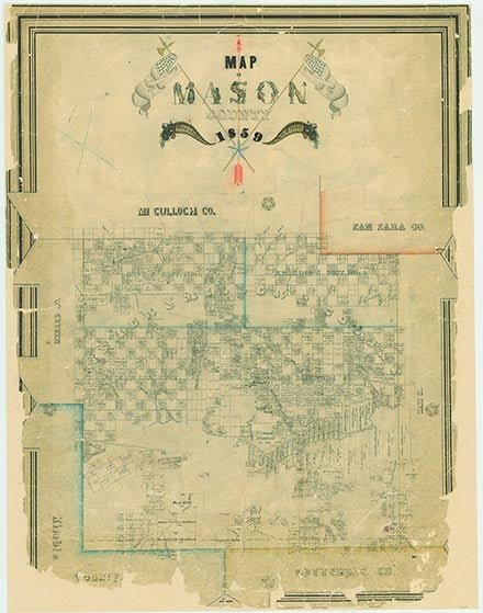
Mason County

.jpg)
Mason County, Texas

Mason County, Texas
Mason County is located in Central Texas, just south of the geographic center of the state. The county's center lies at approximately 30°45' north latitude and 99°11' west longitude, just over ninety-five miles northwest of Austin. The county covers an area of 935 square miles in the region commonly called the Hill Country; its elevation ranges from 1,300 to 2,200 feet. The western part of the county lies on the edge of the Edwards Plateau and is characterized by generally flat terrain surfaced by shallow, stony clays and loams. The eastern part of the county, in the Llano basin, is characterized by rolling to steep terrain surfaced by deeper sandy and clayey loams. The primary natural resources are derived from the limestone and granite formations underlying these areas and include quarried stone, crushed rock and gravel, sand, and lime. Mineral resources include granitic quartz, feldspar, iron, lead, manganese, and topaz, but none appears in significant amounts. The county flora comprises an assortment of grasses, scrub brush, creosote bush, and cacti, with open stands of various hardwoods, primarily live oak, mesquite, and Ashe juniper. Native pecan trees can be found along the banks of creeks and rivers. The county's abundant wildlife, particularly deer, wild turkey, dove, and quail, has made it a popular hunting and fishing area. The Llano River, which flows west to east through the center of the county, drains the majority of Mason County. Other rivers include the James River, which enters the Llano from the south, and the San Saba River, which crosses the extreme northwestern corner of the county. There are also a number of spring-fed creeks. The western edge of the county overlies the Edwards-Trinity (Plateau) aquifer, and portions of the county overlie the Hickory Sandstone and Ellenburger-San Saba aquifers. Rainfall averages approximately 25 inches a year, temperatures range from an average high of 97° F in July to an average low of 37° in January, and the growing season lasts approximately 217 days.
For centuries the countryside surrounding the Llano River served as summer hunting grounds for a number of roving Indian peoples, primarily the Lipan Apaches. The Comanches moved down from the Panhandle during the eighteenth century and drove the Apaches south. The Spanish made some grants during the late 1700s for land along the Llano River, but no permanent settlements were established in Spanish or Mexican Texas.
Alice J. Rhoades | © TSHA
Adapted from the official Handbook of Texas, a state encyclopedia developed by Texas State Historical Association (TSHA). It is an authoritative source of trusted historical records.
- ✅ Adoption Status:
Currently Exists
Yes
Place type
Mason County is classified as a County
Altitude Range
1180 ft – 2217 ft
Size
Land area does not include water surface area, whereas total area does
- Land Area: 928.8 mi²
- Total Area: 932.2 mi²
Temperature
January mean minimum:
32.1°F
July mean maximum:
92.3°F
Rainfall, 2019
29.2 inches
Population Count, 2019
4,274
Civilian Labor Count, 2019
1,657
Unemployment, 2019
6.0%
Property Values, 2019
$2,632,251,160 USD
Per-Capita Income, 2019
$44,601 USD
Retail Sales, 2019
$21,818,790 USD
Wages, 2019
$9,849,378 USD
County Map of Texas
Mason County
- Mason County
Places of Mason County
| Place | Type | Population (Year/Source) | Currently Exists |
|---|---|---|---|
| Town | – | – | |
| Town | 14 (2009) | Yes | |
| Town | – | – | |
| Town | – | – | |
| Town | – | – | |
| Town | – | – | |
| Town | – | – | |
| Town | – | – | |
| Town | – | – | |
| Town | – | – | |
| Town | 12 (2009) | Yes | |
| Town | – | – | |
| Town | – | – | |
| Town | – | – | |
| Town | – | – | |
| Town | – | – | |
| Town | – | – | |
| Town | – | – | |
| Town | 55 (2009) | Yes | |
| Town | – | – | |
| Town | – | – | |
| Town | 15 (2009) | Yes | |
| Town | – | – | |
| Town | 12 (2009) | Yes | |
| Town | – | – | |
| Town | – | – | |
| Town | – | – | |
| Town | – | – | |
| Town | – | – | |
| Town | – | – | |
| Town | – | – | |
| Town | – | – | |
| Town | 80 (2009) | Yes | |
| Town | – | – | |
| Town | – | – | |
| Town | 52 (2009) | Yes | |
| Town | 2,119 (2021) | Yes | |
| Town | – | – | |
| Town | – | – | |
| Town | 125 (2009) | Yes | |
| Town | – | – | |
| Town | – | – | |
| Town | 85 (2009) | Yes | |
| Town | – | – | |
| Town | – | – | |
| Town | – | – |
Proud to call Texas home?
Put your name on the town, county, or lake of your choice.
Search Places »