Midland County

.JPG)
Midland County, Texas

Midland County, Texas
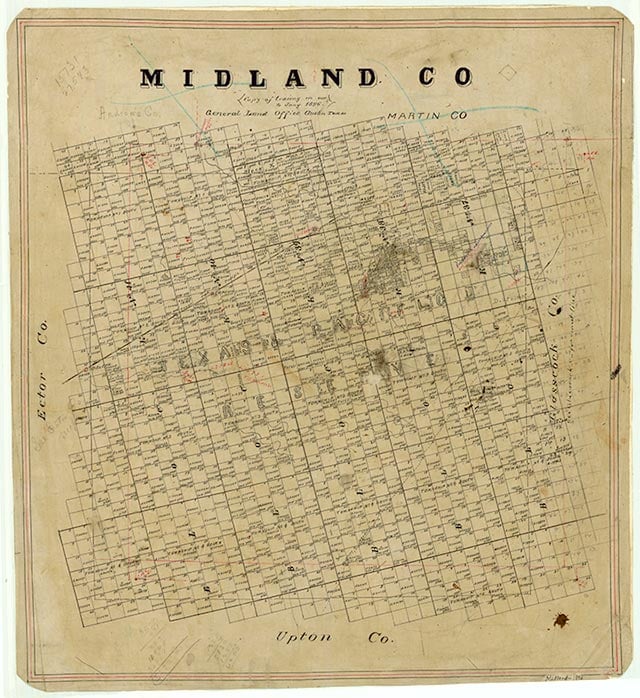
Midland County is on the southern edge of the High Plains in West Texas, bounded on the east by Glasscock County, on the south by Upton County, on the West by Ector County, and on the north by Martin and Andrews counties. The center of the county lies at approximately 31°52' north latitude and 102°00' west longitude, 120 miles south of Lubbock. The county was named for its location halfway between Fort Worth and El Paso on the Texas and Pacific Railway. Midland County extends across 939 square miles of flat land broken by draws and covered by scattered mesquite; sandy red and dark loam soils predominate, and elevations range from 2,550 to 2,900 feet above sea level. There are no rivers or any other permanent surface waters in the county. Annual rainfall is only 13.51 inches. Temperatures range from an average minimum of 31° F in January to an average maximum of 95° F in July; the growing season lasts 218 days. In the 1980s the agricultural sector of county's economy averaged $11 million in annual income from beef cattle, hogs, sheep, cotton, sorghums, and small grains. Over 13,600 acres are irrigated. The city of Midland is the county's seat of government and the bustling administrative center of the huge Permian Basin petroleum fields. Over $1 billion was paid in wages to the county's 54,207 workers in 1980. About $53,800,000 in goods were manufactured in Midland County in 1982, including clothing, oilfield equipment, plastics, electronic calculators, and watches. County wells produced 7,616,000 barrels of oil, valued at over $225 million, that year. Interstate Highway 20 cuts the northeast corner of the county, coursing southwesterly, and State Highway 349 bisects it north to south. The Missouri Pacific Railroad crosses the northwest corner of the county, connecting the city of Midland with Odessa, Abilene, and other points to the northeast and southwest.
In 1953 archaeologists discovered the fossilized remains of "Midland Minnie" on the Scharbauer Ranch in the county. Though "Minnie's" age could not be conclusively established, the remains were tentatively determined to belong to the Folsom culture of the late Pleistocene age, when the area had a cool, humid climate. Fossil evidence of extinct species of horse, antelope, peccary, wolf, mammoth, and sloth were also found at the site. Long before settlers entered what is now Midland County, the region was crossed by a number of early transportation routes. The Comanches used the Great Comanche War Trail, which ran through the area from Indian territory to the south. In 1839 Mexican travelers blazed the Chihuahua Trail, which ran northwesterly from the site of Big Spring to Castle Gap and Horsehead Crossing on the Pecos River. Another trail was the Emigrant Road, which led to the site of Preston on the Red River. Wagon roads also crossed through the area. One led from the head of the North Concho to the Double Mountain Fork of the Brazos; another, also beginning at the head of the North Concho, ran to Five Wells and Laguna Cuates. There were also two wagon roads that led from Five Wells to Monument Spring in New Mexico. After 1850 these two roads were familiar to various surveying parties charged with marking out the Texas-United States boundary lines. In the 1870s buffalo hunters decimated the great herds occupying the region, forcing Indian migration and setting the stage for a new era of land use. The last recorded incident of White-Indian strife in what is now Midland County occurred in 1879. Twenty-five Comanches led by Chief Black Horse were given permission to leave their reservation to hunt buffalo. After the Indians resorted to eating horses from local ranches when no buffalo could be found, they were attacked by Texas Rangers, who surprised them while they were eating one of the stolen horses.
John Leffler | © TSHA
Adapted from the official Handbook of Texas, a state encyclopedia developed by Texas State Historical Association (TSHA). It is an authoritative source of trusted historical records.
- ✅ Adoption Status:
Currently Exists
Yes
Place type
Midland County is classified as a County
Altitude Range
2550 ft – 2980 ft
Size
Land area does not include water surface area, whereas total area does
- Land Area: 900.3 mi²
- Total Area: 902.1 mi²
Temperature
January mean minimum:
31.5°F
July mean maximum:
96.2°F
Rainfall, 2019
14.8 inches
Population Count, 2019
176,832
Civilian Labor Count, 2019
100,998
Unemployment, 2019
9.7%
Property Values, 2019
$29,099,178,571 USD
Per-Capita Income, 2019
$124,455 USD
Retail Sales, 2019
$4,436,523,540 USD
Wages, 2019
$2,140,883,438 USD
County Map of Texas
Midland County
- Midland County
Places of Midland County
| Place | Type | Population (Year/Source) | Currently Exists |
|---|---|---|---|
| Town | – | – | |
| Town | – | – | |
| Town | – | – | |
| Town | – | – | |
| Town | – | – | |
| Town | – | – | |
| Town | – | – | |
| Town | – | – | |
| Town | – | – | |
| Town | – | – | |
| Town | – | – | |
| Town | – | – | |
| Town | – | – | |
| Town | 2,000 (2009) | Yes | |
| Town | – | – | |
| Town | – | – | |
| Town | – | – | |
| Town | – | – | |
| Town | – | – | |
| Town | – | – | |
| Town | – | – | |
| Town | 131,325 (2021) | Yes | |
| Town | – | – | |
| Town | 112,483 (2021) | Yes | |
| Town | – | – | |
| Town | – | – | |
| Town | – | – | |
| Town | – | – | |
| Town | – | – | |
| Town | – | – | |
| Town | – | – | |
| Town | – | – | |
| Town | – | – | |
| Town | 46 (2009) | Yes | |
| Town | – | – | |
| Town | – | – | |
| Town | – | – | |
| Town | – | – | |
| Town | – | – | |
| Town | – | – | |
| Town | – | – | |
| Town | – | – | |
| Town | – | – |
Photos Nearby:

Odessa, Texas
View of the Odessa Presidential Museum.
Photograph Credit: Robert Plocheck.

Midland, Texas
View of Permian Basin Vietnman Memorial in Midland, Texas.
Photograph Credit: Robert Plocheck.
Proud to call Texas home?
Put your name on the town, county, or lake of your choice.
Search Places »