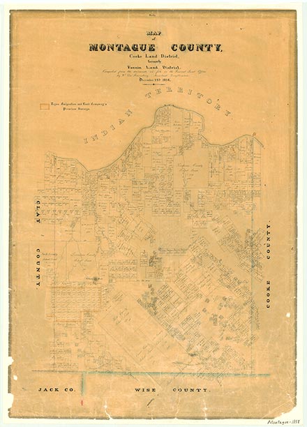
Montague County

Montague County, Texas
Photograph Credit: Robert Plocheck.

Montague County, Texas

Montague County, Texas
Montague County is in north central Texas on the Oklahoma border. The county seat, also named Montague, is 100 miles northwest of Dallas. The county's center lies at approximately 33°30' north latitude and 97°30' west longitude. Most of Montague County's 937 square miles lies in the region known as the western Cross Timbers, in which the dominantly light colored, sandy, and loamy soils support a post oak savannah. A small portion of the northwestern part of the county lies in the north central prairie, where the soils are dominantly dark colored and loamy and support grass. In the extreme east central part of the county lies the Grand Prairie Land Resource Area. There dominantly dark colored, loamy, and clayey soils support grass. The terrain of the county is level to gently rolling with broad valleys and high rolling prairies. The elevation ranges from 850 to 1,318 feet. A belt of woodland fifteen miles wide, known as the Upper Cross Timbers, runs north and south through the county and contains post oak interspersed with pecan, walnut, and blackjack trees. Three watersheds drain Montague County. The Red River drains the northern part of the county and has the largest drainage area of the three watersheds. The Denton-Elm Fork of the Trinity River drains the east-central portion of the county, and the West Fork of the Trinity River, which rises in Young County, drains the southern part. Between 41 and 50 percent of the land is considered prime farmland. The growing season extends 229 days, and rainfall averages thirty to thirty-five inches a year. Temperatures during the year range from an average high of 96° F in July to average low of 32° in January. Mineral resources produced by the county are petroleum and natural gas.
Comanche, Wichita, and Kiowa Indians lived in the western Cross Timbers several decades before the arrival of French trappers and Spanish explorers in the sixteenth century. In 1747 French trappers negotiated a Wichita-Comanche alliance that, within a decade, produced two large settlements on the banks of the Red River, the northern boundary of present Montague County. The principal village was north of the river and was inhabited by the Taovayas, a branch of the Wichita Indians. A smaller settlement south of the river was inhabited by Wichitas. Following an Indian attack on the San Saba Mission, the Spanish attempted a reprisal raid on the Red River settlements in 1759 only to discover that the villages were protected by a moat and stockade. The Spanish suffered heavy losses and fled. Approximately twenty years later Athanase de Mézières conducted a peace with the Indians and renamed the villages San Bernardo and San Teodoro. By 1812, however, losses suffered from smallpox had forced the Indians to abandon their settlements. Decades later Anglo-Americans discovered traces of the villages and named the location Spanish Fort. Although no permanent settlement remained, Comanche and Wichita Indians continued to inhabit the area, and their presence slowed Anglo-American development of the region.
David Minor | © TSHA
Adapted from the official Handbook of Texas, a state encyclopedia developed by Texas State Historical Association (TSHA). It is an authoritative source of trusted historical records.
- ✅ Adoption Status:
Currently Exists
Yes
Place type
Montague County is classified as a County
Altitude Range
715 ft – 1138 ft
Size
Land area does not include water surface area, whereas total area does
- Land Area: 930.9 mi²
- Total Area: 938.3 mi²
Temperature
January mean minimum:
29.2°F
July mean maximum:
93.3°F
Rainfall, 2019
35.1 inches
Population Count, 2019
19,818
Civilian Labor Count, 2019
9,057
Unemployment, 2019
7.7%
Property Values, 2019
$3,505,784,309 USD
Per-Capita Income, 2019
$42,074 USD
Retail Sales, 2019
$212,108,567 USD
Wages, 2019
$55,328,174 USD
County Map of Texas
Montague County
- Montague County
Places of Montague County
| Place | Type | Population (Year/Source) | Currently Exists |
|---|---|---|---|
| Town | – | – | |
| Town | – | – | |
| Town | – | – | |
| Town | – | – | |
| Town | 25 (2009) | Yes | |
| Town | – | – | |
| Town | 25 (2009) | Yes | |
| Town | 5,534 (2021) | Yes | |
| Town | – | – | |
| Town | 30 (2009) | Yes | |
| Town | – | – | |
| Town | – | – | |
| Town | – | – | |
| Town | – | – | |
| Town | – | – | |
| Town | – | – | |
| Town | – | – | |
| Town | – | – | |
| Town | – | – | |
| Town | 30 (2009) | Yes | |
| Town | – | – | |
| Town | – | – | |
| Town | – | – | |
| Town | 50 (2009) | Yes | |
| Town | 20 (2009) | Yes | |
| Town | – | – | |
| Town | – | – | |
| Town | – | – | |
| Town | – | – | |
| Town | – | – | |
| Town | – | – | |
| Town | – | – | |
| Town | – | – | |
| Town | – | – | |
| Town | 40 (2009) | Yes | |
| Town | – | – | |
| Town | – | – | |
| Town | – | – | |
| Lake | – | Yes | |
| Lake | – | Yes | |
| Town | – | – | |
| Town | – | – | |
| Town | – | – | |
| Town | – | – | |
| Town | – | – | |
| Town | – | – | |
| Town | 12 (2009) | Yes | |
| Town | – | – | |
| Town | – | – | |
| Town | – | – | |
| Town | – | – | |
| Town | 248 (2021) | Yes | |
| Town | – | – | |
| Town | 3,059 (2021) | Yes | |
| Town | 578 (2021) | Yes | |
| Town | – | – | |
| Town | – | – | |
| Town | – | – | |
| Town | – | – | |
| Town | – | – | |
| Town | – | – | |
| Town | – | – | |
| Town | – | – | |
| Town | – | – | |
| Town | – | – | |
| Town | 171 (2021) | Yes | |
| Town | – | – | |
| Town | – | – | |
| Town | 901 (2021) | Yes | |
| Town | – | – | |
| Town | – | – | |
| Town | – | – | |
| Town | – | – | |
| Town | – | – | |
| Town | – | – | |
| Town | – | – | |
| Town | 50 (2009) | Yes | |
| Town | – | – | |
| Town | – | – | |
| Town | – | – | |
| Town | 51 (2009) | Yes | |
| Town | 520 (2021) | Yes | |
| Town | – | – | |
| Town | – | – | |
| Town | – | – | |
| Town | – | – | |
| Town | – | – | |
| Town | – | – | |
| Town | – | – | |
| Town | – | – | |
| Town | – | – | |
| Town | – | – | |
| Town | – | – | |
| Town | – | – | |
| Town | – | – |
Photos Nearby:

Shops in downtown Saint Jo
Photo by Nicholas Henderson, CC2

Classic car museum in Nocona
Photo by Nicholas Henderson, CC2

Montague, Texas
The Montague County Courthouse is located in the City of Montague, Texas, the county seat. Photograph by Larry D. Moore.

Forestburg, Texas
View of Red Barn in the area of Forestburg in Montague County, Texas.
Photograph Credit: Robert Plocheck.

Stoneburg, Texas
Red Rock house in the vicinity of Stoneburg, in Montague County, Texas.
Photograph Credit: Robert Plocheck.

An old schoolhouse in Illinois Bend
Photo by Nicholas Henderson, CC2
Proud to call Texas home?
Put your name on the town, county, or lake of your choice.
Search Places »