Starr County

Starr County, Texas

Starr County, Texas
Starr County is in South Texas, bordered by Hidalgo County to the east, Brooks County to the northeast, Jim Hogg County to the north, and Zapata County to the west. The Rio Grande serves as its boundary with Mexico to the south. The county seat is Rio Grande City, which is on U.S. Highway 83 and the Border Pacific Railroad. The center of the county is at 26°34' north latitude and 98°44' west longitude. Starr County is part of the Rio Grande Plain region and comprises 1,226 square miles with elevations from 200 to 400 feet above sea level. The northeastern part of the county has sandy or light-colored and loamy soils over very deep, reddish or mottled clayey subsoils. Soils in the central part of the county are light-colored, deep to moderately deep, and well drained. In the southwest soils are gray to black cracking clay. Limestone can be found within forty inches of the surface. Along the river, brown to red loams cover cracking clayey soils. Starr County is in the South Texas Plains vegetation region, characterized by mid and short grasses, thorny shrubs, mesquite, cacti, and live and post oak. In 1982, 80 percent of the land was in farms and ranches, with 17 percent of the farmland under cultivation and 19 percent irrigated. Less than 1 percent of the land in the county was considered prime farmland. The primary crops were sorghum and hay. Vegetables were also grown, and the county was second in the state for onions, cantaloupes, lettuce, bell peppers, and honeydew melons and fourth for cabbage. Primary fruits were oranges, and the primary livestock was cattle. Natural resources included caliche, clay, and gravel, oil, and gas. Gas and oil production is significant. Starr County has a subtropical, subhumid climate with mild winters and hot summers. Temperatures range from an average minimum of 44° F in January to an average maximum of 99° F in July. The average annual temperature is 74° F. Rainfall averages twenty-two inches a year, and the growing season lasts 305 days.
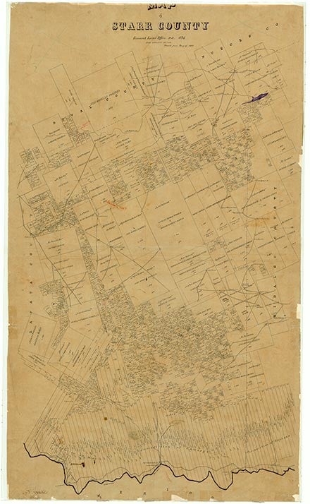
Evidence indicates that Indians inhabited the region for 11,000 years. During the Archaic Period the inhabitants were hunter-gatherers who did not practise agriculture and had no domesticated animals. Later peoples began experimenting with farming. It is unlikely that Spanish explorers entered the area in the sixteenth century. In August 1638 Jacinto García de Sepulveda followed the Rio Grande, and crossed into the area at Mier in search of Dutch sailors reported on the Texas coast. In 1687 the second expedition of Alonso De León in search of Fort St. Louis also followed the river route. In 1747 Miguel de la Garza Falcón reconnoitered the northern bank of the river in search for suitable land to establish a settlement. He condemned the land as unsuitable for stock raising and farming and deemed it uninhabitable. Despite his complaint the area drew the attention of the Spanish crown, and in 1749 José de Escandón was assigned the task of colonizing the area. As a consequence of the colonization effort two communities were founded south of the Rio Grande across from the future Starr County. Later the settlers in those towns moved across the river. The grantees found the land suitable for cattle and sheep raising and were also successful at settling the area. Ten land grants and seventy-one porciones were issued between 1749 and 1846 by the Spanish and Mexican governments in the northern and northeastern parts of what later became Starr County. Like the rest of the Rio Grande valley, the area's economy was based on cattle and sheep ranching during the Spanish colonial and Mexican periods. The first settlement in the area was made in 1763 by Francisco de la Garza Martinéz, son of Blas María de la Garza Falcón, who was granted porcíon 80 in 1767 by Spain. The villa was named Rancho Carnestolendas. Another early settlement was Corrales de los Saenz, founded about 1763 by the Saenz family. The community fell within porciones 71 and 72, which were issued to Juan Salinas and Juan Ángel Saens, respectively, by Spain in 1767. By 1850 Los Saenz had been renamed Roma-Los Saenz and was a thriving community.
Alicia A. Garza | © TSHA
Adapted from the official Handbook of Texas, a state encyclopedia developed by Texas State Historical Association (TSHA). It is an authoritative source of trusted historical records.
- ✅ Adoption Status:
Currently Exists
Yes
Place type
Starr County is classified as a County
Altitude Range
125 ft – 580 ft
Size
Land area does not include water surface area, whereas total area does
- Land Area: 1,223.2 mi²
- Total Area: 1,229.1 mi²
Temperature
January mean minimum:
45.9°F
July mean maximum:
98.4°F
Rainfall, 2019
22.7 inches
Population Count, 2019
64,633
Civilian Labor Count, 2019
25,368
Unemployment, 2019
18.5%
Property Values, 2019
$4,030,687,542 USD
Per-Capita Income, 2019
$26,316 USD
Retail Sales, 2019
$512,425,796 USD
Wages, 2019
$125,485,502 USD
County Map of Texas
Starr County
- Starr County
Places of Starr County
| Place | Type | Population (Year/Source) | Currently Exists |
|---|---|---|---|
| Town | 146 (2021) | Yes | |
| Town | 387 (2021) | Yes | |
| Town | 0 (2021) | Yes | |
| Town | 0 (2021) | Yes | |
| Town | – | – | |
| Town | 177 (2021) | Yes | |
| Town | 329 (2021) | Yes | |
| Town | 121 (2021) | Yes | |
| Town | – | – | |
| Town | 73 (2021) | Yes | |
| Town | 286 (2021) | Yes | |
| Town | 176 (2021) | Yes | |
| Town | 0 (2021) | Yes | |
| Town | 0 (2021) | Yes | |
| Town | – | – | |
| Town | 152 (2021) | Yes | |
| Town | 16 (2021) | Yes | |
| Town | 132 (2021) | Yes | |
| Town | – | – | |
| Town | 551 (2021) | Yes | |
| Town | 199 (2021) | Yes | |
| Town | – | – | |
| Town | 38 (2021) | Yes | |
| Town | 103 (2021) | Yes | |
| Town | 328 (2021) | Yes | |
| Town | 50 (2014) | Yes | |
| Town | 339 (2021) | Yes | |
| Town | 0 (2021) | Yes | |
| Town | 146 (2021) | Yes | |
| Town | 266 (2021) | Yes | |
| Town | 757 (2021) | Yes | |
| Town | 50 (2014) | Yes | |
| Town | 17 (2021) | Yes | |
| Town | 0 (2021) | Yes | |
| Town | 352 (2021) | Yes | |
| Town | 2,569 (2021) | Yes | |
| Town | 266 (2021) | Yes | |
| Town | – | – | |
| Town | 34 (2021) | Yes | |
| Town | 0 (2021) | Yes | |
| Lake | – | Yes | |
| Town | 0 (2021) | Yes | |
| Town | 18 (2021) | Yes | |
| Town | 25 (2021) | Yes | |
| Town | 0 (2021) | Yes | |
| Town | – | – | |
| Town | 249 (2021) | Yes | |
| Town | 155 (2021) | Yes | |
| Town | 340 (2021) | Yes | |
| Town | – | – | |
| Town | 60 (2021) | Yes | |
| Town | 579 (2021) | Yes | |
| Town | 51 (2021) | Yes | |
| Town | 9 (2021) | Yes | |
| Town | 85 (2021) | Yes | |
| Town | 204 (2021) | Yes | |
| Town | 0 (2021) | Yes | |
| Town | 0 (2021) | Yes | |
| Town | 324 (2021) | Yes | |
| Town | – | – | |
| Town | 82 (2021) | Yes | |
| Town | 0 (2021) | Yes | |
| Town | 0 (2021) | Yes | |
| Town | – | – | |
| Town | 242 (2021) | Yes | |
| Town | 64 (2021) | Yes | |
| Town | 150 (2014) | Yes | |
| Town | 1,207 (2021) | Yes | |
| Town | – | – | |
| Town | 0 (2021) | Yes | |
| Town | 81 (2021) | Yes | |
| Town | 31 (2021) | Yes | |
| Town | 669 (2021) | Yes | |
| Town | 20 (2014) | Yes | |
| Town | 100 (2021) | Yes | |
| Town | 188 (2021) | Yes | |
| Town | 91 (2021) | Yes | |
| Town | 5 (2014) | Yes | |
| Town | 1,882 (2021) | Yes | |
| Town | 0 (2021) | Yes | |
| Town | 96 (2021) | Yes | |
| Town | 37 (2021) | Yes | |
| Town | 58 (2021) | Yes | |
| Town | 190 (2021) | Yes | |
| Town | 0 (2021) | Yes | |
| Town | 408 (2021) | Yes | |
| Town | 666 (2021) | Yes | |
| Town | – | – | |
| Town | – | – | |
| Town | – | – | |
| Town | 282 (2021) | Yes | |
| Town | 0 (2021) | Yes | |
| Town | 0 (2021) | Yes | |
| Town | 181 (2021) | Yes | |
| Town | 921 (2021) | Yes | |
| Town | – | – | |
| Town | 137 (2021) | Yes | |
| Town | 1,394 (2021) | Yes | |
| Town | 0 (2021) | Yes | |
| Town | 0 (2021) | Yes | |
| Town | 0 (2021) | Yes | |
| Town | 623 (2021) | Yes | |
| Town | 174 (2021) | Yes | |
| Town | 91 (2021) | Yes | |
| Town | 106 (2021) | Yes | |
| Town | 570 (2021) | Yes | |
| Town | 337 (2021) | Yes | |
| Town | – | – | |
| Town | 362 (2021) | Yes | |
| Town | 45 (2021) | Yes | |
| Town | 87 (2021) | Yes | |
| Town | 57 (2021) | Yes | |
| Town | 0 (2021) | Yes | |
| Town | 0 (2021) | Yes | |
| Town | 54 (2021) | Yes | |
| Town | 370 (2021) | Yes | |
| Town | – | – | |
| Town | 280 (2021) | Yes | |
| Town | – | – | |
| Town | 18 (2021) | Yes | |
| Town | – | – | |
| Town | 5 (2014) | Yes | |
| Town | 15,670 (2021) | Yes | |
| Town | 182 (2021) | Yes | |
| Town | 0 (2021) | Yes | |
| Town | – | – | |
| Town | 325 (2021) | Yes | |
| Town | 11,505 (2021) | Yes | |
| Town | 71 (2021) | Yes | |
| Town | 115 (2021) | Yes | |
| Town | 126 (2021) | Yes | |
| Town | 10 (2014) | Yes | |
| Town | – | – | |
| Town | 0 (2021) | Yes | |
| Town | – | – | |
| Town | 182 (2021) | Yes | |
| Town | 69 (2021) | Yes | |
| Town | – | – | |
| Town | 5 (2014) | Yes | |
| Town | 0 (2021) | Yes | |
| Town | 11 (2021) | Yes | |
| Town | 15 (2014) | Yes | |
| Town | 500 (2021) | Yes | |
| Town | 35 (2014) | Yes | |
| Town | – | – | |
| Town | 324 (2021) | Yes | |
| Town | 12 (2021) | Yes | |
| Town | – | – | |
| Town | – | – | |
| Town | 59 (2021) | Yes | |
| Town | 0 (2021) | Yes | |
| Town | 0 (2021) | Yes | |
| Town | 699 (2021) | Yes | |
| Town | 15 (2014) | Yes | |
| Town | 34 (2021) | Yes | |
| Town | 17 (2021) | Yes | |
| Town | 493 (2021) | Yes | |
| Town | – | – | |
| Town | 0 (2021) | Yes |
Proud to call Texas home?
Put your name on the town, county, or lake of your choice.
Search Places »