Fisher County

Fisher County, Texas

Fisher County, Texas
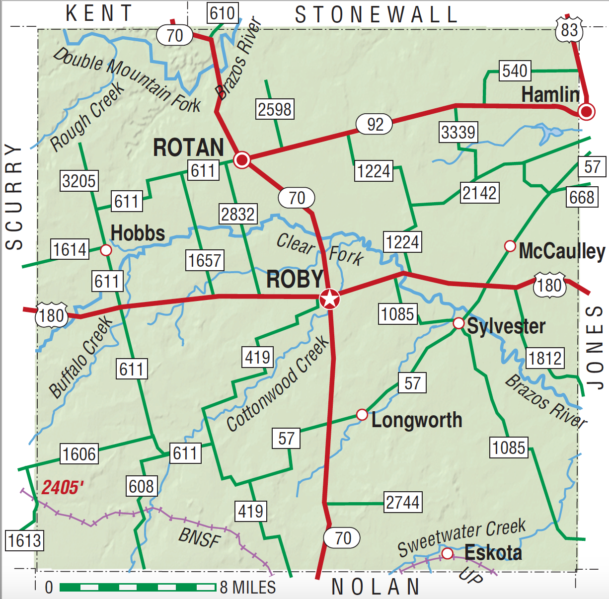
Fisher County is on U.S. Highway 180 west of Abilene in the Rolling Plains region of central West Texas. The county is bordered on the north by Kent and Stonewall counties, on the east by Jones County, on the south by Nolan County, and on the west by Scurry County. Its center point is 32°45' north latitude and 100°23' west longitude. Roby is the county seat; Rotan, the county's largest town, is 225 miles west of Dallas, 65 miles northwest of Abilene and 125 miles southeast of Lubbock. In addition to U.S. 180 the county's transportation needs are served by State highways 70 and 92. Fisher County covers 897 square miles of grassy, rolling prairies. The elevation ranges from 1,800 to 2,400 feet. The northern third of the county is drained by the Double Mountain Fork of the Brazos River, and the southern two-thirds is drained by the Clear Fork of the Brazos. Soils range from red to brown, with loamy surface layers and clayey or loamy subsoils. Between 51 percent and 60 percent of the land in the county is considered prime farmland. The vegetation, typical of the Rolling Prairies, features medium-height to tall grasses, mesquite, and cacti. Cedar, cottonwood, and pecan trees also grow along streams. Many species of wildflowers bloom in the spring and early summer, including daisies, buttercups, tallow weed, Indian blanket, baby's breath, prairie lace, wild verbena, belladonna, and hollyhock. Texas bluebells thrive in low places. The climate is subtropical and subhumid, with cool winters and hot summers. Temperatures range in January from an average low of 28° F to an average high of 56°, and in July from 70° to 96°. The average annual rainfall measures twenty-two inches, and the average relative humidity is 73 percent at 6 A.M. and 40 percent at 6 P.M. The average annual snowfall is five inches. The growing season averages 222 days, with the last freeze in early April and the first freeze in early November.
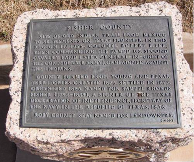
Fisher County comprises a region that has been the site of human habitation for several thousand years. Archeological artifacts recovered in the area suggest that the earliest human inhabitants arrived around 10,000 to 12,000 years ago, and evidence of Paleo, Archaic, and Historic cultures have been found in the county. Following these earliest inhabitants were the Lipan Apaches, who had settled in the region by the sixteenth century; later, around 1700, Comanches and Kiowas drifted in from the north, and Pawnees, Wichita, and Wacos occasionally hunted along the upper Brazos valley. The Old Indian Trial, which crossed the county, was used by various Indians to travel between the Plains region and Central Texas. Spanish explorer Francisco Vázquez de Coronado traversed the general region in 1541, and José Mares crossed it in 1788 while searching for a more direct route from Santa Fe to San Antonio. In the spring of 1847 Robert B. Marcy traveled along the Old Indian Trial through Fisher County on his way to El Paso; he camped for two days near the site of present-day Rotan. In the early summer of 1856 Robert E. Lee explored the county while leading a punitive expedition against the Indians.
Hooper Shelton | © TSHA

Adapted from the official Handbook of Texas, a state encyclopedia developed by Texas State Historical Association (TSHA). It is an authoritative source of trusted historical records.

- ✅ Adoption Status:
Currently Exists
Yes
Place type
Fisher County is classified as a County
Altitude Range
1720 ft – 2405 ft
Size
Land area does not include water surface area, whereas total area does
- Land Area: 898.9 mi²
- Total Area: 901.8 mi²
Temperature
January mean minimum:
30.5°F
July mean maximum:
94.6°F
Rainfall, 2019
24.8 inches
Population Count, 2019
3,830
Civilian Labor Count, 2019
1,507
Unemployment, 2019
5.4%
Property Values, 2019
$1,000,985,410 USD
Per-Capita Income, 2019
$46,444 USD
Retail Sales, 2019
$15,405,564 USD
Wages, 2019
$10,015,056 USD
County Map of Texas
Fisher County
- Fisher County
Places of Fisher County
| Place | Type | Population (Year/Source) | Currently Exists |
|---|---|---|---|
| Town | – | – | |
| Town | – | – | |
| Town | – | – | |
| Town | – | – | |
| Town | – | – | |
| Town | – | – | |
| Town | – | – | |
| Town | – | – | |
| Town | – | – | |
| Town | – | – | |
| Town | – | – | |
| Town | – | – | |
| Town | – | – | |
| Town | – | – | |
| Town | – | – | |
| Town | – | – | |
| Town | – | – | |
| Town | 32 (2009) | Yes | |
| Town | – | – | |
| Town | – | – | |
| Town | – | – | |
| Town | – | – | |
| Town | 1,879 (2021) | Yes | |
| Town | – | – | |
| Town | – | – | |
| Town | 32 (2009) | Yes | |
| Town | – | – | |
| Town | – | – | |
| Town | – | – | |
| Town | 47 (2009) | Yes | |
| Town | – | – | |
| Town | 36 (2021) | Yes | |
| Town | – | – | |
| Town | – | – | |
| Town | – | – | |
| Town | – | – | |
| Town | – | – | |
| Town | – | – | |
| Town | – | – | |
| Town | – | – | |
| Town | – | – | |
| Town | – | – | |
| Town | – | – | |
| Town | – | – | |
| Town | – | – | |
| Town | 594 (2021) | Yes | |
| Town | 1,349 (2021) | Yes | |
| Town | – | – | |
| Town | – | – | |
| Town | – | – | |
| Town | – | – | |
| Town | – | – | |
| Town | – | – | |
| Town | – | – | |
| Town | – | – | |
| Town | – | – | |
| Town | 40 (2021) | Yes | |
| Town | – | – | |
| Town | – | – |
Photos Nearby:

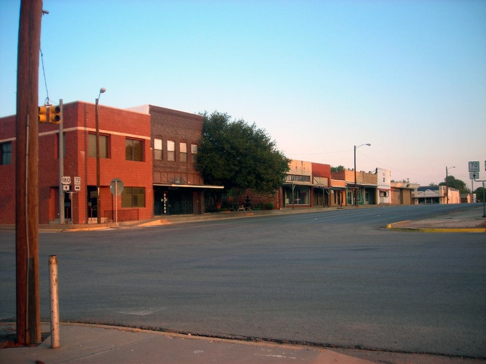
City of Roby, Fisher County, Texas
Downtown Roby, the seat of Fisher County, Texas. Photograph by Lothar1976.
.jpg)
City of Rotan, in Fisher County, Texas
Downtown view of the City of Rotan, in Fisher County, Texas. Photograph by Nicholas Henderson.

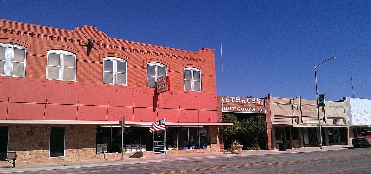
City of Hamlin, Fisher County, Texas
Strauss Dry Goods Company Storefront, Historic Building in downtown Hamlin, Texas in Fisher County. Photograph by CletusDitto.

Proud to call Texas home?
Put your name on the town, county, or lake of your choice.
Search Places »

