Caldwell County

Caldwell County, Texas

Caldwell County, Texas
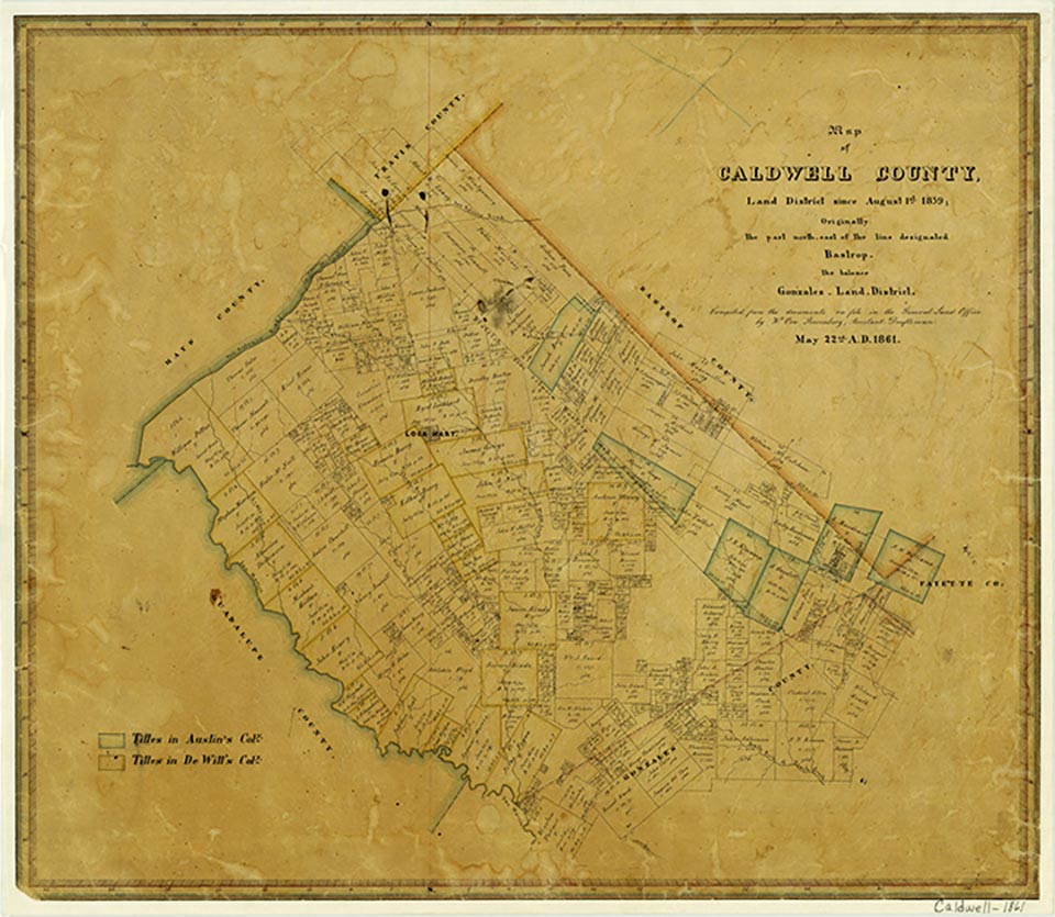
Caldwell County, 120 miles inland from the Gulf of Mexico in south central Texas, is bordered by Bastrop, Fayette, Gonzales, Guadalupe, Hays, and Travis counties. Lockhart, the county seat, is at the intersection of U.S. Highway 183 and Farm Road 20, thirty miles south of Austin and seventy miles northeast of San Antonio. The county's center lies four miles southeast of Lockhart at approximately 29°50' north latitude and 97°37' west longitude. The county comprises roughly 546 square miles of flat to rolling terrain with elevations ranging from 375 to 500 feet above sea level. It is bisected from southwest to northeast by the Luling-Darst Creek fault zone. The northwest part of the county is in the blackland prairie region, where the terrain is low-rolling to flat and tall grasses and mesquite flourish in the black, waxy soils. The southeastern half of the county is more hilly, and the sandy soils support a wider variety of vegetation, including hardwoods such as oak and elm as well as mesquite and grasses. The county is almost entirely within the Guadalupe River basin; it is drained primarily by Plum Creek and its tributaries, and by the San Marcos River, which forms the boundary with Guadalupe County. Wildlife in the area includes deer, javelinas, coyotes, bobcats, beavers, otters, foxes, raccoons, skunks, turkeys, squirrels, and a variety of small birds, fish, and reptiles. Among the county's mineral resources are clay, industrial sand, gravel, oil, and gas. The climate is subtropical and humid, with an average minimum temperature of 38° F in January and an average high temperature of 96° F in July. The growing season averages 274 days annually, and the rainfall averages thirty-five inches.
Although Caldwell County is on the border between Central Texas and the Coastal Plains, its archeological record is more closely related to that of Central Texas. The region has supported human habitation for several thousand years. Archeological evidence suggests that hunting and gathering peoples established themselves in the area as early as 10,000 years ago. Some of these may have been ancestors of the Tonkawa Indians, who appear to have been native to the region. Other Indian groups included the Karankawas, who sometimes ranged as far inland as Gonzales and Caldwell counties, and the Comanches, who migrated from north and west Texas in the early nineteenth century.
Vivian Elizabeth Smyrl | © TSHA
Adapted from the official Handbook of Texas, a state encyclopedia developed by Texas State Historical Association (TSHA). It is an authoritative source of trusted historical records.
- ✅ Adoption Status:
Currently Exists
Yes
Place type
Caldwell County is classified as a County
Altitude Range
315 ft – 736 ft
Size
Land area does not include water surface area, whereas total area does
- Land Area: 545.3 mi²
- Total Area: 547.2 mi²
Temperature
January mean minimum:
37.8°F
July mean maximum:
94.8°F
Rainfall, 2019
35.9 inches
Population Count, 2019
43,664
Civilian Labor Count, 2019
19,148
Unemployment, 2019
7.4%
Property Values, 2019
$3,576,867,106 USD
Per-Capita Income, 2019
$33,668 USD
Retail Sales, 2019
$388,422,490 USD
Wages, 2019
$88,812,292 USD
County Map of Texas
Caldwell County
- Caldwell County
Places of Caldwell County
| Place | Type | Population (Year/Source) | Currently Exists |
|---|---|---|---|
| Town | – | – | |
| Town | – | – | |
| Town | – | – | |
| Town | – | – | |
| Town | – | – | |
| Town | 50 (2014) | Yes | |
| Town | – | – | |
| Town | – | – | |
| Town | – | – | |
| Town | – | – | |
| Town | – | – | |
| Town | – | – | |
| Town | 300 (2014) | Yes | |
| Town | 150 (2014) | Yes | |
| Town | – | – | |
| Town | – | – | |
| Town | – | – | |
| Town | 380 (2014) | Yes | |
| Town | – | – | |
| Town | – | – | |
| Town | – | – | |
| Town | 70 (2014) | Yes | |
| Town | – | – | |
| Town | – | – | |
| Town | – | – | |
| Town | – | – | |
| Town | 14,844 (2021) | Yes | |
| Town | 5,518 (2021) | Yes | |
| Town | 300 (2014) | Yes | |
| Town | – | – | |
| Town | 1,209 (2021) | Yes | |
| Town | 500 (2014) | Yes | |
| Town | 90 (2014) | Yes | |
| Town | 50 (2014) | Yes | |
| Town | 100 (2014) | Yes | |
| Town | – | – | |
| Town | 966 (2021) | Yes | |
| Town | – | – | |
| Town | – | – | |
| Town | 671 (2021) | Yes | |
| Town | – | – | |
| Town | – | – | |
| Town | – | – | |
| Town | – | – | |
| Town | – | – | |
| Town | – | – | |
| Town | 320 (2014) | Yes | |
| Town | – | – | |
| Town | 520 (2014) | Yes | |
| Town | – | – | |
| Town | – | – | |
| Town | – | – | |
| Town | – | – | |
| Town | 68,580 (2021) | Yes | |
| Town | 75 (2014) | Yes | |
| Town | – | – | |
| Town | – | – | |
| Town | – | – | |
| Town | – | – | |
| Town | 150 (2014) | Yes | |
| Town | 35 (2014) | Yes | |
| Town | 35 (2014) | Yes | |
| Town | 60 (2014) | Yes | |
| Town | – | – | |
| Town | 1,667 (2021) | Yes | |
| Town | – | – | |
| Town | – | – | |
| Town | – | – | |
| Town | – | – | |
| Town | – | – |
Photos Nearby:

San Marcos, Texas
The historic district in dowtown San Marcos, the seat of Hays County. Photograph by Larry D. Moore.

Lockhart, Texas
Downtown Lockhart, Texas. Photograph by Aleksomber.
Proud to call Texas home?
Put your name on the town, county, or lake of your choice.
Search Places »