Denton County

Denton County, Texas

Denton County, Texas
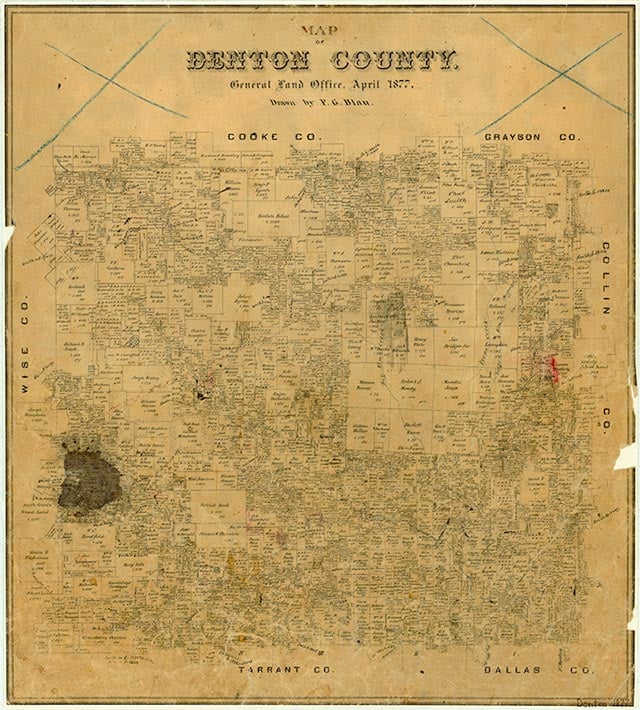
Denton County covers 911 square miles in north central Texas. Its center point is at 33°12' north latitude and 97°13' west longitude. It borders Dallas and Tarrant counties on the south and Cooke and Grayson counties on the north; it is one county south of Oklahoma. The western half of the county is surfaced by the black soil of the Grand Prairie. An eastern sliver is on the western edge of the Blackland Prairie, where the rich black soil contrasts sharply with the sandy land of the Eastern Cross Timbers jutting down from Oklahoma through the central part of the county. Denton County ranges in elevation from 500 to 900 feet, has an annual average rainfall of about thirty-three inches, and a temperature average ranging from a minimum of 34° F in January to a maximum of 96° in July. With an average growing season of 226 days, it is a good area for general crop and livestock production. The Elm Fork of the Trinity River flows through the east central part of the county. It was dammed in the 1920s to form Lake Dallas, which has since been joined with Garza–Little Elm Reservoir to form Lewisville Lake, a moderately large reservoir. The western part of the county is cut by several major creeks. Clear Creek drains into the Elm Fork and Hickory Creek into Lewisville Lake. Denton Creek and its tributaries, in the southern part of the county, are sources of water for Grapevine Lake, which is partly in Denton County and partly in Tarrant County. In the Cross Timbers and the floodplains of the creeks black jack and post oak, pecan, white ash, sycamore, cottonwood, hackberry, elm, and willow trees predominate. Most of the rest of the county was originally covered by grasses. Some native pasture remained in the 1980s, but the bulk of county land not in cultivation was improved pasture, planted mainly with coastal Bermuda grass. The Trinity Sands underlie the area at about 700 to 1,200 feet, but in some parts of the county residents are able to reach artesian water at depths as shallow as 100 feet. Though Denton County is not abundant in natural resources, it has produced a modest but significant amount of oil (5,696,311 barrels by the end of 2004), mostly from the Bolivar field between the 1930s and the 1960s. Other natural resources are natural gas, sand and gravel, and some building stone—the stone courthouse on the square in Denton was built in 1896 from stone quarried a few miles north.
Although archeological field surveys done under contract with the United States Army Corps of Engineers indicate some use of the area as early as the Middle Archaic Period (4,000 to 2,500 B.C.), only one county site, near Lewisville, has been deemed highly significant, and it is controversial. A Clovis point from the site was radiocarbon-dated at 37,000 B.C., but most other information contradicts the possibility that human beings inhabited the area that early. All other archeological work indicates nothing unique about prehistoric occupation of Denton County. There is no evidence that the county was the site of any large Indian villages in the Historic Period (1600–1800), although remains of many small transitory camps and small burial grounds have been found. Early Spanish and French explorers may also have trekked across the county, but documentation is lacking.
E. Dale Odom | © TSHA
Adapted from the official Handbook of Texas, a state encyclopedia developed by Texas State Historical Association (TSHA). It is an authoritative source of trusted historical records.
- ✅ Adoption Status:
Currently Exists
Yes
Place type
Denton County is classified as a County
Location
Latitude: 32.23400000Longitude: 325.30000000
Altitude Range
433 ft – 980 ft
Size
Land area does not include water surface area, whereas total area does
- Land Area: 878.4 mi²
- Total Area: 953.0 mi²
Temperature
January mean minimum:
33.0°F
July mean maximum:
95.3°F
Rainfall, 2019
38.1 inches
Population Count, 2019
887,207
Civilian Labor Count, 2019
492,871
Unemployment, 2019
7.8%
Property Values, 2019
$108,642,770,919 USD
Per-Capita Income, 2019
$55,933 USD
Retail Sales, 2019
$11,517,117,320 USD
Wages, 2019
$3,552,032,541 USD
County Map of Texas
Denton County
- Denton County
Places of Denton County
| Place | Type | Population (Year/Source) | Currently Exists |
|---|---|---|---|
| Town | 133,251 (2021) | Yes | |
| Town | 148,146 (2021) | Yes | |
| Town | – | – | |
| Town | – | – | |
| Town | – | – | |
| Town | 4,707 (2021) | Yes | |
| Town | – | – | |
| Town | 6,490 (2021) | Yes | |
| Town | – | – | |
| Town | 1,771 (2021) | Yes | |
| Town | – | – | |
| Town | – | – | |
| Town | 140 (2009) | Yes | |
| Town | – | – | |
| Town | – | – | |
| Town | – | – | |
| Town | – | – | |
| Town | – | – | |
| Town | 23,811 (2021) | Yes | |
| Town | – | – | |
| Town | – | – | |
| Town | – | – | |
| Town | – | – | |
| Town | – | – | |
| Town | 42,221 (2021) | Yes | |
| Town | 1,759 (2021) | Yes | |
| Town | 22,690 (2021) | Yes | |
| Town | – | – | |
| Town | 36 (2021) | Yes | |
| Town | – | – | |
| Town | 1,817 (2021) | Yes | |
| Town | 1,288,457 (2021) | Yes | |
| Town | – | – | |
| Town | – | – | |
| Town | – | – | |
| Town | – | – | |
| Town | – | – | |
| Town | 437 (2021) | Yes | |
| Town | – | – | |
| Town | 3,054 (2021) | Yes | |
| Town | – | – | |
| Town | 90 (2009) | Yes | |
| Town | – | – | |
| Town | – | – | |
| Town | – | – | |
| Town | – | – | |
| Town | – | – | |
| Town | – | – | |
| Town | 77,243 (2021) | Yes | |
| Town | – | – | |
| Town | 935,508 (2021) | Yes | |
| Town | – | – | |
| Town | – | – | |
| Town | – | – | |
| Town | 210,719 (2021) | Yes | |
| Town | – | – | |
| Town | – | – | |
| Town | – | – | |
| Town | – | – | |
| Lake | – | Yes | |
| Town | 100 (2014) | Yes | |
| Town | 55 (2014) | Yes | |
| Town | – | – | |
| Town | 2,961 (2021) | Yes | |
| Town | – | – | |
| Town | – | – | |
| Town | 803 (2021) | Yes | |
| Town | – | – | |
| Town | 5,244 (2021) | Yes | |
| Town | 15,952 (2021) | Yes | |
| Town | – | – | |
| Town | – | – | |
| Town | – | – | |
| Town | – | – | |
| Town | – | – | |
| Town | – | – | |
| Town | 5,031 (2021) | Yes | |
| Town | – | – | |
| Town | – | – | |
| Town | 1,920 (2021) | Yes | |
| Town | 5,823 (2021) | Yes | |
| Town | 7,722 (2021) | Yes | |
| Town | 660 (2021) | Yes | |
| Town | 11,559 (2021) | Yes | |
| Town | 112,944 (2021) | Yes | |
| Lake | – | Yes | |
| Town | – | – | |
| Town | 308 (2010) | – | |
| Town | 51,042 (2021) | Yes | |
| Town | – | – | |
| Town | – | – | |
| Town | – | – | |
| Town | – | – | |
| Town | – | – | |
| Town | – | – | |
| Town | – | – | |
| Town | – | – | |
| Town | – | – | |
| Town | – | – | |
| Town | – | – | |
| Town | 25 (2009) | Yes | |
| Town | – | – | |
| Town | – | – | |
| Town | – | – | |
| Town | – | – | |
| Town | – | – | |
| Town | 6,829 (2021) | Yes | |
| Town | – | – | |
| Town | 5,557 (2021) | Yes | |
| Town | – | – | |
| Town | – | – | |
| Town | 3,347 (2021) | Yes | |
| Town | 7,896 (2021) | Yes | |
| Town | 44 (2009) | Yes | |
| Town | – | – | |
| Town | 4,651 (2021) | Yes | |
| Town | – | – | |
| Town | – | – | |
| Town | 288,253 (2021) | Yes | |
| Town | 2,429 (2021) | Yes | |
| Town | 34,136 (2021) | Yes | |
| Town | 7,812 (2021) | Yes | |
| Town | – | – | |
| Lake | – | Yes | |
| Town | – | – | |
| Town | – | – | |
| Town | 9,878 (2021) | Yes | |
| Town | – | – | |
| Town | – | – | |
| Town | – | – | |
| Town | – | – | |
| Town | 9,380 (2021) | Yes | |
| Town | 6,565 (2021) | Yes | |
| Town | 2,849 (2021) | Yes | |
| Town | – | – | |
| Town | – | – | |
| Town | – | – | |
| Town | – | – | |
| Town | 31,105 (2021) | Yes | |
| Town | – | – | |
| Town | – | – | |
| Town | – | – | |
| Town | – | – | |
| Town | – | – | |
| Town | – | – | |
| Town | 25 (2009) | Yes | |
| Town | – | – | |
| Town | – | – | |
| Town | 45,000 (2021) | Yes | |
| Town | – | – | |
| Town | – | – | |
| Town | – | – | |
| Town | 13,745 (2021) | Yes | |
| Town | 25 (2009) | Yes | |
| Town | – | – | |
| Town | – | – | |
| Town | – | – | |
| Town | – | – | |
| Town | 1,683 (2021) | Yes | |
| Town | – | – |
Photos Nearby:

Downtown Dallas
Photo of Downtown Dallas from I-35.
.jpg "Come visit Denton's historic square")
Come visit Denton's historic square
Photo of the northwest corner of Denton's historic square. Photo by Monica Bourgeau on Unsplash.

Fort Worth, Texas
Fort Worth, Texas Photo by Alton Stephens on Unsplash
.jpg "City of Aubrey, Denton County, Texas")
City of Aubrey, Denton County, Texas
Downtown section of the City of Aubrey in Denton County, Texas. Photograph by Renelibrary.
.jpg)

The town sign for DISH
Photo by Nicholas Henderson, CC2

Welcome to Carrollton
Located in the heart of the Dallas-Fort Worth area, the City of Carrollton is a vibrant corporate and residential community. Photo by Herve Villard on Unsplash.

City of Roanoke, Texas
The City of Roanoke's Historic District, located in Denton County, Texas. Photograph by Renelibrary.

City of Krum, Denton County, Texas
Krum is a city in Denton County, Texas. It is located 7 miles northwest of Denton. Photograph by Renelibrary.
.jpg)

The 2009 Wounded Warriors Tournament of Heroes was held on Lewisville Lake
Photo by U.S. Navy, Public Domain

Sunset over Ray Roberts Lake
Photo by Morcup, CC by SA 4

Fourth of July fireworks on Grapevine Lake
Photo by Shiva Shenoy, Flickr, CC2
Proud to call Texas home?
Put your name on the town, county, or lake of your choice.
Search Places »